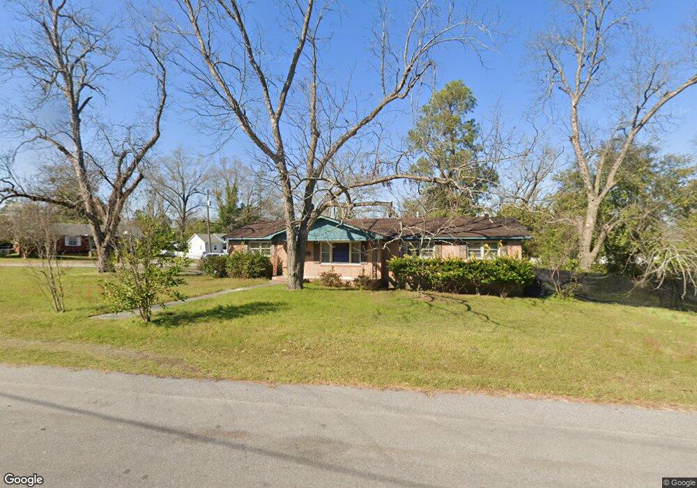
1090 Colleton St Orangeburg, SC 29115
Estimated Value: $117,000 - $169,000
4
Beds
2
Baths
1,778
Sq Ft
$79/Sq Ft
Est. Value
About This Home
This home is located at 1090 Colleton St, Orangeburg, SC 29115 and is currently estimated at $140,772, approximately $79 per square foot. 1090 Colleton St is a home located in Orangeburg County with nearby schools including Brookdale Elementary School, Brookdale Elementary, and Robert E. Howard Middle School.
Ownership History
Date
Name
Owned For
Owner Type
Purchase Details
Closed on
Feb 14, 2019
Sold by
Hodges Veronica C
Bought by
Wearing Kimberly C
Current Estimated Value
Home Financials for this Owner
Home Financials are based on the most recent Mortgage that was taken out on this home.
Original Mortgage
$68,000
Outstanding Balance
$43,668
Interest Rate
4.5%
Mortgage Type
New Conventional
Estimated Equity
$97,104
Purchase Details
Closed on
Dec 17, 2001
Sold by
Livingston Alice and Adams Janet
Bought by
Wearing Willie R
Create a Home Valuation Report for This Property
The Home Valuation Report is an in-depth analysis detailing your home's value as well as a comparison with similar homes in the area
Home Values in the Area
Average Home Value in this Area
Purchase History
| Date | Buyer | Sale Price | Title Company |
|---|---|---|---|
| Wearing Kimberly C | $68,000 | None Available | |
| Wearing Willie R | $82,500 | -- |
Source: Public Records
Mortgage History
| Date | Status | Borrower | Loan Amount |
|---|---|---|---|
| Open | Wearing Kimberly C | $68,000 |
Source: Public Records
Tax History Compared to Growth
Tax History
| Year | Tax Paid | Tax Assessment Tax Assessment Total Assessment is a certain percentage of the fair market value that is determined by local assessors to be the total taxable value of land and additions on the property. | Land | Improvement |
|---|---|---|---|---|
| 2024 | $1,073 | $4,400 | $784 | $3,616 |
| 2023 | $957 | $3,284 | $744 | $2,540 |
| 2022 | $892 | $3,284 | $744 | $2,540 |
| 2021 | $885 | $3,284 | $744 | $2,540 |
| 2020 | $2,252 | $3,284 | $744 | $2,540 |
| 2019 | $2,193 | $3,284 | $744 | $2,540 |
| 2018 | $2,214 | $4,669 | $0 | $0 |
| 2017 | $762 | $3,112 | $0 | $0 |
| 2016 | $762 | $3,112 | $0 | $0 |
| 2015 | $444 | $3,112 | $0 | $0 |
| 2014 | $444 | $3,113 | $745 | $2,368 |
| 2013 | -- | $3,164 | $744 | $2,420 |
Source: Public Records
Map
Nearby Homes
- 1174 Ellis Ave
- 1231 Eutaw St
- 1103 Ellis Ave
- 1135 Gloria St
- 1085 Ellis Ave
- 1069 Chestnut St
- 1235 Sawyer St
- 1238 Dantzler St
- 1254 Sawyer St
- 782 Spring St
- 1188 Gloria St
- 1280 Saint Matthews Rd
- 1090 College Ave
- 898 Ellis Ave
- 1236 College Ave
- 1840 Carolina Ave
- 841 State Road S-38-252
- 0 State Road S-38-252
- 1740 Carolina Ave
- 661663 State Road S-38-225
- 1091 Colleton St
- 1223 Fairfield St
- 1193 Ellis Ave
- 1205 Fairfield St
- 1221 Ellis Ave
- 1247 Ellis Ave
- 1190 Fairfield St
- 1175 Ellis Ave
- 1175 Ellis Ave
- 1241 Fairfield St
- 1280 Fairfield St
- 1235 Ellis Ave
- 1189 Fairfield St
- 1188 Schley St
- 1198 Schley St
- 1251 Fairfield St
- 1178 Schley St
- 1159 Ellis Ave
- 1194 Ellis Ave
- 1210 Ellis Ave