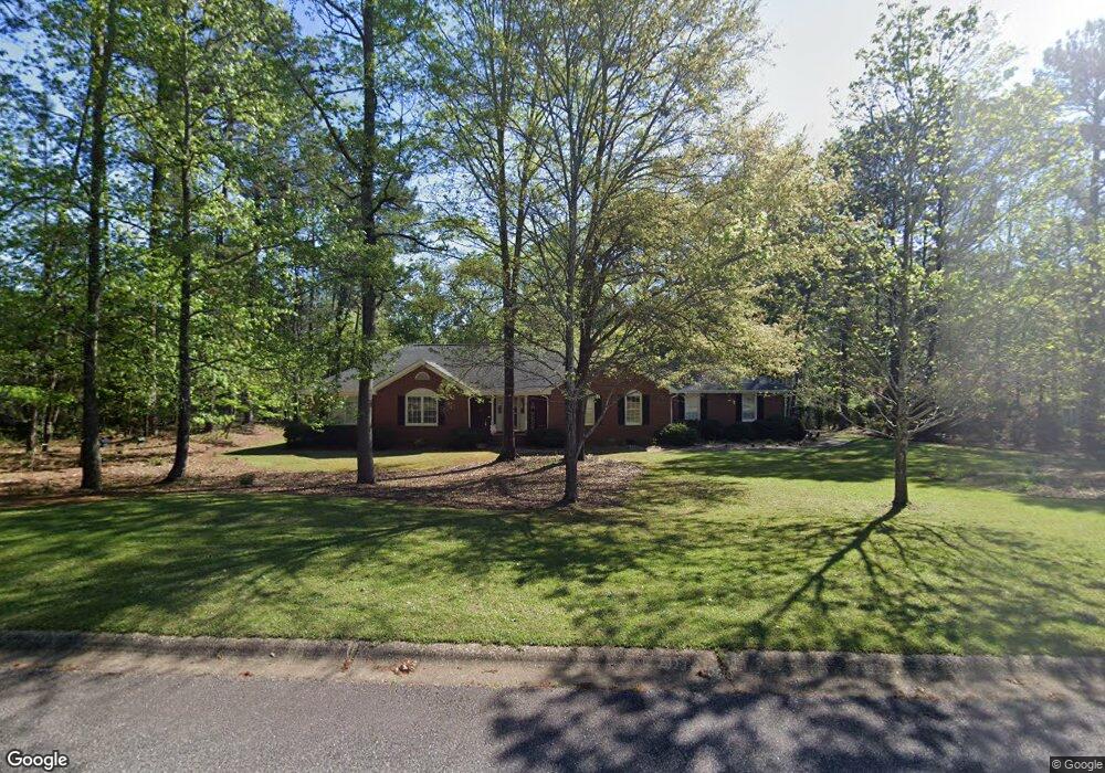
1090 Harrowford Rd S Statham, GA 30666
Estimated Value: $448,000 - $535,000
--
Bed
--
Bath
2,053
Sq Ft
$241/Sq Ft
Est. Value
About This Home
This home is located at 1090 Harrowford Rd S, Statham, GA 30666 and is currently estimated at $495,757, approximately $241 per square foot. 1090 Harrowford Rd S is a home located in Oconee County with nearby schools including Rocky Branch Elementary School, Malcom Bridge Middle School, and North Oconee High School.
Ownership History
Date
Name
Owned For
Owner Type
Purchase Details
Closed on
Feb 27, 2003
Sold by
Banks Lori Anne
Bought by
Chandler Ryan P
Current Estimated Value
Purchase Details
Closed on
Jul 31, 1995
Bought by
Banks Lori Anne
Purchase Details
Closed on
Aug 22, 1994
Bought by
Moss Phillip J
Create a Home Valuation Report for This Property
The Home Valuation Report is an in-depth analysis detailing your home's value as well as a comparison with similar homes in the area
Home Values in the Area
Average Home Value in this Area
Purchase History
| Date | Buyer | Sale Price | Title Company |
|---|---|---|---|
| Chandler Ryan P | -- | -- | |
| Banks Lori Anne | $122,000 | -- | |
| Moss Phillip J | $14,500 | -- |
Source: Public Records
Tax History Compared to Growth
Tax History
| Year | Tax Paid | Tax Assessment Tax Assessment Total Assessment is a certain percentage of the fair market value that is determined by local assessors to be the total taxable value of land and additions on the property. | Land | Improvement |
|---|---|---|---|---|
| 2024 | $3,324 | $178,186 | $30,000 | $148,186 |
| 2023 | $3,324 | $162,157 | $22,000 | $140,157 |
| 2022 | $3,086 | $144,341 | $22,000 | $122,341 |
| 2021 | $2,559 | $111,176 | $22,000 | $89,176 |
| 2020 | $2,163 | $93,934 | $18,000 | $75,934 |
| 2019 | $2,159 | $93,729 | $18,000 | $75,729 |
| 2018 | $2,085 | $88,690 | $18,000 | $70,690 |
| 2017 | $1,935 | $82,342 | $18,000 | $64,342 |
| 2016 | $1,924 | $81,905 | $18,000 | $63,905 |
| 2015 | $1,932 | $82,105 | $18,000 | $64,105 |
| 2014 | $1,726 | $71,778 | $18,000 | $53,778 |
| 2013 | -- | $70,085 | $18,000 | $52,085 |
Source: Public Records
Map
Nearby Homes
- 1080 Ashland Dr
- N/A Hog Mountain Rd
- 1901 Hog Mountain Rd
- 1921 Hog Mountain Rd
- 4611 Monroe Hwy - Hwy 78
- 4611 Monroe Hwy - Hwy 78 Unit PARCEL C
- LOT 10 Sikes Rd
- LOT 9 Sikes Rd
- LOT 8 Sikes Rd
- LOT 7 Sikes Rd
- LOT 6 Sikes Rd
- LOT 5 Sikes Rd
- LOT 4 Sikes Rd
- LOT 3 Sikes Rd
- LOT 2 Sikes Rd
- LOT 1 Sikes Rd
- 2903 Brookstone Crossing Unit 34-B
- 2903 Brookstone Crossing
- 1111 Brookstone Crossing Unit 11D
- 1621 Westland Ct
- 1021 Marys Ct
- 1091 Harrowford Dr S
- 1081 Harrowford Rd S
- 1081 Harrowford Dr S
- 1091 Harrowford Rd S
- 1070 Harrowford Rd S
- 1020 Marys Ct
- 1010 Charles Ct
- S Harrowford Dr S
- 1050 Harrowford Dr S
- 1050 Harrowford Rd S
- 0 Charles Ct Unit 8755773
- 0 Charles Ct Unit 7081559
- 1020 Charles Ct
- 1041 Harrowford Rd S
- 1030 Harrowford Rd S
- 1021 Charles Ct
- 1011 Harrowford Rd S
- 1010 Harrowford Rd S
- 1011 Harrowford Dr S