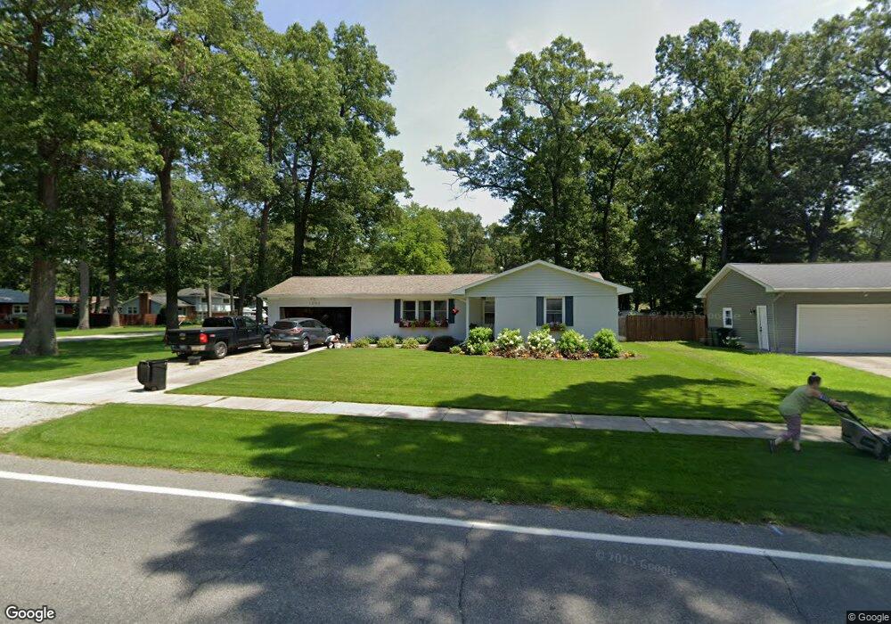
1090 Horton Rd Muskegon, MI 49445
Estimated Value: $249,842 - $285,000
3
Beds
2
Baths
1,321
Sq Ft
$203/Sq Ft
Est. Value
About This Home
This home is located at 1090 Horton Rd, Muskegon, MI 49445 and is currently estimated at $268,461, approximately $203 per square foot. 1090 Horton Rd is a home located in Muskegon County with nearby schools including Reeths-Puffer High School.
Ownership History
Date
Name
Owned For
Owner Type
Purchase Details
Closed on
Oct 5, 2007
Sold by
Carlson Sheree L
Bought by
Mortgage Electronic Registration Systems and Novastar Mortgage Inc
Current Estimated Value
Purchase Details
Closed on
Mar 25, 2005
Sold by
Collis Donald and Collis Valerie
Bought by
Carlson Sheree L
Home Financials for this Owner
Home Financials are based on the most recent Mortgage that was taken out on this home.
Original Mortgage
$111,055
Interest Rate
8.99%
Mortgage Type
Fannie Mae Freddie Mac
Create a Home Valuation Report for This Property
The Home Valuation Report is an in-depth analysis detailing your home's value as well as a comparison with similar homes in the area
Home Values in the Area
Average Home Value in this Area
Purchase History
| Date | Buyer | Sale Price | Title Company |
|---|---|---|---|
| Mortgage Electronic Registration Systems | -- | E Title Agency | |
| Carlson Sheree L | -- | Harbor Title |
Source: Public Records
Mortgage History
| Date | Status | Borrower | Loan Amount |
|---|---|---|---|
| Previous Owner | Carlson Sheree L | $111,055 |
Source: Public Records
Tax History Compared to Growth
Tax History
| Year | Tax Paid | Tax Assessment Tax Assessment Total Assessment is a certain percentage of the fair market value that is determined by local assessors to be the total taxable value of land and additions on the property. | Land | Improvement |
|---|---|---|---|---|
| 2025 | $1,891 | $109,800 | $0 | $0 |
| 2024 | $669 | $104,400 | $0 | $0 |
| 2023 | $640 | $94,700 | $0 | $0 |
| 2022 | $1,721 | $76,200 | $0 | $0 |
| 2021 | $1,674 | $69,700 | $0 | $0 |
| 2020 | $1,660 | $66,400 | $0 | $0 |
| 2019 | $1,631 | $64,800 | $0 | $0 |
| 2018 | $1,608 | $61,500 | $0 | $0 |
| 2017 | $1,626 | $61,400 | $0 | $0 |
| 2016 | $546 | $55,900 | $0 | $0 |
| 2015 | -- | $47,300 | $0 | $0 |
| 2014 | -- | $47,600 | $0 | $0 |
| 2013 | -- | $44,200 | $0 | $0 |
Source: Public Records
Map
Nearby Homes
- 1596 Nottingham Ct
- 1709 Hampstead Dr
- 1024 Bear Lake Rd
- 780 Horton Rd
- 1045 Greenbriar Dr
- 1310 W Giles Rd
- 690 W Wedgewood Dr
- 1141 N Robinhood Dr
- 1234 W Giles Rd
- 0 Horton Rd Unit 25046889
- 1516 W Addison Way Unit 54
- 1518 W Addison Way Unit 54
- 1513 W Addison Way Unit 28
- 1603 Horton Rd
- 1463 Glenwood Ave
- 1499 Glenwood Ave
- 1616 Westwind Ct
- 421 W Chadwick Dr
- 834 Dykstra Rd
- 1601 Westwind Ct
- 1076 Horton Rd
- 1587 Nottingham Ct
- 1085 Horton Rd
- 1579 Nottingham Ct
- 1586 Nottingham Ct
- 1514 Nottingham Ct
- 1065 Horton Rd
- 1615 Gladstone Dr
- 1520 Nottingham Ct
- 1055 Horton Rd
- 1124 Horton Rd
- 1614 Gladstone Dr
- 1555 Nottingham Ct
- 1133 W Robinhood Dr
- 1629 Gladstone Dr
- 1070 Cadillac Dr
- 1530 Nottingham Ct
- 1043 Horton Rd
- 1130 Horton Rd
- 1509 Nottingham Ct