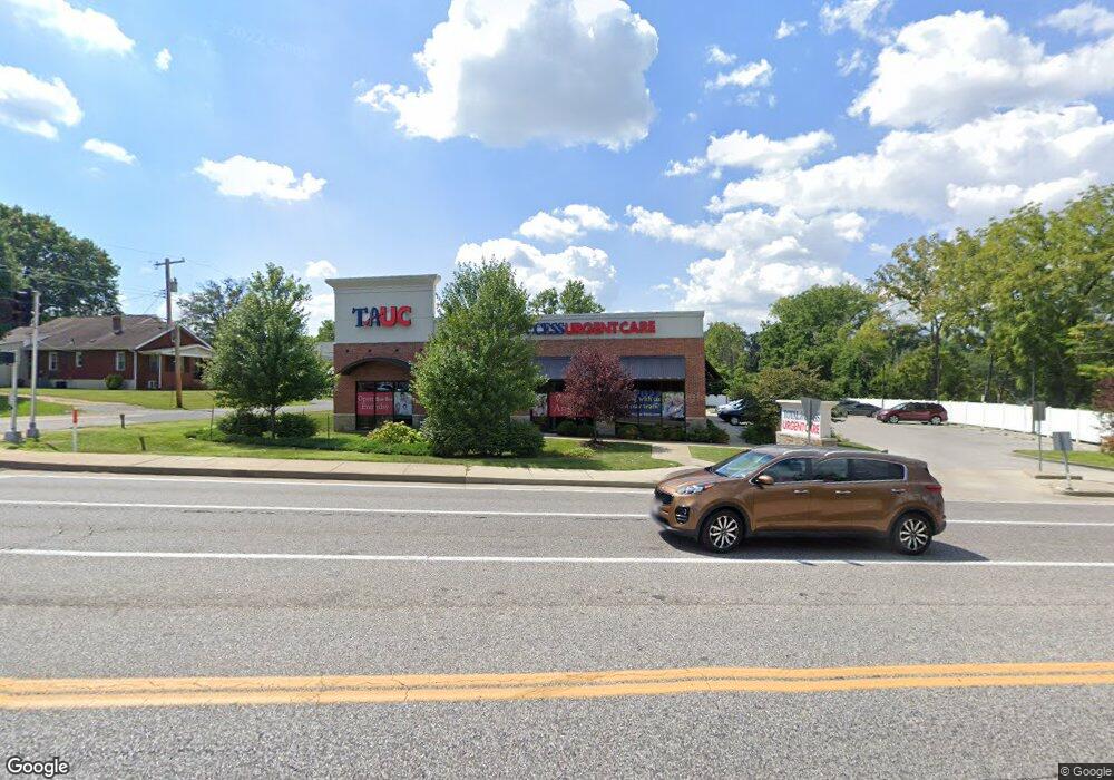
1090 N Highway 67 St Florissant, MO 63031
Estimated Value: $182,000
--
Bed
--
Bath
5,772
Sq Ft
$32/Sq Ft
Est. Value
About This Home
This home is located at 1090 N Highway 67 St, Florissant, MO 63031 and is currently priced at $182,000, approximately $31 per square foot. 1090 N Highway 67 St is a home located in St. Louis County with nearby schools including Combs Elementary School, Cross Keys Middle School, and McCluer North High School.
Ownership History
Date
Name
Owned For
Owner Type
Purchase Details
Closed on
Sep 19, 2025
Sold by
Tauc Properties Llc
Bought by
Br Ta Highway 67 Llc
Current Estimated Value
Home Financials for this Owner
Home Financials are based on the most recent Mortgage that was taken out on this home.
Original Mortgage
$1,635,945
Outstanding Balance
$1,635,945
Interest Rate
6.63%
Mortgage Type
New Conventional
Purchase Details
Closed on
Jun 15, 2016
Sold by
Teubner R David and Teubner Carole M
Bought by
Tauc Properties Llc
Create a Home Valuation Report for This Property
The Home Valuation Report is an in-depth analysis detailing your home's value as well as a comparison with similar homes in the area
Home Values in the Area
Average Home Value in this Area
Purchase History
| Date | Buyer | Sale Price | Title Company |
|---|---|---|---|
| Br Ta Highway 67 Llc | -- | None Listed On Document | |
| Tauc Properties Llc | -- | St Louis Title Llc Cm |
Source: Public Records
Mortgage History
| Date | Status | Borrower | Loan Amount |
|---|---|---|---|
| Open | Br Ta Highway 67 Llc | $1,635,945 |
Source: Public Records
Tax History Compared to Growth
Tax History
| Year | Tax Paid | Tax Assessment Tax Assessment Total Assessment is a certain percentage of the fair market value that is determined by local assessors to be the total taxable value of land and additions on the property. | Land | Improvement |
|---|---|---|---|---|
| 2025 | $38,187 | $530,460 | $84,350 | $446,110 |
| 2024 | $38,187 | $340,670 | $84,350 | $256,320 |
| 2023 | $37,853 | $340,670 | $84,350 | $256,320 |
| 2022 | $37,038 | $318,170 | $84,350 | $233,820 |
| 2021 | $36,242 | $318,170 | $84,350 | $233,820 |
| 2020 | $39,175 | $344,290 | $84,350 | $259,940 |
| 2019 | $37,984 | $344,290 | $84,350 | $259,940 |
| 2018 | $59,198 | $507,710 | $84,350 | $423,360 |
| 2017 | $58,372 | $507,710 | $84,350 | $423,360 |
| 2016 | $9,291 | $78,690 | $56,130 | $22,560 |
| 2015 | $9,314 | $78,690 | $56,130 | $22,560 |
| 2014 | $9,852 | $85,020 | $71,710 | $13,310 |
Source: Public Records
Map
Nearby Homes
- 6 Redwood Dr
- 849 Saint Ferdinand St
- 13 Saint Celeste Dr
- 1365 Saint Jean St
- 1415 Saint Jean St
- 733 Rue Saint Charles St
- 37 Marquette Dr
- 865 Boone St
- 1148 Boone St
- 43 Saint Celeste Dr
- 1580 Queens Dr
- 1215 Pamela Dr
- 1105 Patterson Rd
- 1023 Saint Denis St
- 1090 Saint Joseph St
- 1540 Angelus Dr
- 1700 Patterson Rd
- 1205 Fox Run Dr
- 1480 Vesper Dr
- 260 N Jefferson St
- 1080 Saint Jean St
- 1090 Saint Jean St
- 1 Saint George Ct
- 435 Saint Joseph St
- 1001 Saint Jean St
- 2 Saint George Ct
- 3 Saint George Ct
- 449 Saint Joseph St
- 965 Saint Jean St
- 4 Saint George Ct
- 1149 Saint Jean St
- 1075 N Saint Jacques St
- 455 Saint Joseph St
- 5 Saint George Ct
- 1089 N Saint Jacques St
- 955 Saint Jean St
- 1065 N Saint Jacques St
- 6 Saint George Ct
- 404 Saint Joseph St
- 945 Saint Jean St