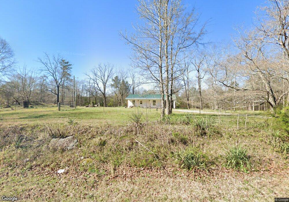
1090 Sims Bridge Rd Commerce, GA 30530
Estimated Value: $144,856 - $237,000
1
Bed
1
Bath
600
Sq Ft
$330/Sq Ft
Est. Value
About This Home
This home is located at 1090 Sims Bridge Rd, Commerce, GA 30530 and is currently estimated at $197,964, approximately $329 per square foot. 1090 Sims Bridge Rd is a home located in Banks County with nearby schools including Banks County Primary School, Banks County Elementary School, and Banks County Middle School.
Ownership History
Date
Name
Owned For
Owner Type
Purchase Details
Closed on
Jul 28, 2023
Sold by
Krieg Alan
Bought by
Krieg Augie
Current Estimated Value
Home Financials for this Owner
Home Financials are based on the most recent Mortgage that was taken out on this home.
Original Mortgage
$135,800
Outstanding Balance
$132,376
Interest Rate
6.71%
Mortgage Type
New Conventional
Estimated Equity
$65,588
Purchase Details
Closed on
May 27, 2010
Sold by
Welch Timothy A
Bought by
Krieg Alan and Krieg Denise
Purchase Details
Closed on
Jun 21, 2007
Sold by
Nations Ray
Bought by
Nations Bobby
Create a Home Valuation Report for This Property
The Home Valuation Report is an in-depth analysis detailing your home's value as well as a comparison with similar homes in the area
Home Values in the Area
Average Home Value in this Area
Purchase History
| Date | Buyer | Sale Price | Title Company |
|---|---|---|---|
| Krieg Augie | $140,000 | -- | |
| Krieg Alan | $24,000 | -- | |
| Nations Bobby | -- | -- | |
| Welch Timothy A | $20,000 | -- |
Source: Public Records
Mortgage History
| Date | Status | Borrower | Loan Amount |
|---|---|---|---|
| Open | Krieg Augie | $135,800 |
Source: Public Records
Tax History
| Year | Tax Paid | Tax Assessment Tax Assessment Total Assessment is a certain percentage of the fair market value that is determined by local assessors to be the total taxable value of land and additions on the property. | Land | Improvement |
|---|---|---|---|---|
| 2025 | $1,131 | $59,230 | $19,776 | $39,454 |
| 2024 | $1,131 | $55,984 | $17,978 | $38,006 |
| 2023 | $1,103 | $48,582 | $14,916 | $33,666 |
| 2022 | $908 | $43,200 | $13,825 | $29,375 |
| 2021 | $824 | $36,888 | $9,875 | $27,013 |
| 2020 | $779 | $33,975 | $8,298 | $25,677 |
| 2019 | $783 | $33,975 | $8,298 | $25,677 |
| 2018 | $716 | $30,556 | $6,383 | $24,173 |
| 2017 | $643 | $26,304 | $4,912 | $21,392 |
| 2016 | $123 | $4,912 | $4,912 | $0 |
| 2015 | $234 | $4,912 | $4,912 | $0 |
| 2014 | $234 | $9,932 | $9,932 | $0 |
| 2013 | -- | $9,932 | $9,932 | $0 |
Source: Public Records
Map
Nearby Homes
- 0 Freedom Ln Unit 9B
- 0 Freedom Ln Unit 18C 10380663
- 0 Freedom Ln Unit 9D
- 0 Freedom Ln Unit 9C
- 0 Freedom Ln Unit 18B 10379747
- 0 Freedom Ln Unit 9E
- 224 Hebron Rd
- 166 Freedom Ln
- 731 Borders Rd
- 333 Sims Bridge Rd
- 163 M t Trail
- 193 Wrights Mill Ln
- 161 Meadow Lake Dr
- 2015 Highway 59
- 119 Gordon Rd
- 482 Hooper Rd
- 0 Varner Rd
- 0 Lord Road Tract #5 Unit 10693839
- 0 Lord Road Tract #5 Unit CL349237
- 21 Jess Ln
- 228 Marigold Ln
- 1061 Sims Bridge Rd
- 1061 Sims Bridge Rd Unit 3
- 000 Sims Bridge Rd
- 101 Freedom Ln
- 1150 Sims Bridge Rd
- 1021 Sims Bridge Rd
- 1147 Sims Bridge Rd
- 7 Freedom Ln
- 7 Freedom Ln Unit 19
- 125 Freedom Ln
- B0 Freedom Ln
- 1049 Sims Bridge Rd
- 1045 Sims Bridge Rd
- 163 Marigold Ln
- 185 Marigold Ln
- 102 Freedom Ln
- 113 Freedom Ln Unit 21
- 113 Freedom Ln
- 143 Marigold Ln
Your Personal Tour Guide
Ask me questions while you tour the home.