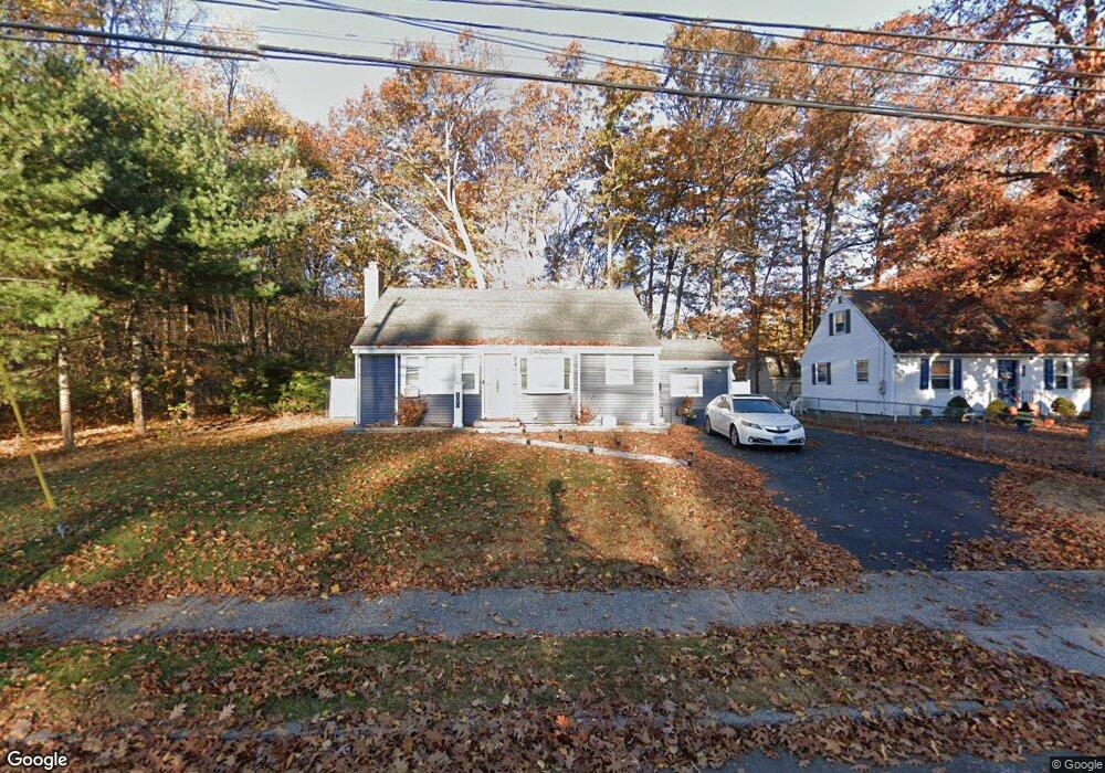
1090 Slater Rd New Britain, CT 06053
Estimated Value: $265,000 - $314,000
3
Beds
2
Baths
1,628
Sq Ft
$180/Sq Ft
Est. Value
About This Home
This home is located at 1090 Slater Rd, New Britain, CT 06053 and is currently estimated at $293,176, approximately $180 per square foot. 1090 Slater Rd is a home located in Hartford County with nearby schools including Jefferson School, Pulaski Middle School, and Mountain Laurel Sudbury School.
Ownership History
Date
Name
Owned For
Owner Type
Purchase Details
Closed on
Feb 23, 2010
Sold by
Topa Peter and Topa Peter
Bought by
Bozeman Charese L
Current Estimated Value
Home Financials for this Owner
Home Financials are based on the most recent Mortgage that was taken out on this home.
Original Mortgage
$142,348
Outstanding Balance
$92,881
Interest Rate
4.75%
Mortgage Type
FHA
Estimated Equity
$200,295
Purchase Details
Closed on
Nov 8, 2004
Sold by
Holliday John and Grant Trevonya
Bought by
3Rd Peter Toxa and Toxa Peter M
Home Financials for this Owner
Home Financials are based on the most recent Mortgage that was taken out on this home.
Original Mortgage
$121,500
Interest Rate
8.3%
Purchase Details
Closed on
Dec 9, 1988
Sold by
Michaels Burton A
Bought by
Charest Leo A
Create a Home Valuation Report for This Property
The Home Valuation Report is an in-depth analysis detailing your home's value as well as a comparison with similar homes in the area
Home Values in the Area
Average Home Value in this Area
Purchase History
| Date | Buyer | Sale Price | Title Company |
|---|---|---|---|
| Bozeman Charese L | $145,000 | -- | |
| 3Rd Peter Toxa | $135,000 | -- | |
| Charest Leo A | $141,000 | -- |
Source: Public Records
Mortgage History
| Date | Status | Borrower | Loan Amount |
|---|---|---|---|
| Open | Charest Leo A | $142,348 | |
| Closed | Charest Leo A | $7,656 | |
| Previous Owner | Charest Leo A | $121,500 | |
| Previous Owner | Charest Leo A | $101,250 |
Source: Public Records
Tax History Compared to Growth
Tax History
| Year | Tax Paid | Tax Assessment Tax Assessment Total Assessment is a certain percentage of the fair market value that is determined by local assessors to be the total taxable value of land and additions on the property. | Land | Improvement |
|---|---|---|---|---|
| 2025 | $5,365 | $136,920 | $58,520 | $78,400 |
| 2024 | $5,421 | $136,920 | $58,520 | $78,400 |
| 2023 | $5,241 | $136,920 | $58,520 | $78,400 |
| 2022 | $4,543 | $91,770 | $24,640 | $67,130 |
| 2021 | $4,543 | $91,770 | $24,640 | $67,130 |
| 2020 | $4,634 | $91,770 | $24,640 | $67,130 |
| 2019 | $4,634 | $91,770 | $24,640 | $67,130 |
| 2018 | $4,634 | $91,770 | $24,640 | $67,130 |
| 2017 | $4,002 | $79,240 | $24,640 | $54,600 |
| 2016 | $4,002 | $79,240 | $24,640 | $54,600 |
| 2015 | $3,883 | $79,240 | $24,640 | $54,600 |
| 2014 | $3,883 | $79,240 | $24,640 | $54,600 |
Source: Public Records
Map
Nearby Homes
- 79 Helen Dr
- 874 Slater Rd
- 2453 Corbin Ave
- 27 Candlewood Ln
- 59 Heather Ln
- 34 Hutchinson St
- 910 Farmington Ave
- 67 Eastwick Rd
- 95 Pierremount Ave
- 410 Farmington Ave Unit O6
- 152 Oakland Ave
- 234 Pierremount Ave
- 34 Dorman Rd
- 16 Jeffrey Dr
- 83 Kim Dr
- 1114 Fienemann Rd
- 394 Mcclintock St
- 19 Maplehurst Ave
- 108 Commonwealth Ave
- 8128 Colt Hwy
- 1096 Slater Rd
- 1104 Slater Rd
- 40 Royal Oak Rd
- 34 Royal Oak Rd
- 1110 Slater Rd
- 1097 Slater Rd
- 1081 Slater Rd
- 1099 Slater Rd
- 30 Royal Oak Rd
- 46 Royal Oak Rd
- 1116 Slater Rd
- 1111 Slater Rd
- 24 Royal Oak Rd
- 54 Royal Oak Rd
- 1124 Slater Rd
- 1117 Slater Rd
- 41 Royal Oak Rd
- 18 Royal Oak Rd
- 27 Royal Oak Rd
- 1129 Slater Rd