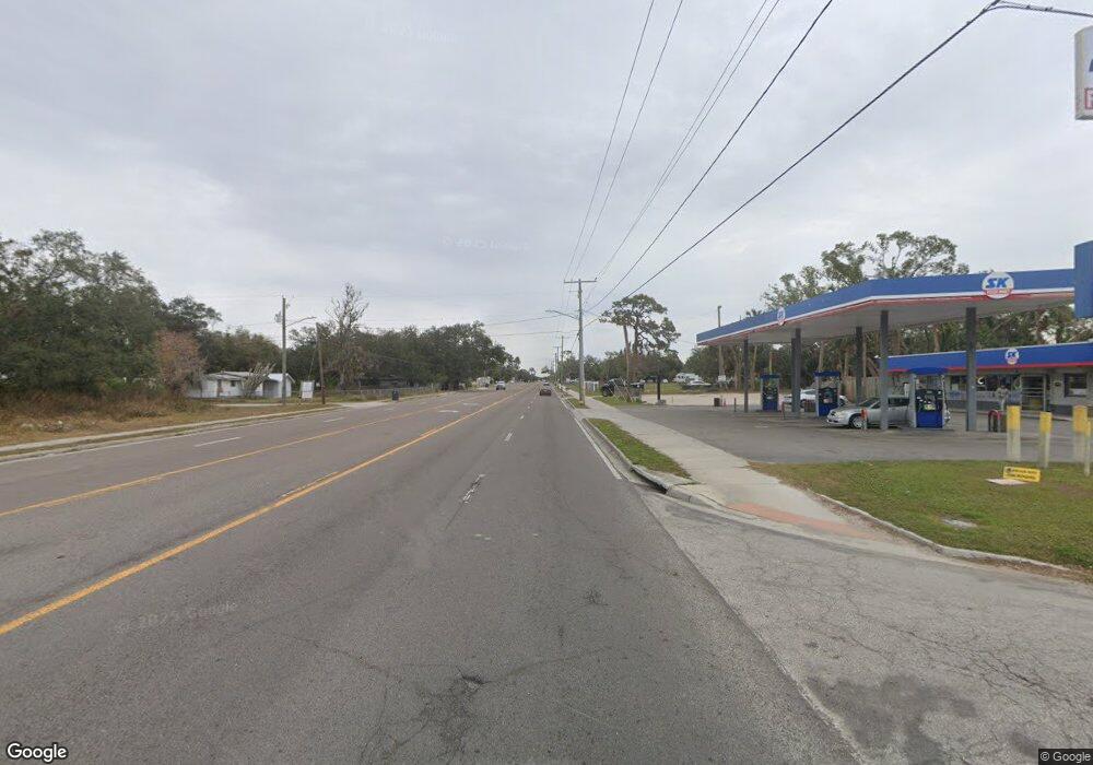
10905 S 41st Hwy Gibsonton, FL 33534
Estimated Value: $1,276,265
1
Bed
1
Bath
34,668
Sq Ft
$37/Sq Ft
Est. Value
About This Home
This home is located at 10905 S 41st Hwy, Gibsonton, FL 33534 and is currently estimated at $1,276,265, approximately $36 per square foot. 10905 S 41st Hwy is a home located in Hillsborough County with nearby schools including Gibsonton Elementary School, Dowdell Middle Magnet School, and East Bay High School.
Ownership History
Date
Name
Owned For
Owner Type
Purchase Details
Closed on
Apr 29, 2022
Sold by
General Holdings Inc
Bought by
Ccd Jr Lorain Llc
Current Estimated Value
Purchase Details
Closed on
Aug 19, 2016
Sold by
Wjjs Properties Llc
Bought by
General Holdings Inc
Home Financials for this Owner
Home Financials are based on the most recent Mortgage that was taken out on this home.
Original Mortgage
$574,000
Interest Rate
3.42%
Mortgage Type
Future Advance Clause Open End Mortgage
Create a Home Valuation Report for This Property
The Home Valuation Report is an in-depth analysis detailing your home's value as well as a comparison with similar homes in the area
Home Values in the Area
Average Home Value in this Area
Purchase History
| Date | Buyer | Sale Price | Title Company |
|---|---|---|---|
| Ccd Jr Lorain Llc | $1,400,000 | Commerce Title | |
| General Holdings Inc | $675,000 | None Available |
Source: Public Records
Mortgage History
| Date | Status | Borrower | Loan Amount |
|---|---|---|---|
| Previous Owner | General Holdings Inc | $574,000 |
Source: Public Records
Tax History Compared to Growth
Tax History
| Year | Tax Paid | Tax Assessment Tax Assessment Total Assessment is a certain percentage of the fair market value that is determined by local assessors to be the total taxable value of land and additions on the property. | Land | Improvement |
|---|---|---|---|---|
| 2024 | $23,633 | $1,307,500 | $492,039 | $815,461 |
| 2023 | $21,392 | $1,131,300 | $464,526 | $666,774 |
| 2022 | $14,447 | $821,100 | $382,783 | $438,317 |
| 2021 | $12,790 | $629,536 | $283,849 | $345,687 |
| 2020 | $12,325 | $599,009 | $266,658 | $332,351 |
| 2019 | $11,930 | $575,758 | $266,658 | $309,100 |
| 2018 | $11,568 | $517,415 | $0 | $0 |
| 2017 | $10,958 | $494,055 | $0 | $0 |
| 2016 | $11,156 | $503,678 | $0 | $0 |
| 2015 | $10,607 | $457,889 | $0 | $0 |
| 2014 | -- | $420,580 | $0 | $0 |
| 2013 | -- | $416,132 | $0 | $0 |
Source: Public Records
Map
Nearby Homes
- 0 Palm Ave
- 11224 Restwood Dr
- 6110 Nundy Ave
- 7013 Gibsonton Dr
- 10009 Connecticut St
- 10004 Ethel St
- 7013 Symmes Rd
- 7604 Sunshine Bridge Ave
- 9909 S Us Highway 41
- 11520 Corwin St
- 10119 Candleberry Woods Ln
- 7414 Indigo Oasis Ct
- 11539 Tangle Branch Ln
- 7707 Sunshine Bridge Ave
- 6901 Michigan Ave
- 7707 Gibsonton Dr
- 7515 Anna Ave
- 7309 Tangle Bend Dr
- 6214 Bucket Ct
- 11632 Tangle Stone Dr
- 11003 S Us Highway 41
- 10901 S Us Highway 41
- 6129 Cliff Ave
- 11011 S Us Highway 41
- 6123 Cedar Ave
- 6118 Cedar Ave
- 10833 S Us Highway 41
- 10902 S Us Highway 41
- 6121 Cliff Ave
- 6117 Cedar Ave
- 6128 Cliff Ave
- 6122 Palm Ave
- 0 Cedar Ave
- 6126 Cliff Ave
- 6119 Cliff Ave
- 6120 Palm Ave
- 6124 Cliff Ave
- 6117 Cliff Ave
- 6122 Cliff Ave
- 6118 Palm Ave
