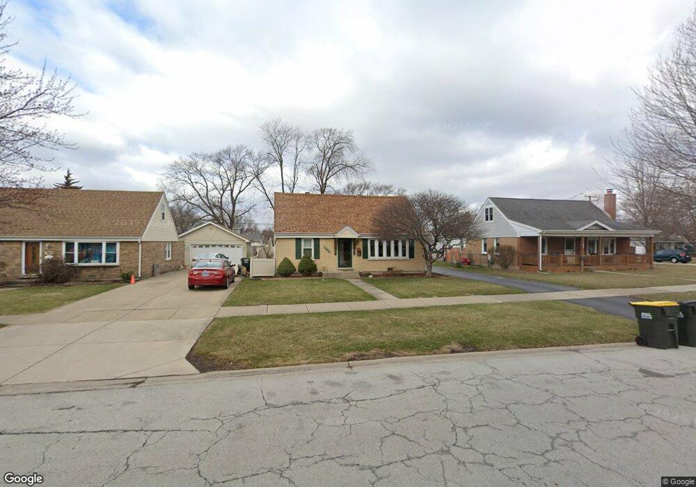
10906 Austin Ave Chicago Ridge, IL 60415
Estimated Value: $230,000 - $316,000
2
Beds
1
Bath
973
Sq Ft
$285/Sq Ft
Est. Value
About This Home
This home is located at 10906 Austin Ave, Chicago Ridge, IL 60415 and is currently estimated at $277,173, approximately $284 per square foot. 10906 Austin Ave is a home located in Cook County with nearby schools including Ridge Central Elementary School, Elden D Finley Jr High School, and Harold L. Richards High School.
Ownership History
Date
Name
Owned For
Owner Type
Purchase Details
Closed on
Aug 14, 2007
Sold by
Balich Joseph D and Balich Sharon
Bought by
Balich Joseph D and Balich Sharon
Current Estimated Value
Purchase Details
Closed on
Jun 28, 1994
Sold by
Zapalik John C and Zapalik Deborah
Bought by
Balich Joseph D and Selcke Sharon J
Home Financials for this Owner
Home Financials are based on the most recent Mortgage that was taken out on this home.
Original Mortgage
$108,450
Interest Rate
5.6%
Create a Home Valuation Report for This Property
The Home Valuation Report is an in-depth analysis detailing your home's value as well as a comparison with similar homes in the area
Home Values in the Area
Average Home Value in this Area
Purchase History
| Date | Buyer | Sale Price | Title Company |
|---|---|---|---|
| Balich Joseph D | -- | None Available | |
| Balich Joseph D | $121,500 | Attorneys Natl Title Network |
Source: Public Records
Mortgage History
| Date | Status | Borrower | Loan Amount |
|---|---|---|---|
| Closed | Balich Joseph D | $108,450 |
Source: Public Records
Tax History Compared to Growth
Tax History
| Year | Tax Paid | Tax Assessment Tax Assessment Total Assessment is a certain percentage of the fair market value that is determined by local assessors to be the total taxable value of land and additions on the property. | Land | Improvement |
|---|---|---|---|---|
| 2024 | $5,736 | $21,000 | $4,572 | $16,428 |
| 2023 | $5,047 | $21,000 | $4,572 | $16,428 |
| 2022 | $5,047 | $16,304 | $4,001 | $12,303 |
| 2021 | $4,863 | $16,302 | $4,000 | $12,302 |
| 2020 | $4,888 | $16,302 | $4,000 | $12,302 |
| 2019 | $4,502 | $14,958 | $3,619 | $11,339 |
| 2018 | $4,278 | $14,958 | $3,619 | $11,339 |
| 2017 | $4,308 | $14,958 | $3,619 | $11,339 |
| 2016 | $3,895 | $12,262 | $3,048 | $9,214 |
| 2015 | $3,772 | $12,262 | $3,048 | $9,214 |
| 2014 | $3,715 | $12,262 | $3,048 | $9,214 |
| 2013 | $4,297 | $14,957 | $3,048 | $11,909 |
Source: Public Records
Map
Nearby Homes
- 10925 Mcvicker Ave
- 10925 Lyman Ave
- 10854 Lyman Ave
- 5924 W 109th St
- 10937 Moody Ave
- 10755 Mason Ave
- 5825 109th St
- 11024 Mason Ave
- 6040 111th St
- 10807 Oak Ave
- 10821 Princess Ave
- 10832 Massasoit Ave
- 10912 Princess Ave
- 10706 Oak Ave
- 11013 Menard Ave
- 10825 Oxford Ave
- 5810 107th Court Way
- 5730 110th St
- 10647 Princess Ave
- 10529 Lyman Ave
- 10912 Austin Ave
- 10900 Austin Ave
- 10918 Austin Ave
- 10907 Mcvicker Ave
- 10913 Mcvicker Ave
- 10901 Mcvicker Ave
- 10924 Austin Ave
- 10901 Austin Ave
- 10854 Austin Ave
- 10907 Austin Ave
- 10855 Mcvicker Ave
- 10930 Austin Ave
- 10848 Austin Ave
- 10913 Austin Ave
- 5937 109th St
- 10931 Mcvicker Ave
- 10849 Mcvicker Ave
- 10919 Austin Ave
- 10936 Austin Ave
- 10842 Austin Ave