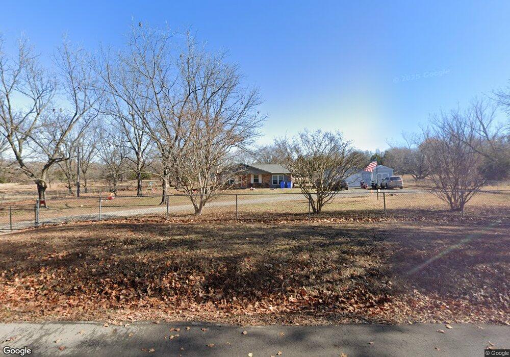
109079 S 4110 Rd Checotah, OK 74426
Estimated Value: $266,039 - $278,000
3
Beds
2
Baths
1,418
Sq Ft
$191/Sq Ft
Est. Value
About This Home
This home is located at 109079 S 4110 Rd, Checotah, OK 74426 and is currently estimated at $270,510, approximately $190 per square foot. 109079 S 4110 Rd is a home located in McIntosh County with nearby schools including Marshall Elementary School, Checotah Intermediate Elementary School, and Checotah Middle School.
Ownership History
Date
Name
Owned For
Owner Type
Purchase Details
Closed on
Apr 9, 2024
Sold by
Larry Paul And Roxanna Swanson Family Re and Swanson Larry Paul
Bought by
White Luke and White Megan Leann
Current Estimated Value
Home Financials for this Owner
Home Financials are based on the most recent Mortgage that was taken out on this home.
Original Mortgage
$254,000
Outstanding Balance
$249,131
Interest Rate
6.74%
Mortgage Type
VA
Estimated Equity
$21,379
Purchase Details
Closed on
Dec 23, 2002
Sold by
Nixon
Bought by
Swanson
Create a Home Valuation Report for This Property
The Home Valuation Report is an in-depth analysis detailing your home's value as well as a comparison with similar homes in the area
Purchase History
| Date | Buyer | Sale Price | Title Company |
|---|---|---|---|
| White Luke | $254,000 | Titan Title & Closing | |
| Swanson | $63,000 | -- |
Source: Public Records
Mortgage History
| Date | Status | Borrower | Loan Amount |
|---|---|---|---|
| Open | White Luke | $254,000 |
Source: Public Records
Tax History
| Year | Tax Paid | Tax Assessment Tax Assessment Total Assessment is a certain percentage of the fair market value that is determined by local assessors to be the total taxable value of land and additions on the property. | Land | Improvement |
|---|---|---|---|---|
| 2025 | $1,334 | $15,098 | $1,100 | $13,998 |
| 2024 | $1,420 | $16,488 | $1,100 | $15,388 |
| 2023 | $800 | $10,416 | $1,081 | $9,335 |
| 2022 | $807 | $10,370 | $1,035 | $9,335 |
| 2021 | $810 | $9,538 | $203 | $9,335 |
| 2020 | $821 | $9,538 | $203 | $9,335 |
| 2019 | $780 | $10,314 | $222 | $10,092 |
| 2018 | $749 | $9,164 | $197 | $8,967 |
| 2017 | $719 | $8,638 | $186 | $8,452 |
| 2016 | $712 | $8,387 | $181 | $8,206 |
| 2015 | $689 | $8,143 | $184 | $7,959 |
| 2014 | $665 | $7,905 | $179 | $7,726 |
Source: Public Records
Map
Nearby Homes
- 411321 E 1080 Rd
- N 4110 Rd
- 410052 E 1103 Rd
- 000 Spencer Rd
- 107349 S 4091 Rd
- 0 1065 Rd Unit 2551189
- 413697 E 1090 Rd
- 409612 E 1115 Rd
- 409623 E 1115 Rd
- 0000 Highway 150
- 116785 S 4214 Rd
- 415472 E 1073 Rd
- 414397 E 1074 Rd
- 0000 Oklahoma 150
- 109866 S 4155 Rd
- 415461 E 1094 Rd
- 410800 E 1135 Rd
- TBD S 4110 Rd
- 109948 S 4155 Rd
- 415299 E 1073 Rd
- 109079 S 4110 Rd
- 109142 S 4110 Rd
- 0 N 4110 Rd Unit 2118192
- 0 N 4110 Rd Unit 2204347
- 0 Ns 4110 Rd Unit 994848
- 109278 S 4110 Rd
- 109296 S 4110 Rd
- 0 Pierce Rd Unit 1606555
- 411626 E 1090 Rd
- 410175 E 1080 Rd
- 411631 E 1090 Rd
- 410397 E 1090 Rd
- 410240 E 1090 Rd
- 410910 E 1097 Rd
- 410303 E 1090 Rd
- 410873 E 1099 Rd
- 410873 E 1099 Rd
- 109655 S 4108 Rd
- 410840 E 1098 Rd
- 410845 E 1098 Rd