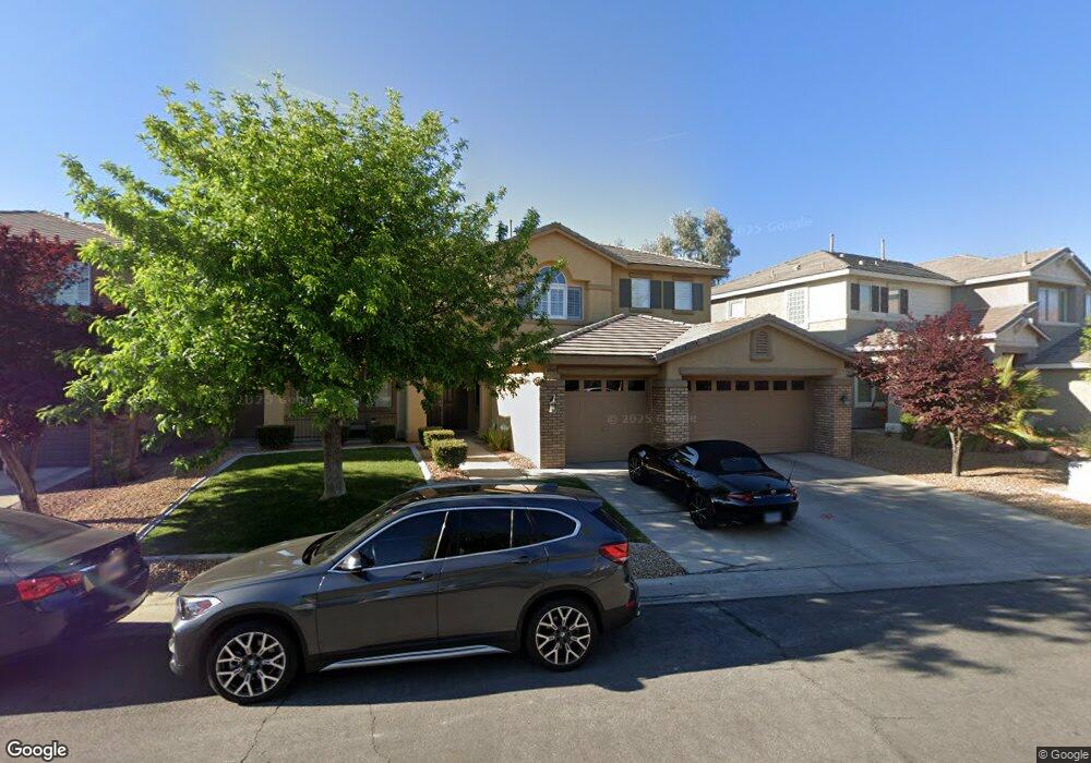
10909 Salford Dr Las Vegas, NV 89144
Summerlin NeighborhoodEstimated Value: $896,780 - $992,000
4
Beds
3
Baths
3,424
Sq Ft
$276/Sq Ft
Est. Value
About This Home
This home is located at 10909 Salford Dr, Las Vegas, NV 89144 and is currently estimated at $944,695, approximately $275 per square foot. 10909 Salford Dr is a home located in Clark County with nearby schools including Ethel W. Staton Elementary School, Sig Rogich Middle School, and Palo Verde High School.
Ownership History
Date
Name
Owned For
Owner Type
Purchase Details
Closed on
Sep 18, 2000
Sold by
Kaufman & Broad Of Nevada Inc
Bought by
Galsky Mark B and Galsky Debra J
Current Estimated Value
Home Financials for this Owner
Home Financials are based on the most recent Mortgage that was taken out on this home.
Original Mortgage
$158,800
Outstanding Balance
$57,754
Interest Rate
8.07%
Estimated Equity
$886,941
Create a Home Valuation Report for This Property
The Home Valuation Report is an in-depth analysis detailing your home's value as well as a comparison with similar homes in the area
Home Values in the Area
Average Home Value in this Area
Purchase History
| Date | Buyer | Sale Price | Title Company |
|---|---|---|---|
| Galsky Mark B | $317,656 | First American Title Co |
Source: Public Records
Mortgage History
| Date | Status | Borrower | Loan Amount |
|---|---|---|---|
| Open | Galsky Mark B | $158,800 |
Source: Public Records
Tax History Compared to Growth
Tax History
| Year | Tax Paid | Tax Assessment Tax Assessment Total Assessment is a certain percentage of the fair market value that is determined by local assessors to be the total taxable value of land and additions on the property. | Land | Improvement |
|---|---|---|---|---|
| 2025 | $4,789 | $220,589 | $85,260 | $135,329 |
| 2024 | $4,650 | $220,589 | $85,260 | $135,329 |
| 2023 | $4,650 | $199,929 | $72,030 | $127,899 |
| 2022 | $4,515 | $169,528 | $52,553 | $116,975 |
| 2021 | $4,383 | $164,512 | $53,288 | $111,224 |
| 2020 | $4,253 | $156,484 | $46,305 | $110,179 |
| 2019 | $4,129 | $150,760 | $42,263 | $108,497 |
| 2018 | $4,008 | $140,383 | $36,383 | $104,000 |
| 2017 | $4,579 | $139,482 | $34,178 | $105,304 |
| 2016 | $3,795 | $135,136 | $29,768 | $105,368 |
| 2015 | $3,788 | $128,309 | $24,990 | $103,319 |
| 2014 | $3,677 | $110,613 | $16,538 | $94,075 |
Source: Public Records
Map
Nearby Homes
- 11001 Edina Ct
- 10813 Elk Lake Dr
- 620 Bianca Bay St
- 533 Via Santiago St
- 10728 Balsam Creek Ave
- 10730 Amber Ridge Dr Unit 206
- 10705 Sprucedale Ave
- 10710 Destination Ln Unit 201
- 500 Joe Willis St
- 11226 Kenyan Sunshine Ct
- 10600 Amber Ridge Dr Unit 203
- 205 Derwent Place
- 10524 India Hawthorn Ave
- 956 Baronet Dr
- 452 Crocus Hill St
- 713 Jacobs Ladder Place
- 353 Amber Pine St Unit 203
- 653 Del Giorno St
- 957 Baronet Dr
- 11304 Asilo Bianco Ave
- 10905 Salford Dr
- 10913 Salford Dr
- 10917 Salford Dr
- 10901 Salford Dr Unit 1
- 609 Runbridge St
- 10908 Salford Dr
- 612 Runbridge St
- 10912 Salford Dr
- 10921 Salford Dr
- 605 Runbridge St
- 608 Runbridge St
- 612 Napatree St
- 604 Runbridge St
- 11001 Salford Dr
- 10917 Maryville Ave
- 608 Napatree St
- 601 Runbridge St
- 600 Runbridge St
- 10921 Maryville Ave
- 11001 Cherwell Ct