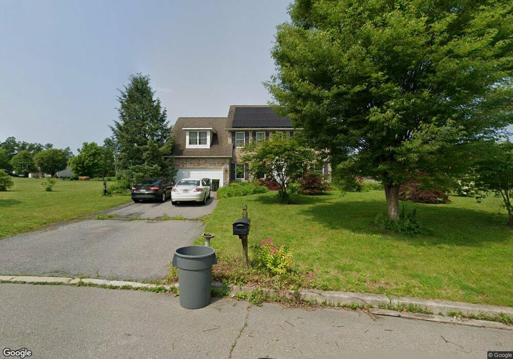
1091 Del Dr Walnutport, PA 18088
Estimated Value: $526,964 - $557,000
3
Beds
3
Baths
2,516
Sq Ft
$217/Sq Ft
Est. Value
About This Home
This home is located at 1091 Del Dr, Walnutport, PA 18088 and is currently estimated at $544,991, approximately $216 per square foot. 1091 Del Dr is a home located in Northampton County with nearby schools including Lehigh Elementary School, Northampton Area Middle School, and Northampton Area High School.
Ownership History
Date
Name
Owned For
Owner Type
Purchase Details
Closed on
Feb 9, 2018
Sold by
Gardineer Christopher J
Bought by
Gardineer Joy
Current Estimated Value
Purchase Details
Closed on
Jun 18, 2009
Sold by
Wagner Enterprises Ltd
Bought by
Gardineer Christopher J and Gardineer Joy C
Home Financials for this Owner
Home Financials are based on the most recent Mortgage that was taken out on this home.
Original Mortgage
$325,986
Outstanding Balance
$207,734
Interest Rate
4.93%
Mortgage Type
FHA
Estimated Equity
$337,257
Create a Home Valuation Report for This Property
The Home Valuation Report is an in-depth analysis detailing your home's value as well as a comparison with similar homes in the area
Home Values in the Area
Average Home Value in this Area
Purchase History
| Date | Buyer | Sale Price | Title Company |
|---|---|---|---|
| Gardineer Joy | -- | None Available | |
| Gardineer Christopher J | $332,500 | None Available |
Source: Public Records
Mortgage History
| Date | Status | Borrower | Loan Amount |
|---|---|---|---|
| Open | Gardineer Christopher J | $325,986 |
Source: Public Records
Tax History Compared to Growth
Tax History
| Year | Tax Paid | Tax Assessment Tax Assessment Total Assessment is a certain percentage of the fair market value that is determined by local assessors to be the total taxable value of land and additions on the property. | Land | Improvement |
|---|---|---|---|---|
| 2025 | $1,057 | $97,900 | $29,100 | $68,800 |
| 2024 | $7,197 | $97,900 | $29,100 | $68,800 |
| 2023 | $7,069 | $97,900 | $29,100 | $68,800 |
| 2022 | $7,069 | $97,900 | $29,100 | $68,800 |
| 2021 | $7,087 | $97,900 | $29,100 | $68,800 |
| 2020 | $7,087 | $97,900 | $29,100 | $68,800 |
| 2019 | $6,983 | $97,900 | $29,100 | $68,800 |
| 2018 | $6,879 | $97,900 | $29,100 | $68,800 |
| 2017 | $6,730 | $97,900 | $29,100 | $68,800 |
| 2016 | -- | $97,900 | $29,100 | $68,800 |
| 2015 | -- | $97,900 | $29,100 | $68,800 |
| 2014 | -- | $97,900 | $29,100 | $68,800 |
Source: Public Records
Map
Nearby Homes
- 4119 Butternut Dr
- 1015 Honeysuckle Rd
- 137 E Zimmer Dr
- 4231 Independence Ln
- 4390 Woodland Cir
- 904 Municipal Rd
- 1225 Meyer Dr
- 95 Nashua St
- 93 Nashua St
- 79 De Rose St
- 12 E Zimmer Dr
- 4196 Independence Ln
- 32 De Rose St
- 38 De Rose St
- 28 Ritzcraft Dr
- 861 Municipal Rd
- 54 Zimmer Dr W Unit 54
- 4083 W Mountain View Dr
- 4405 Lehigh Dr
- 0 Walnut Dr
- 0 Del Dr Unit 319476
- 0 Del Dr Unit 319474
- 0 Del Dr Unit 319470
- 0 Del Dr Unit 19/20 319674
- 0 Del Dr Unit 326068
- 0 Del Dr Unit 19/20 326067
- 0 Del Dr Unit 326065
- 0 Del Dr Unit 326061
- 0 Del Dr Unit 337223
- 0 Del Dr Unit 19/20 334200
- 0 Del Dr Unit 335939
- 0 Del Dr Unit 339807
- 0 Del Dr Unit 19/20 340466
- 0 Del Dr
- 1045 Del Dr
- 1045 Del Dr Unit Model
- 1049 Del Dr
- 1095 Del Dr
- 1048 Del Dr
- 1048 Del Dr Unit Lot20