Estimated Value: $124,000 - $127,000
2
Beds
2
Baths
1,260
Sq Ft
$99/Sq Ft
Est. Value
About This Home
This home is located at 1091 Normandy Terrace Dr Unit 116, Flint, MI 48532 and is currently estimated at $125,133, approximately $99 per square foot. 1091 Normandy Terrace Dr Unit 116 is a home located in Genesee County with nearby schools including Carman-Ainsworth High School, Genesee STEM Academy, and St. Paul Lutheran School.
Ownership History
Date
Name
Owned For
Owner Type
Purchase Details
Closed on
Jul 2, 2025
Sold by
Arthur G Curtiss G and Arthur Lois E
Bought by
Smith Lon Eugene
Current Estimated Value
Home Financials for this Owner
Home Financials are based on the most recent Mortgage that was taken out on this home.
Original Mortgage
$100,000
Outstanding Balance
$99,832
Interest Rate
6.89%
Mortgage Type
New Conventional
Estimated Equity
$25,301
Purchase Details
Closed on
Oct 8, 2014
Sold by
Curtiss Arthur G and Curtiss Lois E
Bought by
Curtiss Arthur G and Joint Lois E
Create a Home Valuation Report for This Property
The Home Valuation Report is an in-depth analysis detailing your home's value as well as a comparison with similar homes in the area
Home Values in the Area
Average Home Value in this Area
Purchase History
| Date | Buyer | Sale Price | Title Company |
|---|---|---|---|
| Smith Lon Eugene | $125,000 | None Listed On Document | |
| Curtiss Arthur G | -- | None Available |
Source: Public Records
Mortgage History
| Date | Status | Borrower | Loan Amount |
|---|---|---|---|
| Open | Smith Lon Eugene | $100,000 |
Source: Public Records
Tax History Compared to Growth
Tax History
| Year | Tax Paid | Tax Assessment Tax Assessment Total Assessment is a certain percentage of the fair market value that is determined by local assessors to be the total taxable value of land and additions on the property. | Land | Improvement |
|---|---|---|---|---|
| 2025 | $1,075 | $49,100 | $0 | $0 |
| 2024 | $515 | $43,200 | $0 | $0 |
| 2023 | $491 | $35,400 | $0 | $0 |
| 2022 | $500 | $32,200 | $0 | $0 |
| 2021 | $946 | $27,100 | $0 | $0 |
| 2020 | $441 | $27,900 | $0 | $0 |
| 2019 | $435 | $22,100 | $0 | $0 |
| 2018 | $880 | $19,600 | $0 | $0 |
| 2017 | $848 | $19,600 | $0 | $0 |
| 2016 | $869 | $18,500 | $0 | $0 |
| 2015 | $1,054 | $27,700 | $0 | $0 |
| 2014 | $625 | $26,500 | $0 | $0 |
| 2012 | -- | $31,400 | $31,400 | $0 |
Source: Public Records
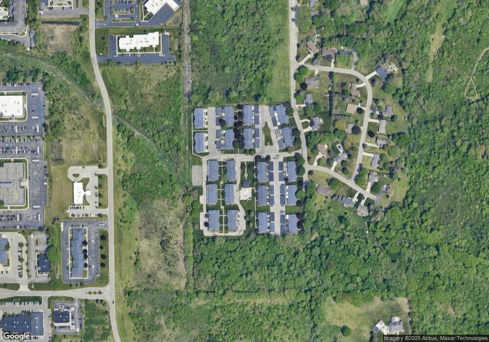
Map
Nearby Homes
- 1193 Normandy Terrace Dr
- 2 Charter Dr
- 0 Charter Dr Unit 50153638
- 3.9 Acres W Court St
- 1090 Cabot Dr
- 1068 S Graham Rd
- 1260 Gilbert St
- 1058 Cora Dr
- 1136 Gilbert St
- 4480 Corunna Rd
- 4474 Corunna Rd
- 1159 N Linden Rd
- 1540 Pound Dr
- Graham Rd N Graham Rd
- 10 Acres T A Mansour Blvd
- 4022 Beecher Rd
- 3528 Beecher Rd
- 5345 Birchtree Ct
- 3493 Ridgecliffe Dr
- 1455 S Linden Rd
- 1091 Normandy Terrace Dr Unit 5
- 1092 Normandy Terrace Dr Unit 117
- 1092 Normandy Terrace Dr Unit 5
- 1093 Normandy Terrace Dr
- 1104 Normandy Terrace Dr Unit 115
- 1104 Normandy Terrace Dr Unit 15
- 1104 Normandy Terrace Dr Unit 4
- 1094 Normandy Terrace Dr
- 1103 Normandy Terrace Dr Unit 114
- 1102 Normandy Terrace Dr
- 1102 Normandy Terrace Dr Unit 113
- 1102 Normandy Terrace Dr Unit 4
- 1101 Normandy Terrace Dr
- 1121 Normandy Terrace Dr Unit 216
- 1122 Normandy Terrace Dr
- 1123 Normandy Terrace Dr Unit 218
- 1123 Normandy Terrace Dr Unit 10
- 1124 Normandy Terrace Dr
- 1134 Normandy Terrace Dr Unit 215
- 1133 Normandy Terrace Dr