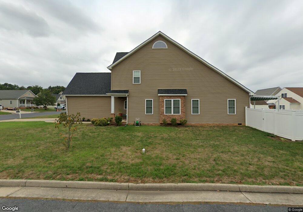
1091 Pendleton Dr Waynesboro, VA 22980
Estimated Value: $356,000 - $378,000
3
Beds
3
Baths
1,775
Sq Ft
$206/Sq Ft
Est. Value
About This Home
This home is located at 1091 Pendleton Dr, Waynesboro, VA 22980 and is currently estimated at $365,614, approximately $205 per square foot. 1091 Pendleton Dr is a home located in Waynesboro City with nearby schools including Westwood Hills Elementary School, Kate Collins Middle School, and Waynesboro High School.
Ownership History
Date
Name
Owned For
Owner Type
Purchase Details
Closed on
Dec 15, 2016
Sold by
Litten Steve E and Billman Bruce K
Bought by
Shoaf Lisa D
Current Estimated Value
Home Financials for this Owner
Home Financials are based on the most recent Mortgage that was taken out on this home.
Original Mortgage
$192,800
Outstanding Balance
$157,667
Interest Rate
3.94%
Mortgage Type
New Conventional
Estimated Equity
$207,947
Create a Home Valuation Report for This Property
The Home Valuation Report is an in-depth analysis detailing your home's value as well as a comparison with similar homes in the area
Purchase History
| Date | Buyer | Sale Price | Title Company |
|---|---|---|---|
| Shoaf Lisa D | $241,000 | Vs Title |
Source: Public Records
Mortgage History
| Date | Status | Borrower | Loan Amount |
|---|---|---|---|
| Open | Shoaf Lisa D | $192,800 |
Source: Public Records
Tax History
| Year | Tax Paid | Tax Assessment Tax Assessment Total Assessment is a certain percentage of the fair market value that is determined by local assessors to be the total taxable value of land and additions on the property. | Land | Improvement |
|---|---|---|---|---|
| 2025 | $2,745 | $334,800 | $65,000 | $269,800 |
| 2024 | $2,371 | $307,900 | $55,000 | $252,900 |
| 2023 | $2,371 | $307,900 | $55,000 | $252,900 |
| 2022 | $2,218 | $246,400 | $45,000 | $201,400 |
| 2021 | $2,218 | $246,400 | $45,000 | $201,400 |
| 2020 | $2,034 | $226,000 | $45,000 | $181,000 |
| 2019 | $2,034 | $226,000 | $45,000 | $181,000 |
| 2018 | $1,791 | $199,000 | $42,000 | $157,000 |
| 2017 | $1,731 | $194,500 | $42,000 | $152,500 |
| 2016 | $268 | $33,500 | $33,500 | $0 |
| 2015 | $268 | $33,500 | $33,500 | $0 |
| 2014 | -- | $33,500 | $33,500 | $0 |
| 2013 | -- | $0 | $0 | $0 |
Source: Public Records
Map
Nearby Homes
- 1066 Pendleton Dr
- 300 Alphin Ave
- 2229 Cortland St
- 212 Inglecress Rd
- 416 Pelham Cove
- 100 Buckingham Place
- 104 Pelham Woods Cir
- 2814 Jefferson Ln
- 1004 High Point Ct
- 2500 Forest Dr
- TBD Belvue Rd Unit 18
- 124 Pelham Woods Cir
- 2509 Belvue Rd Unit 18
- 2509 Belvue Rd
- 2524 Belvue Rd
- 1837 Cherokee Rd
- 701 Rosser Ave
- 2849 Jefferson Ln
- 553 Summercrest Ave
- 100 Julian Dr
- 1085 Pendleton Dr
- 1001 Pendleton Dr
- 1079 Pendleton Dr
- 1079 Pendleton Dr
- 342 Taylor St
- 342 Taylor St
- 336 Taylor St
- 1096 Pendleton Dr
- 348 Taylor St
- 1013 Pendleton Dr
- 1090 Pendleton Dr
- 330 Taylor St
- 1084 Pendleton Dr
- 1019 Pendleton Dr
- 324 Taylor St
- 1067 Pendleton Dr
- TBD Taylor St
- 1078 Pendleton Dr
- 1025 Pendleton Dr
- 906 Battery Rd
Your Personal Tour Guide
Ask me questions while you tour the home.