Estimated Value: $149,000 - $158,000
3
Beds
1
Bath
912
Sq Ft
$171/Sq Ft
Est. Value
About This Home
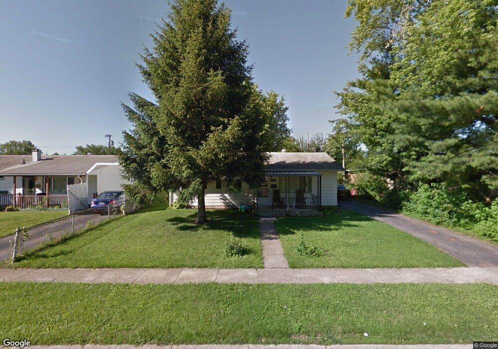
This home is located at 1091 Reid Ave, Xenia, OH 45385 and is currently estimated at $155,564, approximately $170 per square foot. 1091 Reid Ave is a home located in Greene County with nearby schools including Xenia High School, Summit Academy Community School for Alternative Learners - Xenia, and Legacy Christian Academy.
Ownership History
Date
Name
Owned For
Owner Type
Purchase Details
Closed on
Aug 16, 2013
Sold by
Burrell Rebecca L and Burrell Clarkson E
Bought by
Burrell Rebecca L and Burrell Clarkson E
Current Estimated Value
Home Financials for this Owner
Home Financials are based on the most recent Mortgage that was taken out on this home.
Original Mortgage
$32,000
Outstanding Balance
$23,930
Interest Rate
4.53%
Mortgage Type
New Conventional
Estimated Equity
$131,634
Purchase Details
Closed on
Dec 31, 2012
Sold by
Geeslin Lenora L
Bought by
Burrell Rebecca L
Purchase Details
Closed on
Sep 18, 1996
Sold by
Sturgeon Grace A
Bought by
Geeslin George W and Geeslin L
Create a Home Valuation Report for This Property
The Home Valuation Report is an in-depth analysis detailing your home's value as well as a comparison with similar homes in the area
Home Values in the Area
Average Home Value in this Area
Purchase History
| Date | Buyer | Sale Price | Title Company |
|---|---|---|---|
| Burrell Rebecca L | -- | None Available | |
| Burrell Rebecca L | -- | None Available | |
| Geeslin George W | $55,000 | -- |
Source: Public Records
Mortgage History
| Date | Status | Borrower | Loan Amount |
|---|---|---|---|
| Open | Burrell Rebecca L | $32,000 | |
| Closed | Geeslin George W | -- |
Source: Public Records
Tax History Compared to Growth
Tax History
| Year | Tax Paid | Tax Assessment Tax Assessment Total Assessment is a certain percentage of the fair market value that is determined by local assessors to be the total taxable value of land and additions on the property. | Land | Improvement |
|---|---|---|---|---|
| 2024 | $1,599 | $37,370 | $9,990 | $27,380 |
| 2023 | $1,599 | $37,370 | $9,990 | $27,380 |
| 2022 | $1,323 | $26,370 | $7,130 | $19,240 |
| 2021 | $1,341 | $26,370 | $7,130 | $19,240 |
| 2020 | $1,285 | $26,370 | $7,130 | $19,240 |
| 2019 | $1,148 | $22,190 | $4,790 | $17,400 |
| 2018 | $1,153 | $22,190 | $4,790 | $17,400 |
| 2017 | $1,104 | $22,190 | $4,790 | $17,400 |
| 2016 | $1,105 | $20,870 | $4,790 | $16,080 |
| 2015 | $1,108 | $20,870 | $4,790 | $16,080 |
| 2014 | $1,061 | $20,870 | $4,790 | $16,080 |
Source: Public Records
Map
Nearby Homes
- 1223 June Dr
- 1233 June Dr
- 1283 June Dr
- 1391 June Dr
- 1342 Kylemore Dr
- 343 Sheelin Rd
- 1351 Omard Dr
- 883 Omard Dr
- 912 Omard Dr
- 509 Antrim Rd
- 1144 Rockwell Dr
- 305-325 Bellbrook Ave
- 453 Walnut St
- 121 S Progress Dr
- 1208 Bellbrook Ave
- 0 W Church St
- 613 N West St
- 1568 Cheyenne Dr
- 137 Pleasant St
- 1272 Bellbrook Ave
- 1105 Reid Ave
- 1117 Reid Ave
- 1067 Reid Ave
- 1096 Reid Ave
- 78 Franklin Ave
- 1110 Reid Ave
- 1129 Reid Ave
- 1055 Reid Ave
- 1120 Reid Ave
- 75 Franklin Ave
- 1141 Reid Ave
- 1043 Reid Ave
- 1132 Reid Ave
- 1093 Frost Circle Dr
- 102 Franklin Ave
- 1105 Frost Circle Dr
- 1044 Reid Ave
- 93 Franklin Ave
- 1144 Reid Ave
- 1031 Reid Ave