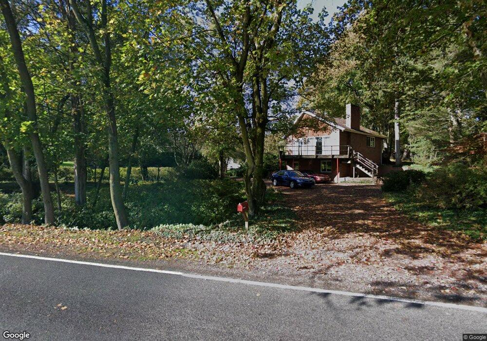
1091 Smoketown Rd Lewisburg, PA 17837
East Buffalo Township NeighborhoodEstimated Value: $325,315 - $364,000
3
Beds
3
Baths
1,546
Sq Ft
$223/Sq Ft
Est. Value
About This Home
This home is located at 1091 Smoketown Rd, Lewisburg, PA 17837 and is currently estimated at $344,579, approximately $222 per square foot. 1091 Smoketown Rd is a home located in Union County with nearby schools including Kelly Elementary School, Linntown Elementary School, and Donald H. Eichhorn Middle School.
Ownership History
Date
Name
Owned For
Owner Type
Purchase Details
Closed on
Nov 11, 2011
Sold by
Williams Richard L and Williams Jeanette M
Bought by
Trego Kristine M
Current Estimated Value
Home Financials for this Owner
Home Financials are based on the most recent Mortgage that was taken out on this home.
Original Mortgage
$163,400
Outstanding Balance
$111,369
Interest Rate
4.01%
Mortgage Type
New Conventional
Estimated Equity
$233,210
Create a Home Valuation Report for This Property
The Home Valuation Report is an in-depth analysis detailing your home's value as well as a comparison with similar homes in the area
Home Values in the Area
Average Home Value in this Area
Purchase History
| Date | Buyer | Sale Price | Title Company |
|---|---|---|---|
| Trego Kristine M | $172,000 | None Available |
Source: Public Records
Mortgage History
| Date | Status | Borrower | Loan Amount |
|---|---|---|---|
| Open | Trego Kristine M | $163,400 |
Source: Public Records
Tax History Compared to Growth
Tax History
| Year | Tax Paid | Tax Assessment Tax Assessment Total Assessment is a certain percentage of the fair market value that is determined by local assessors to be the total taxable value of land and additions on the property. | Land | Improvement |
|---|---|---|---|---|
| 2025 | $4,470 | $152,300 | $35,700 | $116,600 |
| 2024 | $4,350 | $152,300 | $35,700 | $116,600 |
| 2023 | $4,219 | $152,300 | $35,700 | $116,600 |
| 2022 | $4,211 | $152,300 | $35,700 | $116,600 |
| 2021 | $4,229 | $152,300 | $35,700 | $116,600 |
| 2020 | $4,232 | $152,300 | $35,700 | $116,600 |
| 2019 | $42,644 | $152,300 | $35,700 | $116,600 |
| 2018 | $4,207 | $152,300 | $35,700 | $116,600 |
| 2017 | $4,207 | $152,300 | $35,700 | $116,600 |
| 2016 | $4,047 | $152,300 | $35,700 | $116,600 |
| 2015 | -- | $152,300 | $35,700 | $116,600 |
| 2014 | -- | $152,300 | $35,700 | $116,600 |
Source: Public Records
Map
Nearby Homes
- 211 James Rd
- 96 Dogwood Ln
- 1500 Smoketown Rd
- 14 Edward Cir
- 183 Pheasant Ridge Rd
- 612 Stein Ln
- 520 S 22nd St
- 407 S 20th St
- 300 Sunnyside Dr
- 351 Pheasant Ridge Rd
- 84 Windsor Way
- 114 Windsor Way
- 2111 Madison Ave
- 169 Windsor Way
- 217 Hardscrabble Ln
- 692 Beagle Club Rd
- 237 Hardscrabble Ln
- 688 Beagle Club Rd
- 36 Classic Hills Dr
- 908 Hillcrest Ln
- 1069 Smoketown Rd
- 1115 Smoketown Rd
- 184 Beth Ellen Dr
- 210 Beth Ellen Dr Unit Lewisburg
- 210 Beth Ellen Dr
- 940 Stein Ln
- 984 Stein Ln
- 1145 Smoketown Rd
- 89 Anlyn Dr
- 164 Beth Ellen Dr
- 1008 Stein Ln
- 234 Beth Ellen Dr
- 23 Anlyn Dr
- 207 Beth Ellen Dr
- 185 Beth Ellen Dr
- 128 Beth Ellen Dr
- 266 Beth Ellen Dr
- 60 Anlyn Dr
- 167 Beth Ellen Dr
- 1195 Smoketown Rd