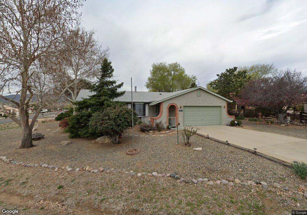
10913 E Buckboard Trail Dewey, AZ 86327
Prescott Golf & Country Club NeighborhoodEstimated Value: $358,450 - $401,000
Studio
--
Bath
1,408
Sq Ft
$271/Sq Ft
Est. Value
About This Home
This home is located at 10913 E Buckboard Trail, Dewey, AZ 86327 and is currently estimated at $381,863, approximately $271 per square foot. 10913 E Buckboard Trail is a home located in Yavapai County with nearby schools including Lake Valley Elementary School, Glassford Hill Middle School, and Bradshaw Mountain High School.
Ownership History
Date
Name
Owned For
Owner Type
Purchase Details
Closed on
May 22, 2025
Sold by
Bado Robert Dean and Bado Kerri D
Bought by
Mcquality Elijah and Alvis Elah
Current Estimated Value
Home Financials for this Owner
Home Financials are based on the most recent Mortgage that was taken out on this home.
Original Mortgage
$368,207
Outstanding Balance
$365,976
Interest Rate
6.81%
Mortgage Type
FHA
Estimated Equity
$15,887
Purchase Details
Closed on
Aug 11, 2022
Sold by
Schmitz William P
Bought by
Bado Robert Dean and Bado Kerri D
Home Financials for this Owner
Home Financials are based on the most recent Mortgage that was taken out on this home.
Original Mortgage
$150,000
Interest Rate
5.3%
Mortgage Type
New Conventional
Create a Home Valuation Report for This Property
The Home Valuation Report is an in-depth analysis detailing your home's value as well as a comparison with similar homes in the area
Home Values in the Area
Average Home Value in this Area
Purchase History
| Date | Buyer | Sale Price | Title Company |
|---|---|---|---|
| Mcquality Elijah | $375,000 | Yavapai Title Agency | |
| Bado Robert Dean | $200,000 | Dhi Title |
Source: Public Records
Mortgage History
| Date | Status | Borrower | Loan Amount |
|---|---|---|---|
| Open | Mcquality Elijah | $368,207 | |
| Previous Owner | Bado Robert Dean | $150,000 |
Source: Public Records
Tax History
| Year | Tax Paid | Tax Assessment Tax Assessment Total Assessment is a certain percentage of the fair market value that is determined by local assessors to be the total taxable value of land and additions on the property. | Land | Improvement |
|---|---|---|---|---|
| 2026 | $1,707 | $27,184 | -- | -- |
| 2024 | $1,336 | $28,031 | -- | -- |
| 2023 | $1,336 | $23,389 | $4,642 | $18,747 |
| 2022 | $1,314 | $19,154 | $4,061 | $15,093 |
| 2021 | $1,373 | $17,555 | $4,074 | $13,481 |
| 2020 | $1,319 | $0 | $0 | $0 |
| 2019 | $1,303 | $0 | $0 | $0 |
| 2018 | $1,239 | $0 | $0 | $0 |
| 2017 | $1,215 | $0 | $0 | $0 |
| 2016 | $1,174 | $0 | $0 | $0 |
| 2015 | $1,156 | $0 | $0 | $0 |
| 2014 | -- | $0 | $0 | $0 |
Source: Public Records
Map
Nearby Homes
- 10833 E Oxbow Dr
- 10784 E Oxbow Dr
- 10812 E Buckboard Trail Unit 5
- 1357 N Rustlers Roost
- 1395 N Rustlers Roost
- 10746 E Manzanita Trail
- 11040 E Singletree Trail
- 11080 E Manzanita Trail
- 10825 E Turquoise Cir
- 11055 E Lariat Ln
- 11160 E Manzanita Trail
- 1099 N Conestoga Way
- 10603 E Straight Arrow Rd
- 1049 N Arrowhead Ln Unit 645
- 1049 N Arrowhead Ln
- 10658 E High Point Dr
- 1073 N Broken Wagon Trail
- 1078 N Broken Wagon Trail
- 1246 N Barzona Ave Unit F
- 11347 E Manzanita Trail
- 10880 E Manzanita Trail Unit 3
- 10585 Manzanita Trail Unit 2
- 10585 Manzanita Trail Unit 3
- 10585 Manzanita Trail
- 10845 E Oxbow Dr
- 10875 E Oxbow Dr Unit III
- 10875 E Oxbow Dr Unit 3
- 10833 E Oxbow Dr Unit 3
- 10833 E Oxbow Dr Unit 5
- 10983 Manzanita Trail
- 10914 E Buckboard Trail
- 10872 E Manzanita Trail Unit 3
- 10895 E Manzanita Trail
- 10912 E Buckboard Trail
- 10901 E Manzanita Trail
- 10825 E Oxbow Dr
- 10904 E Buckboard Trail
- 10864 E Manzanita Trail Unit 3
- 10869 E Manzanita Trail
- 10927 E Manzanita Trail