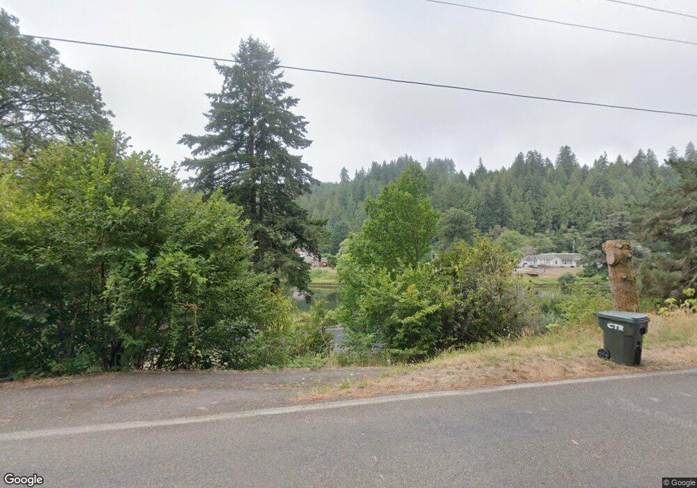
10915 E Mapleton Rd Mapleton, OR 97453
Estimated Value: $359,000 - $666,000
3
Beds
3
Baths
1,336
Sq Ft
$389/Sq Ft
Est. Value
About This Home
This home is located at 10915 E Mapleton Rd, Mapleton, OR 97453 and is currently estimated at $520,226, approximately $389 per square foot. 10915 E Mapleton Rd is a home located in Lane County with nearby schools including Mapleton Elementary School and Mapleton Junior/Senior High School.
Ownership History
Date
Name
Owned For
Owner Type
Purchase Details
Closed on
Mar 27, 2017
Sold by
Conrad Walter Wayne
Bought by
Ebert Kevin
Current Estimated Value
Home Financials for this Owner
Home Financials are based on the most recent Mortgage that was taken out on this home.
Original Mortgage
$289,750
Interest Rate
4.14%
Mortgage Type
New Conventional
Purchase Details
Closed on
Aug 10, 2016
Sold by
Conrad Margaret Gloria
Bought by
Conrad Walter Wayne
Purchase Details
Closed on
Aug 29, 2006
Sold by
Cox Randolph
Bought by
Conrad Walter Wayne and Conrad Margaret Gloria
Home Financials for this Owner
Home Financials are based on the most recent Mortgage that was taken out on this home.
Original Mortgage
$275,000
Interest Rate
6.44%
Mortgage Type
Credit Line Revolving
Create a Home Valuation Report for This Property
The Home Valuation Report is an in-depth analysis detailing your home's value as well as a comparison with similar homes in the area
Purchase History
| Date | Buyer | Sale Price | Title Company |
|---|---|---|---|
| Ebert Kevin | $345,000 | Western Title & Escrow Co | |
| Conrad Walter Wayne | -- | None Available | |
| Conrad Walter Wayne | $235,000 | First American Title |
Source: Public Records
Mortgage History
| Date | Status | Borrower | Loan Amount |
|---|---|---|---|
| Previous Owner | Ebert Kevin | $289,750 | |
| Previous Owner | Conrad Walter Wayne | $275,000 |
Source: Public Records
Tax History
| Year | Tax Paid | Tax Assessment Tax Assessment Total Assessment is a certain percentage of the fair market value that is determined by local assessors to be the total taxable value of land and additions on the property. | Land | Improvement |
|---|---|---|---|---|
| 2025 | $2,533 | $202,742 | -- | -- |
| 2024 | $2,452 | $196,837 | -- | -- |
| 2023 | $2,452 | $191,104 | $0 | $0 |
| 2022 | $2,288 | $185,538 | $0 | $0 |
| 2021 | $2,234 | $180,134 | $0 | $0 |
| 2020 | $2,165 | $174,888 | $0 | $0 |
| 2019 | $2,085 | $169,795 | $0 | $0 |
| 2018 | $1,946 | $160,049 | $0 | $0 |
| 2017 | $1,993 | $160,049 | $0 | $0 |
| 2016 | $1,934 | $155,387 | $0 | $0 |
| 2015 | $1,702 | $150,861 | $0 | $0 |
| 2014 | $1,674 | $146,467 | $0 | $0 |
Source: Public Records
Map
Nearby Homes
- 10887 E Mapleton Rd
- 10786 Oregon 126
- 11406 E Mapleton Rd
- 10195 Sweet Creek Rd
- 11425 E Mapleton Rd
- 11445 E Mapleton Rd
- 12407 Highway 36
- 87511 Tiernan Rd
- 0 Tiernan Rd Unit 2000 366995926
- 0 Tiernan Rd Unit 100
- 89731 Indian Creek Rd
- 9247 Highway 126
- 0 18-10-00-00-01300500 Unit 24316239
- 9580 N Fork Siuslaw Rd
- 90450 Deadwood Creek Rd
- 15755 Highway 36
- 0 Hwy 126 Unit 600 793013519
- 6651 Twin Fawn Dr
- 16807 Highway 36
- 0 View Loop Unit 3 526137347
- 10919 E Mapleton Rd
- 10907 E Mapleton Rd
- 88148 Chestnut St
- 10901 E Mapleton Rd
- 11736 Walnut Ave
- 88154 Chestnut St
- 11739 Walnut Ave
- 10914 E Mapleton Rd
- 10895 E Mapleton Rd
- 10894 E Mapleton Rd
- 88164 Chestnut St
- 11736 Orchard Ave
- 88153 Chestnut St
- 10945 E Mapleton Rd
- 10891 E Mapleton Rd
- 10892 E Mapleton Rd
- 11748 Orchard Ave
- 88182 Chestnut St
- 88161 Chestnut St
- 10888 E Mapleton Rd
