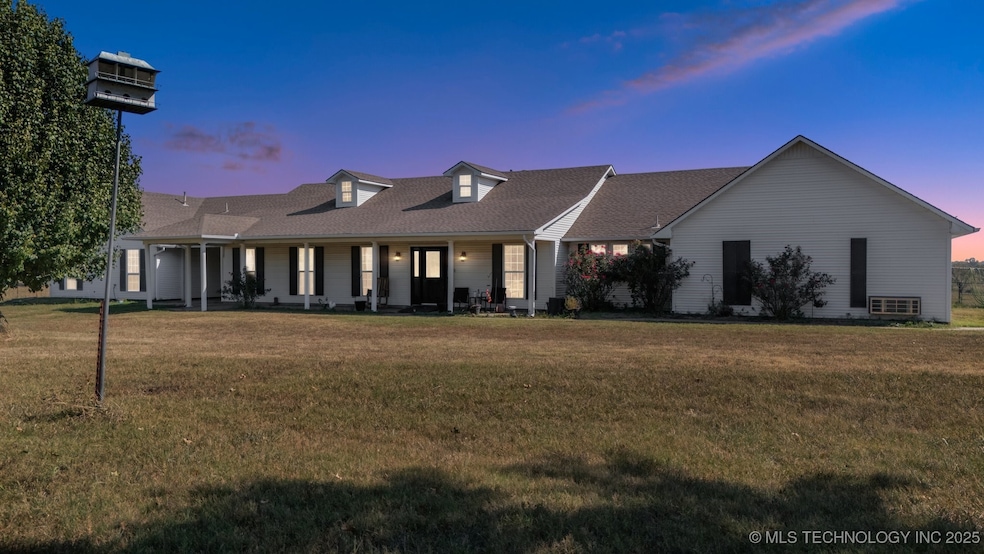
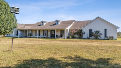
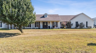
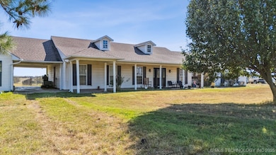
109159 S 4210 Rd Checotah, OK 74426
Estimated payment $2,332/month
Highlights
- Horses Allowed On Property
- Farm
- No HOA
- Marshall Elementary School Rated 10
- Granite Countertops
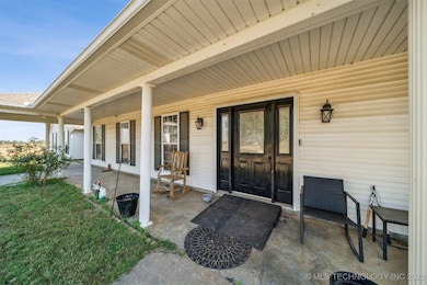
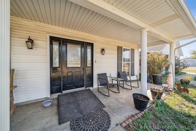
- Covered Patio or Porch
About This Home
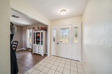
Country Living with Room for Everyone! Welcome to this beautiful property nestled on 5 acres in Checotah, OK. The main home features 4 bedrooms and 3 bathrooms, including two master suites—ideal for multi-generational living or hosting guests. Layout includes a spacious kitchen with a large pantry, dining area, a dedicated office, and plenty of natural light throughout.Step outside and enjoy the peace of country life and beautiful sunsets. The property includes a 30 x 50 insulated shop with electric and 12 ft doors, perfect for hobbies, or storing your lake toys. There is an additional storage shed, corrals for your animals and a chicken coop. Everything you need to start your own little farm! BONUS!! Adding even more value, there’s a 1-bedroom, 1-bath apartment or mother-in-law suite complete with its own kitchen and laundry area—great for guests, rental income, or extended family.Enjoy the freedom of rural living while staying close to town amenities and beautiful Lake Eufaula. Seller prefers to sell As-Is.
Home Details
Home Type
- Single Family
Est. Annual Taxes
- $236
Year Built
- Built in 1993
Lot Details
- 5 Acre Lot
- West Facing Home
- Chain Link Fence
Home Design
- Slab Foundation
- Wood Frame Construction
- Fiberglass Roof
- Vinyl Siding
- Asphalt
Interior Spaces
- 3,288 Sq Ft Home
- 1-Story Property
- Ceiling Fan
- Vinyl Clad Windows
Kitchen
- Oven
- Stove
- Range
- Dishwasher
- Granite Countertops
Flooring
- Carpet
- Tile
Bedrooms and Bathrooms
- 4 Bedrooms
- 3 Full Bathrooms
Outdoor Features
- Covered Patio or Porch
- Separate Outdoor Workshop
- Shed
- Storm Cellar or Shelter
Schools
- Checotah Elementary School
- Checotah High School
Utilities
- Zoned Heating and Cooling
- Window Unit Cooling System
- Heating System Uses Gas
- Gas Water Heater
- Septic Tank
Additional Features
- Farm
- Horses Allowed On Property
Community Details
- No Home Owners Association
- Mcintosh Co Unplatted Subdivision
Listing and Financial Details
- Exclusions: Starlink Satellite, Mini-Split in shop, Security System and Ring Doorbell
Map
Home Values in the Area
Average Home Value in this Area
Tax History
| Year | Tax Paid | Tax Assessment Tax Assessment Total Assessment is a certain percentage of the fair market value that is determined by local assessors to be the total taxable value of land and additions on the property. | Land | Improvement |
|---|---|---|---|---|
| 2025 | $3,067 | $35,698 | $2,200 | $33,498 |
| 2024 | $2,986 | $34,658 | $2,200 | $32,458 |
Property History
| Date | Event | Price | List to Sale | Price per Sq Ft |
|---|---|---|---|---|
| 10/30/2025 10/30/25 | Price Changed | $439,000 | -0.2% | $134 / Sq Ft |
| 10/15/2025 10/15/25 | For Sale | $440,000 | -- | $134 / Sq Ft |
Source: MLS Technology
MLS Number: 2543445
APN: 0000-16-11N-17E-2-004-00
Disclaimer: Certain information contained herein is derived from information provided by parties other than Homes.com. All information provided is deemed reliable, but is not guaranteed to be accurate and should be independently verified.
![]() IDX information is provided exclusively for personal, non-commercial use, and may not be used for any purpose other than to identify prospective properties consumers may be interested in purchasing.
IDX information is provided exclusively for personal, non-commercial use, and may not be used for any purpose other than to identify prospective properties consumers may be interested in purchasing.
Information is deemed reliable but not guaranteed.
- 0 Old Hwy 69 Hwy Unit 2526532
- 1130 White Stag Ave
- 419315 E 1090 Rd
- 219 SE 1st St
- 514 SE Main St
- 310 E Audd Ave
- 220 E Audd Ave
- 1045 W Mcintosh Ave
- 911 W Mcintosh Ave
- 510 W Jefferson Ave
- 0 Paul Carr Dr Unit 2524865
- 000 W N
- 126 SW 6th St
- 110 NW 3rd St
- 112580 New Texanna Rd
- 419000 E 1110 Rd
- 513 N Wineblood St
- 602 NW 1st St
- 613 N Wineblood St
- 0 S 4183 Rd Unit 1078694
