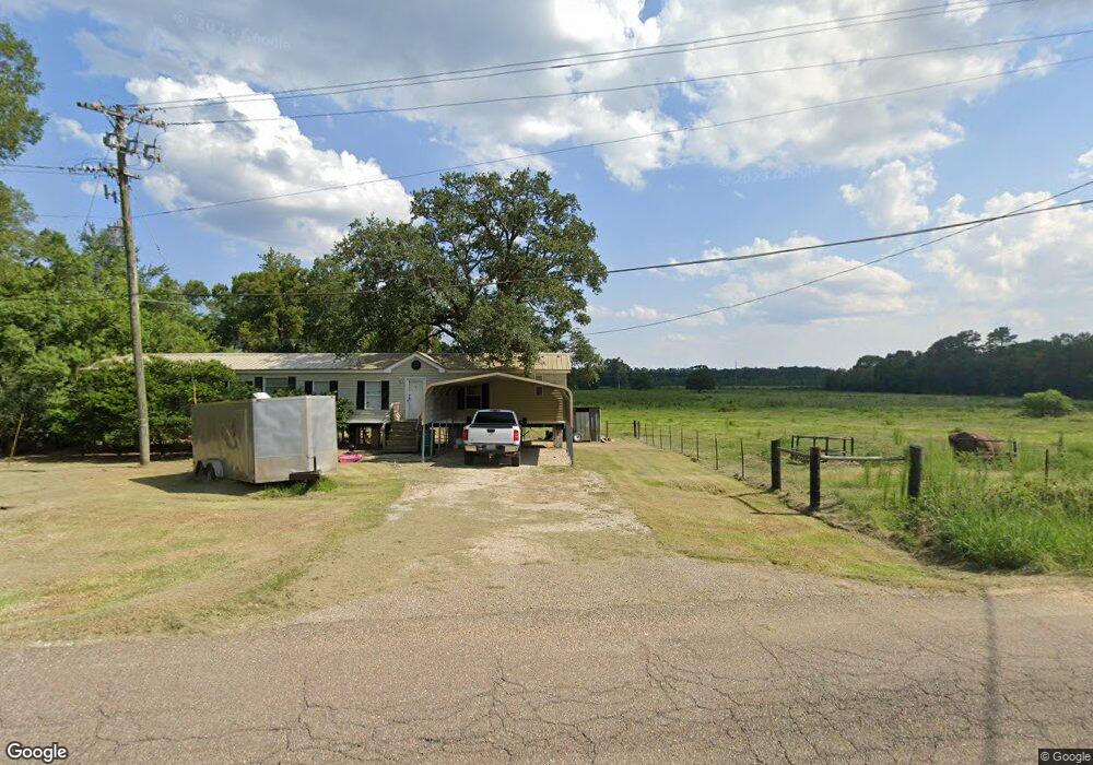
10918 La Highway 1033 Denham Springs, LA 70726
Estimated Value: $90,920 - $228,000
--
Bed
--
Bath
--
Sq Ft
0.3
Acres
About This Home
This home is located at 10918 La Highway 1033, Denham Springs, LA 70726 and is currently estimated at $147,730. 10918 La Highway 1033 is a home located in Livingston Parish with nearby schools including Gray's Creek Elementary School, Juban Parc Junior High School, and Denham Springs Freshman High School.
Ownership History
Date
Name
Owned For
Owner Type
Purchase Details
Closed on
Nov 19, 2014
Sold by
Vicknair Gwenda M
Bought by
Anv Properties L L C
Current Estimated Value
Purchase Details
Closed on
Mar 9, 2007
Sold by
Jennings Allen Blake
Bought by
Martin Martn Jr Terry Dale and Martin Hw Amy
Home Financials for this Owner
Home Financials are based on the most recent Mortgage that was taken out on this home.
Original Mortgage
$90,306
Interest Rate
6.26%
Mortgage Type
New Conventional
Create a Home Valuation Report for This Property
The Home Valuation Report is an in-depth analysis detailing your home's value as well as a comparison with similar homes in the area
Home Values in the Area
Average Home Value in this Area
Purchase History
| Date | Buyer | Sale Price | Title Company |
|---|---|---|---|
| Anv Properties L L C | -- | Tri Parish Title | |
| Martin Martn Jr Terry Dale | $88,500 | Title Plus Llc |
Source: Public Records
Mortgage History
| Date | Status | Borrower | Loan Amount |
|---|---|---|---|
| Previous Owner | Martin Martn Jr Terry Dale | $90,306 |
Source: Public Records
Tax History Compared to Growth
Tax History
| Year | Tax Paid | Tax Assessment Tax Assessment Total Assessment is a certain percentage of the fair market value that is determined by local assessors to be the total taxable value of land and additions on the property. | Land | Improvement |
|---|---|---|---|---|
| 2024 | $482 | $4,470 | $843 | $3,627 |
| 2023 | $407 | $3,380 | $770 | $2,610 |
| 2022 | $409 | $3,380 | $770 | $2,610 |
| 2021 | $360 | $3,380 | $770 | $2,610 |
| 2020 | $358 | $3,380 | $770 | $2,610 |
| 2019 | $347 | $3,190 | $740 | $2,450 |
| 2018 | $352 | $3,190 | $740 | $2,450 |
| 2017 | $339 | $3,070 | $740 | $2,330 |
| 2015 | $374 | $3,450 | $740 | $2,710 |
| 2014 | $380 | $3,450 | $740 | $2,710 |
Source: Public Records
Map
Nearby Homes
- 10674 Louisiana 1033
- 22835 La Hwy 16
- 11536 Mary Lee Dr
- 11556 Mary Lee Dr
- 14259 Monmouth Ave
- 14301 Monmouth Ave
- 14253 Monmouth Ave
- 14252 Monmouth Ave
- 14258 Monmouth Ave
- 14264 Monmouth Ave
- 11652 Derby Dr
- 11568 Cypress Dr Unit 17
- Idris II Plan at Manor Pointe
- 11588 Regal St
- 25640 4-H Club Rd
- Eastwood Plan at Belmont
- Evergreen Plan at Belmont
- Birch Plan at Belmont
- Hickory Plan at Belmont
- Kenner Plan at Belmont
- 10964 La Highway 1033
- 10936 La Highway 1033
- 10902 Louisiana 1033
- 10902 La Highway 1033
- 10961 La Highway 1033
- 10925 La Highway 1033
- 11004 Louisiana 1033
- 10974 La Highway 1033
- 11004 La Hwy 1033
- 10865 La Highway 1033
- 11004 La Highway 1033
- 22407 Provost Ln
- 10983 La Highway 1033
- 10880 La Highway 1033
- 11047 La Highway 1033
- 10839 La Highway 1033
- 10801 La Highway 1033
- 11057 La Highway 1033
- 11405 Louisiana 1033
- 10801 Louisiana 1033