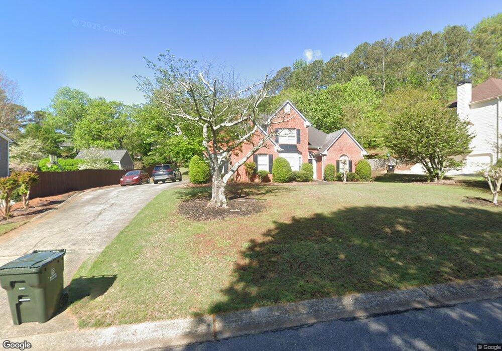
1092 Angel Ln Unit 1 Powder Springs, GA 30127
West Cobb NeighborhoodEstimated Value: $467,000 - $508,000
4
Beds
3
Baths
2,393
Sq Ft
$203/Sq Ft
Est. Value
About This Home
This home is located at 1092 Angel Ln Unit 1, Powder Springs, GA 30127 and is currently estimated at $485,769, approximately $202 per square foot. 1092 Angel Ln Unit 1 is a home located in Cobb County with nearby schools including Kemp Elementary School, Lovinggood Middle School, and Hillgrove High School.
Ownership History
Date
Name
Owned For
Owner Type
Purchase Details
Closed on
Mar 27, 2000
Sold by
Richards Philip W
Bought by
Tew Sherry and Tew Rodney
Current Estimated Value
Home Financials for this Owner
Home Financials are based on the most recent Mortgage that was taken out on this home.
Original Mortgage
$155,958
Outstanding Balance
$53,198
Interest Rate
8.38%
Mortgage Type
VA
Estimated Equity
$432,571
Purchase Details
Closed on
Sep 22, 1993
Sold by
B K G Inc
Bought by
Richards Philip N
Home Financials for this Owner
Home Financials are based on the most recent Mortgage that was taken out on this home.
Original Mortgage
$127,102
Interest Rate
7.19%
Mortgage Type
FHA
Create a Home Valuation Report for This Property
The Home Valuation Report is an in-depth analysis detailing your home's value as well as a comparison with similar homes in the area
Home Values in the Area
Average Home Value in this Area
Purchase History
| Date | Buyer | Sale Price | Title Company |
|---|---|---|---|
| Tew Sherry | $152,900 | -- | |
| Richards Philip N | $127,500 | -- |
Source: Public Records
Mortgage History
| Date | Status | Borrower | Loan Amount |
|---|---|---|---|
| Open | Tew Sherry | $155,958 | |
| Previous Owner | Richards Philip N | $127,102 |
Source: Public Records
Tax History Compared to Growth
Tax History
| Year | Tax Paid | Tax Assessment Tax Assessment Total Assessment is a certain percentage of the fair market value that is determined by local assessors to be the total taxable value of land and additions on the property. | Land | Improvement |
|---|---|---|---|---|
| 2024 | $3,858 | $165,820 | $16,000 | $149,820 |
| 2023 | $3,316 | $165,820 | $16,000 | $149,820 |
| 2022 | $3,298 | $138,816 | $12,800 | $126,016 |
| 2021 | $2,624 | $107,996 | $12,800 | $95,196 |
| 2020 | $2,624 | $107,996 | $12,800 | $95,196 |
| 2019 | $2,351 | $95,540 | $12,800 | $82,740 |
| 2018 | $2,351 | $95,540 | $12,800 | $82,740 |
| 2017 | $2,012 | $83,792 | $12,800 | $70,992 |
| 2016 | $1,733 | $71,032 | $14,400 | $56,632 |
| 2015 | $1,775 | $71,032 | $14,400 | $56,632 |
| 2014 | $1,340 | $53,924 | $0 | $0 |
Source: Public Records
Map
Nearby Homes
- 1079 Angel Ln
- 1072 Sweet Mia Ln
- 1073 Sweet Mia Ln
- 1077 Sweet Mia Ln
- 4408 Shiloh Trail
- 1150 Sweet Mia Ln
- 777 Chanson Dr SW
- 700 Broadlands Ln Unit 1
- 4562 Willow Oak Trail Unit 3
- 990 Casteel Rd
- 1175 Bowerie Chase
- 506 Balleycastle Point
- 3840 McEachern Farm Dr
- 4927 Red Cliff Ct
- 3605 Sunset Ridge
- 633 Wynnewood Ct SW
- 3797 Churchill Dr SW
- 1090 Angel Ln
- 1094 Angel Ln Unit 1
- 1091 Angel Ln Unit 1
- 0 Angel Ln Unit 8385393
- 0 Angel Ln Unit 8370337
- 0 Angel Ln Unit 8081422
- 0 Angel Ln Unit 7252444
- 0 Angel Ln Unit 8279031
- 0 Angel Ln Unit 7618825
- 0 Angel Ln Unit 8974520
- 0 Angel Ln Unit 9071365
- 0 Angel Ln Unit 3252048
- 0 Angel Ln Unit 7035780
- 0 Angel Ln Unit 7312699
- 0 Angel Ln Unit 7371796
- 0 Angel Ln Unit 7461808
- 0 Angel Ln Unit 7548140
- 0 Angel Ln Unit 7605928
- 0 Angel Ln Unit 7606849
- 0 Angel Ln