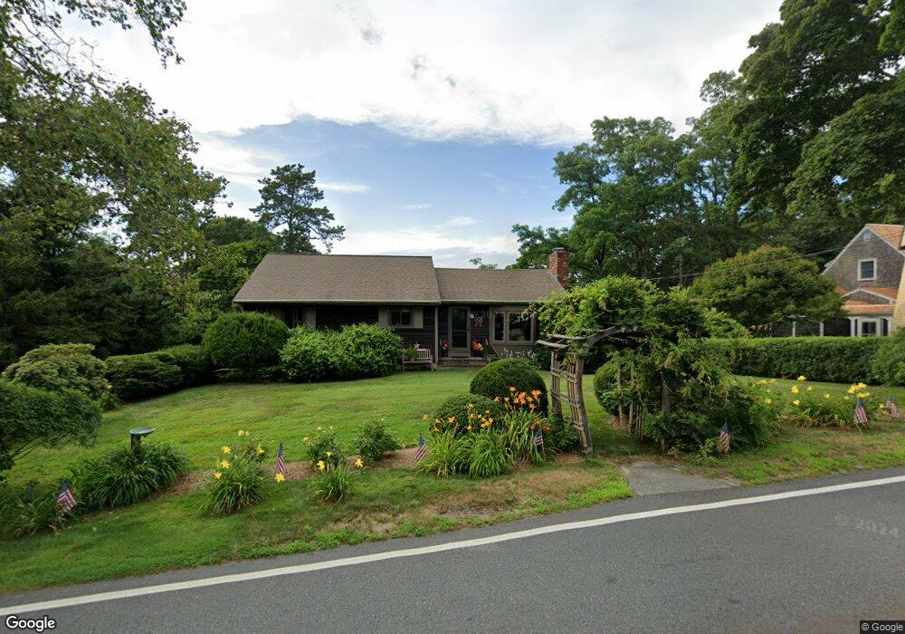
1092 County Rd Pocasset, MA 2559
Pocasset NeighborhoodEstimated Value: $508,000 - $689,000
3
Beds
2
Baths
1,128
Sq Ft
$521/Sq Ft
Est. Value
About This Home
This home is located at 1092 County Rd, Pocasset, MA 2559 and is currently estimated at $587,696, approximately $521 per square foot. 1092 County Rd is a home located in Barnstable County with nearby schools including Bourne High School, Cadence Academy Preschool - Bourne, and Heritage Christian Academy.
Ownership History
Date
Name
Owned For
Owner Type
Purchase Details
Closed on
Apr 13, 2011
Sold by
Kendrick Brian and Kendrick Pamela
Bought by
Kendrick T T and Kendrick K
Current Estimated Value
Purchase Details
Closed on
Nov 10, 1993
Sold by
Forziati Carl A and Forziati Richard Omer
Bought by
Kendrick Brian and Kendrick Pamela
Home Financials for this Owner
Home Financials are based on the most recent Mortgage that was taken out on this home.
Original Mortgage
$96,300
Interest Rate
6.79%
Mortgage Type
Purchase Money Mortgage
Create a Home Valuation Report for This Property
The Home Valuation Report is an in-depth analysis detailing your home's value as well as a comparison with similar homes in the area
Home Values in the Area
Average Home Value in this Area
Purchase History
| Date | Buyer | Sale Price | Title Company |
|---|---|---|---|
| Kendrick T T | -- | -- | |
| Kendrick T T | -- | -- | |
| Kendrick Brian | $107,000 | -- | |
| Kendrick Brian | $107,000 | -- |
Source: Public Records
Mortgage History
| Date | Status | Borrower | Loan Amount |
|---|---|---|---|
| Open | Kendrick Brian | $200,000 | |
| Previous Owner | Kendrick Brian | $96,300 |
Source: Public Records
Tax History Compared to Growth
Tax History
| Year | Tax Paid | Tax Assessment Tax Assessment Total Assessment is a certain percentage of the fair market value that is determined by local assessors to be the total taxable value of land and additions on the property. | Land | Improvement |
|---|---|---|---|---|
| 2025 | $3,260 | $417,400 | $170,600 | $246,800 |
| 2024 | $3,187 | $397,400 | $162,500 | $234,900 |
| 2023 | $3,098 | $351,700 | $143,800 | $207,900 |
| 2022 | $2,882 | $285,600 | $120,600 | $165,000 |
| 2021 | $2,799 | $259,900 | $109,700 | $150,200 |
| 2020 | $2,703 | $251,700 | $108,700 | $143,000 |
| 2019 | $2,561 | $243,700 | $108,700 | $135,000 |
| 2018 | $2,381 | $225,900 | $103,500 | $122,400 |
| 2017 | $2,275 | $220,900 | $113,900 | $107,000 |
| 2016 | $2,223 | $218,800 | $113,900 | $104,900 |
| 2015 | $2,203 | $218,800 | $113,900 | $104,900 |
Source: Public Records
Map
Nearby Homes
- 1094 County Rd
- 3 Red Brook Pond Dr
- 48 Red Brook Harbor Rd
- 22 Nairn Rd
- 1234 Route 28a
- 940 County Rd
- 1234 Route 28a
- 10 Squeteague Harbor Rd
- 31 Baxendale Rd
- 75 Winsor Rd
- 171 Bellavista Dr
- 7 4th Ave
- 254 Barlows Landing Rd
- 940 County Rd
- 250 Scraggy Neck Rd
- 15 1st St
- 709 County Rd
- 174 Barlows Landing Rd
- 34 Kenwood Rd
- 1090 County Rd
- 4 Old Dam Rd
- 17 Red Brook Pond Dr
- 11 Red Brook Pond Dr
- 3 and 5 Red Brook Pond Dr
- 1100 County Rd
- 9 Red Brook Pond Dr
- 0 Mill Pond Cir Unit 71435788
- 3 Mill Pond Cir
- 3 Mill Pond Cir
- 2 Red Brook Harbor Area
- 1054 County Rd
- 2 Red Brook Rd
- 1054 County Rd
- 1068 County Rd
- 1 Mill Pond Cir
- 1050 County Rd
- 1050 County Rd
- 1050 County
- 2 Mill Pond Cir