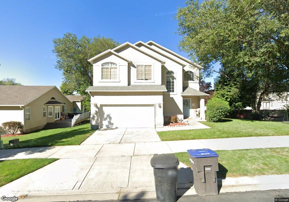
1092 S 1420 E Provo, UT 84606
Provost NeighborhoodEstimated Value: $476,000 - $511,000
4
Beds
3
Baths
2,509
Sq Ft
$197/Sq Ft
Est. Value
About This Home
This home is located at 1092 S 1420 E, Provo, UT 84606 and is currently estimated at $494,654, approximately $197 per square foot. 1092 S 1420 E is a home located in Utah County with nearby schools including Spring Creek Elementary School, Centennial Middle School, and Timpview High School.
Ownership History
Date
Name
Owned For
Owner Type
Purchase Details
Closed on
Nov 6, 2013
Sold by
Higgins Anna
Bought by
Asusao Tumu and Asusao Ada
Current Estimated Value
Home Financials for this Owner
Home Financials are based on the most recent Mortgage that was taken out on this home.
Original Mortgage
$176,000
Outstanding Balance
$130,991
Interest Rate
4.18%
Mortgage Type
New Conventional
Estimated Equity
$363,663
Purchase Details
Closed on
Apr 7, 2008
Sold by
Higgins Clinton
Bought by
Higgins Anna
Purchase Details
Closed on
Jun 14, 2005
Sold by
D R Horton Inc
Bought by
Higgins Clinton J and Higgins Anna
Home Financials for this Owner
Home Financials are based on the most recent Mortgage that was taken out on this home.
Original Mortgage
$177,514
Interest Rate
5.72%
Mortgage Type
FHA
Create a Home Valuation Report for This Property
The Home Valuation Report is an in-depth analysis detailing your home's value as well as a comparison with similar homes in the area
Home Values in the Area
Average Home Value in this Area
Purchase History
| Date | Buyer | Sale Price | Title Company |
|---|---|---|---|
| Asusao Tumu | -- | Bartlett Title Ins Agenc | |
| Higgins Anna | -- | Old Republic Title Company | |
| Higgins Clinton J | -- | Surety Title |
Source: Public Records
Mortgage History
| Date | Status | Borrower | Loan Amount |
|---|---|---|---|
| Open | Asusao Tumu | $176,000 | |
| Previous Owner | Higgins Clinton J | $177,514 |
Source: Public Records
Tax History
| Year | Tax Paid | Tax Assessment Tax Assessment Total Assessment is a certain percentage of the fair market value that is determined by local assessors to be the total taxable value of land and additions on the property. | Land | Improvement |
|---|---|---|---|---|
| 2025 | $2,380 | $241,725 | -- | -- |
| 2024 | $2,380 | $234,300 | $0 | $0 |
| 2023 | $2,441 | $236,830 | $0 | $0 |
| 2022 | $2,537 | $248,215 | $0 | $0 |
| 2021 | $2,067 | $352,800 | $96,800 | $256,000 |
| 2020 | $1,991 | $318,600 | $88,000 | $230,600 |
| 2019 | $1,845 | $306,900 | $88,000 | $218,900 |
| 2018 | $1,604 | $270,600 | $78,000 | $192,600 |
| 2017 | $1,494 | $138,545 | $0 | $0 |
| 2016 | $1,469 | $126,995 | $0 | $0 |
| 2015 | $1,354 | $118,305 | $0 | $0 |
| 2014 | $1,175 | $106,975 | $0 | $0 |
Source: Public Records
Map
Nearby Homes
- 1154 S 1430 E
- 1332 Cinnamon Ridge Way
- 1482 E 1280 S
- 1304 E 900 S
- 1052 Canyon Meadow Dr Unit 4
- 1347 S 1370 E
- 1141 E 1320 S Unit A404
- 1141 E 1320 S Unit B401
- 1141 E 1320 S Unit D104
- 1141 E 1320 S Unit D303
- 1141 E 1320 S Unit 302
- 1402 S 1470 E
- 1145 Canyon Meadow Dr Unit 3
- 1417 E 700 S
- 1261 E 1500 S
- 1263 S 1000 E
- 1156 S 1000 E
- 1184 S 1000 E
- 976 E 1230 S
- 1169 E 700 S
- 1405 E 1120 S
- 1397 E 1120 S
- 1087 S 1420 E
- 1385 E 1120 S
- 1078 Cinnamon Ridge Dr
- 1105 S 1420 E
- 1066 Cinnamon Ridge Dr
- 1092 Cinnamon Ridge Dr
- 1373 E 1120 S
- 1088 S 1440 E
- 1052 S 1420 E
- 1044 Cinnamon Ridge Dr
- 1092 S Cinnamon Ridge Dr
- 1106 S 1440 E
- 1123 S 1410 E
- 1124 S 1410 E
- 1128 S 1430 E
- 1392 E 1120 S
- 1367 E 1120 S
- 1462 E 1050 S
Your Personal Tour Guide
Ask me questions while you tour the home.