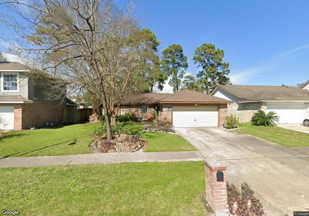
10923 Maple Rock Dr Humble, TX 77396
Estimated Value: $180,761 - $207,000
2
Beds
2
Baths
1,188
Sq Ft
$166/Sq Ft
Est. Value
About This Home
This home is located at 10923 Maple Rock Dr, Humble, TX 77396 and is currently estimated at $197,690, approximately $166 per square foot. 10923 Maple Rock Dr is a home located in Harris County with nearby schools including Ridge Creek Elementary, Middle #10, and Summer Creek High School.
Ownership History
Date
Name
Owned For
Owner Type
Purchase Details
Closed on
Oct 4, 2001
Sold by
Hankins R Jeffrey
Bought by
Camp Mark A and Camp Lisa Marie
Current Estimated Value
Home Financials for this Owner
Home Financials are based on the most recent Mortgage that was taken out on this home.
Original Mortgage
$74,145
Outstanding Balance
$33,648
Interest Rate
9.1%
Estimated Equity
$164,042
Create a Home Valuation Report for This Property
The Home Valuation Report is an in-depth analysis detailing your home's value as well as a comparison with similar homes in the area
Home Values in the Area
Average Home Value in this Area
Purchase History
| Date | Buyer | Sale Price | Title Company |
|---|---|---|---|
| Camp Mark A | -- | Houston Title Co |
Source: Public Records
Mortgage History
| Date | Status | Borrower | Loan Amount |
|---|---|---|---|
| Open | Camp Mark A | $74,145 |
Source: Public Records
Tax History Compared to Growth
Tax History
| Year | Tax Paid | Tax Assessment Tax Assessment Total Assessment is a certain percentage of the fair market value that is determined by local assessors to be the total taxable value of land and additions on the property. | Land | Improvement |
|---|---|---|---|---|
| 2025 | $4,868 | $167,489 | $37,800 | $129,689 |
| 2024 | $4,868 | $176,019 | $37,800 | $138,219 |
| 2023 | $4,868 | $167,109 | $37,800 | $129,309 |
| 2022 | $4,312 | $146,886 | $37,800 | $109,086 |
| 2021 | $3,648 | $118,933 | $37,800 | $81,133 |
| 2020 | $3,743 | $117,601 | $37,800 | $79,801 |
| 2019 | $3,740 | $112,536 | $25,200 | $87,336 |
| 2018 | $1,022 | $96,863 | $13,860 | $83,003 |
| 2017 | $2,820 | $96,863 | $13,860 | $83,003 |
| 2016 | $2,563 | $84,946 | $13,860 | $71,086 |
| 2015 | $1,850 | $75,668 | $13,860 | $61,808 |
| 2014 | $1,850 | $63,051 | $13,860 | $49,191 |
Source: Public Records
Map
Nearby Homes
- 10910 Drakeland Dr
- 10915 Clear Fork Dr
- 11019 Drakeland Dr
- 11111 Clear Fork Dr
- 11123 Drakeland Dr
- 10826 Thorncliff Dr
- 15026 Sunset Creek Dr
- 15203 Albert Oak Dr
- 15019 Silhouette Ridge Dr
- 15214 Central Lakes Dr
- 10731 Spring Brook Pass Dr
- 10515 Kentington Oak Dr
- 15302 Albert Oak Dr
- 10518 Sun River Falls Dr
- 11002 Hillside Creek Dr
- 15318 Central Lakes Dr
- 15031 Arizona Sky Ct
- 11034 Hillside Creek Dr
- 11042 Hillside Creek Dr
- 10602 Sunrise Park Ln
- 10927 Maple Rock Dr
- 10919 Maple Rock Dr
- 10926 Drakeland Dr
- 10922 Drakeland Dr
- 10931 Maple Rock Dr
- 10915 Maple Rock Dr
- 10930 Drakeland Dr
- 10918 Drakeland Dr
- 10922 Maple Rock Dr
- 10934 Drakeland Dr
- 10918 Maple Rock Dr
- 11003 Maple Rock Dr
- 10911 Maple Rock Dr
- 10926 Maple Rock Dr
- 10914 Drakeland Dr
- 10914 Maple Rock Dr
- 10930 Maple Rock Dr
- 11002 Drakeland Dr
- 10910 Maple Rock Dr
- 11007 Maple Rock Dr