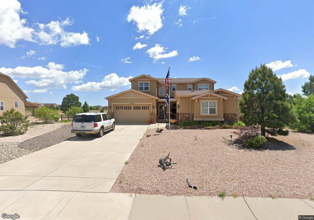
10929 Greenbelt Dr Peyton, CO 80831
Falcon NeighborhoodEstimated Value: $657,583 - $748,000
6
Beds
4
Baths
2,738
Sq Ft
$253/Sq Ft
Est. Value
About This Home
This home is located at 10929 Greenbelt Dr, Peyton, CO 80831 and is currently estimated at $692,646, approximately $252 per square foot. 10929 Greenbelt Dr is a home located in El Paso County with nearby schools including Meridian Ranch International School, Falcon Middle School, and Falcon High School.
Ownership History
Date
Name
Owned For
Owner Type
Purchase Details
Closed on
Jan 1, 2013
Sold by
Menozzi Michael J and Menozzi Mariah L
Bought by
Menozzi Michael J
Current Estimated Value
Home Financials for this Owner
Home Financials are based on the most recent Mortgage that was taken out on this home.
Original Mortgage
$366,877
Outstanding Balance
$254,732
Interest Rate
3.34%
Mortgage Type
VA
Estimated Equity
$437,914
Purchase Details
Closed on
Sep 15, 2010
Sold by
Campbell Homes Llc
Bought by
Menozzi Michael J and Menozzi Miriah L
Home Financials for this Owner
Home Financials are based on the most recent Mortgage that was taken out on this home.
Original Mortgage
$376,549
Interest Rate
4.51%
Mortgage Type
VA
Purchase Details
Closed on
Jan 29, 2010
Sold by
Lankford Fulton Llc
Bought by
Campbell Homes Llc
Create a Home Valuation Report for This Property
The Home Valuation Report is an in-depth analysis detailing your home's value as well as a comparison with similar homes in the area
Home Values in the Area
Average Home Value in this Area
Purchase History
| Date | Buyer | Sale Price | Title Company |
|---|---|---|---|
| Menozzi Michael J | -- | Servicelink | |
| Menozzi Michael J | $411,500 | People National Title Llc | |
| Campbell Homes Llc | $75,600 | Peoples National Title Llc |
Source: Public Records
Mortgage History
| Date | Status | Borrower | Loan Amount |
|---|---|---|---|
| Open | Menozzi Michael J | $366,877 | |
| Closed | Menozzi Michael J | $376,549 |
Source: Public Records
Tax History Compared to Growth
Tax History
| Year | Tax Paid | Tax Assessment Tax Assessment Total Assessment is a certain percentage of the fair market value that is determined by local assessors to be the total taxable value of land and additions on the property. | Land | Improvement |
|---|---|---|---|---|
| 2025 | $4,484 | $46,560 | -- | -- |
| 2024 | $3,661 | $47,420 | $7,200 | $40,220 |
| 2022 | $2,644 | $33,150 | $5,910 | $27,240 |
| 2021 | $2,741 | $34,110 | $6,080 | $28,030 |
| 2020 | $3,440 | $31,370 | $5,510 | $25,860 |
| 2019 | $3,421 | $31,370 | $5,510 | $25,860 |
| 2018 | $3,181 | $28,870 | $5,040 | $23,830 |
| 2017 | $3,008 | $28,870 | $5,040 | $23,830 |
| 2016 | $3,313 | $32,550 | $5,570 | $26,980 |
| 2015 | $3,316 | $35,550 | $5,570 | $29,980 |
| 2014 | $3,332 | $32,320 | $4,780 | $27,540 |
Source: Public Records
Map
Nearby Homes
- 10677 Greenbelt Dr
- 10932 Huron Peak Place
- 10641 Greenbelt Dr
- 12223 Grand Teton Dr
- 10795 Indian Paint Trail
- 10603 Ross Lake Dr
- 10530 Pictured Rocks Dr
- 10467 Pictured Rocks Dr
- 10489 Cedar Breaks Dr
- 10429 Cedar Breaks Dr
- 11824 Black Hills Dr
- 11825 Black Hills Dr
- 12692 Clark Peak Ct
- 12238 Sleeping Bear Rd
- 12150 Fox Brush Dr
- 12708 Sunrise Ridge Dr
- 12714 Sunrise Ridge Dr
- 10433 Capital Peak Way
- 10402 Capital Peak Way
- 10335 Antler Creek Dr
- 10947 Greenbelt Dr
- 12254 Ozark Place
- 12224 Ozark Place
- 10965 Greenbelt Dr
- 10928 Greenbelt Dr
- 12284 Ozark Place
- 10964 Greenbelt Dr
- 12164 Ozark Place
- 12255 Ozark Place
- 11059 Glen Canyon Dr
- 12225 Ozark Place
- 12134 Ozark Place
- 11123 Glen Canyon Dr
- 10856 Greenbelt Dr
- 11043 Glen Canyon Dr
- 10857 Greenbelt Dr
- 11058 Glen Canyon Dr
- 11139 Glen Canyon Dr
- 11106 Glen Canyon Dr
- 12104 Ozark Place