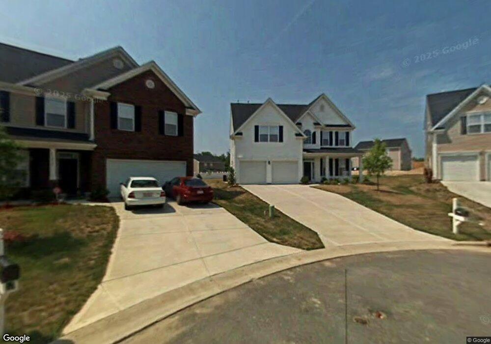
10929 Sand River Ct Davidson, NC 28036
Estimated Value: $478,364 - $570,000
5
Beds
3
Baths
2,676
Sq Ft
$190/Sq Ft
Est. Value
About This Home
This home is located at 10929 Sand River Ct, Davidson, NC 28036 and is currently estimated at $508,841, approximately $190 per square foot. 10929 Sand River Ct is a home located in Cabarrus County with nearby schools including W.R. Odell Elementary School, Harris Road Middle, and Northwest Cabarrus High.
Ownership History
Date
Name
Owned For
Owner Type
Purchase Details
Closed on
Nov 23, 2015
Sold by
Deesch Shannon N and Deesch Adam
Bought by
Deckert Robert C and Deckert Crista E
Current Estimated Value
Home Financials for this Owner
Home Financials are based on the most recent Mortgage that was taken out on this home.
Original Mortgage
$251,750
Outstanding Balance
$197,946
Interest Rate
3.78%
Mortgage Type
New Conventional
Estimated Equity
$310,895
Purchase Details
Closed on
May 25, 2007
Sold by
D R Horton Inc
Bought by
Deesch Adam and Deesch Shannon N
Home Financials for this Owner
Home Financials are based on the most recent Mortgage that was taken out on this home.
Original Mortgage
$37,291
Interest Rate
5.84%
Mortgage Type
Stand Alone Second
Create a Home Valuation Report for This Property
The Home Valuation Report is an in-depth analysis detailing your home's value as well as a comparison with similar homes in the area
Home Values in the Area
Average Home Value in this Area
Purchase History
| Date | Buyer | Sale Price | Title Company |
|---|---|---|---|
| Deckert Robert C | $265,000 | None Available | |
| Deesch Adam | $249,000 | None Available |
Source: Public Records
Mortgage History
| Date | Status | Borrower | Loan Amount |
|---|---|---|---|
| Open | Deckert Robert C | $251,750 | |
| Previous Owner | Deesch Adam | $37,291 | |
| Previous Owner | Deesch Adam | $198,888 |
Source: Public Records
Tax History
| Year | Tax Paid | Tax Assessment Tax Assessment Total Assessment is a certain percentage of the fair market value that is determined by local assessors to be the total taxable value of land and additions on the property. | Land | Improvement |
|---|---|---|---|---|
| 2025 | $4,948 | $435,790 | $95,000 | $340,790 |
| 2024 | $4,948 | $435,790 | $95,000 | $340,790 |
| 2023 | $3,960 | $287,540 | $51,000 | $236,540 |
| 2022 | $3,960 | $289,040 | $51,000 | $238,040 |
| 2021 | $3,960 | $289,040 | $51,000 | $238,040 |
| 2020 | $3,960 | $289,040 | $51,000 | $238,040 |
| 2019 | $3,551 | $259,200 | $45,000 | $214,200 |
| 2018 | $3,499 | $259,200 | $45,000 | $214,200 |
| 2017 | $3,447 | $259,200 | $45,000 | $214,200 |
| 2016 | $3,447 | $205,620 | $34,000 | $171,620 |
| 2015 | $2,591 | $205,620 | $34,000 | $171,620 |
| 2014 | $2,591 | $205,620 | $34,000 | $171,620 |
Source: Public Records
Map
Nearby Homes
- 3351 Streamside Dr
- 10907 Tailwater St
- 3556 Catherine Creek Place
- 3388 Brackhill St
- 10901 Trout Creek Place
- 11120 Hat Creek Ln
- 10997 Alabaster Dr
- 3344 Shiloh Church Rd
- 10971 Claystone Dr
- 3455 Shiloh Church Rd
- 2870 Shale Dr
- 14020 Helen Benson Blvd
- 4980 NW 141st St
- 18308 Shearer Rd
- 10820 Tuff Ln
- 3720 Shiloh Church Rd
- 17319 Silas Place Dr
- 2600 Shiloh Church Rd
- 2580 Shiloh Church Rd
- 17416 Gillican Overlook
- 10931 Sand River Ct
- 10923 Sand River Ct
- 3307 Streamside Dr
- 3309 Streamside Dr
- 3303 Streamside Dr
- 3315 Streamside Dr
- 10936 Sand River Ct
- 10911 Sand River Ct
- 3316 Brackhill St
- 3316 Brackhill St Unit 197
- 3308 Brackhill St
- 3338 Brackhill St
- 3324 Brackhill St
- 3323 Streamside Dr
- 3304 Brackhill St
- 3342 Brackhill St
- 3300 Brackhill St
- 10901 Sand River Ct
- 10930 Sand River Ct
- 3346 Brackhill St
Your Personal Tour Guide
Ask me questions while you tour the home.