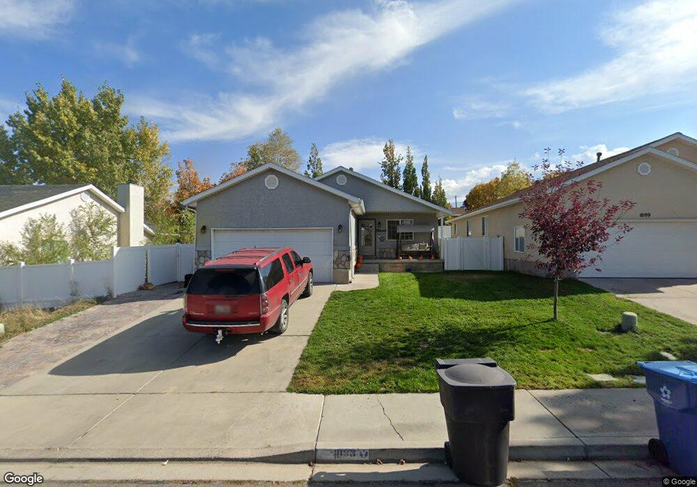
1093 S 580 W Payson, UT 84651
Estimated Value: $466,000 - $499,000
3
Beds
2
Baths
2,864
Sq Ft
$169/Sq Ft
Est. Value
About This Home
This home is located at 1093 S 580 W, Payson, UT 84651 and is currently estimated at $484,220, approximately $169 per square foot. 1093 S 580 W is a home located in Utah County with nearby schools including Wilson Elementary School, Payson Junior High School, and Payson High School.
Ownership History
Date
Name
Owned For
Owner Type
Purchase Details
Closed on
Nov 26, 2001
Sold by
Taylor Michael J
Bought by
Taylor Michael J
Current Estimated Value
Home Financials for this Owner
Home Financials are based on the most recent Mortgage that was taken out on this home.
Original Mortgage
$146,704
Outstanding Balance
$57,580
Interest Rate
6.63%
Mortgage Type
FHA
Estimated Equity
$426,640
Purchase Details
Closed on
Nov 6, 2001
Sold by
Taylor Brook U
Bought by
Taylor Michael J
Home Financials for this Owner
Home Financials are based on the most recent Mortgage that was taken out on this home.
Original Mortgage
$146,704
Outstanding Balance
$57,580
Interest Rate
6.63%
Mortgage Type
FHA
Estimated Equity
$426,640
Purchase Details
Closed on
Aug 4, 1999
Sold by
Ray Zeeman Construction Inc
Bought by
Taylor Michael J and Taylor Brook M
Home Financials for this Owner
Home Financials are based on the most recent Mortgage that was taken out on this home.
Original Mortgage
$139,382
Interest Rate
7.64%
Mortgage Type
FHA
Create a Home Valuation Report for This Property
The Home Valuation Report is an in-depth analysis detailing your home's value as well as a comparison with similar homes in the area
Home Values in the Area
Average Home Value in this Area
Purchase History
| Date | Buyer | Sale Price | Title Company |
|---|---|---|---|
| Taylor Michael J | -- | -- | |
| Taylor Michael J | -- | -- | |
| Taylor Michael J | -- | First American Title Ins Co |
Source: Public Records
Mortgage History
| Date | Status | Borrower | Loan Amount |
|---|---|---|---|
| Open | Taylor Michael J | $146,704 | |
| Closed | Taylor Michael J | $139,382 |
Source: Public Records
Tax History Compared to Growth
Tax History
| Year | Tax Paid | Tax Assessment Tax Assessment Total Assessment is a certain percentage of the fair market value that is determined by local assessors to be the total taxable value of land and additions on the property. | Land | Improvement |
|---|---|---|---|---|
| 2025 | $2,258 | $240,405 | $135,800 | $301,300 |
| 2024 | $2,258 | $229,790 | $0 | $0 |
| 2023 | $2,300 | $234,685 | $0 | $0 |
| 2022 | $2,294 | $230,285 | $0 | $0 |
| 2021 | $1,937 | $311,800 | $89,100 | $222,700 |
| 2020 | $1,816 | $286,000 | $77,500 | $208,500 |
| 2019 | $1,638 | $264,500 | $77,500 | $187,000 |
| 2018 | $1,561 | $243,000 | $60,200 | $182,800 |
| 2017 | $1,434 | $120,010 | $0 | $0 |
| 2016 | $1,394 | $115,940 | $0 | $0 |
| 2015 | $1,308 | $108,020 | $0 | $0 |
| 2014 | $1,190 | $99,000 | $0 | $0 |
Source: Public Records
Map
Nearby Homes
- 1087 S 680 W
- 1161 Utah 198
- 1163 S 730 W
- 1172 S 880 W
- 588 W 1450 S
- 513 W 600 S
- 802 Brookside Ct
- 1287 S 1080 W
- 626 S 800 W Unit 32
- 1128 W 1150 S Unit 9
- 610 S 800 W Unit 30
- 1408 S 30 E
- 533 S 700 W
- 1216 S 1150 W Unit 19
- 1192 W 1130 St S Unit 202
- 1002 W Temple Rim Ln
- 598 W Saddlebrook Dr
- 1872 100 E Unit 6
- 528 S 800 W
- 1338 S 1150 W