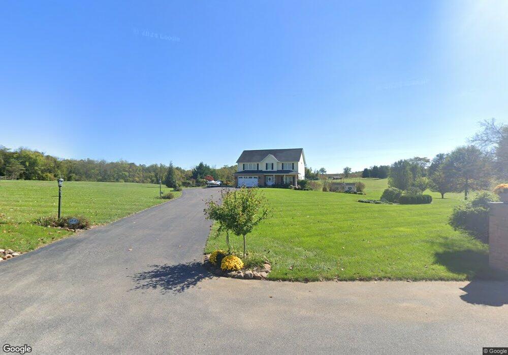
10931 Ashton Rd Clear Spring, MD 21722
Estimated Value: $523,000 - $590,000
About This Home
This home is located at 10931 Ashton Rd, Clear Spring, MD 21722 and is currently estimated at $556,752, approximately $178 per square foot. 10931 Ashton Rd is a home located in Washington County with nearby schools including Clear Spring Elementary School, Clear Spring Middle School, and Clear Spring High School.
Ownership History
We collect this data history from publicly available records. To have your information removed, we recommend requesting removal directly through your county’s website.
Purchase Details
Home Financials for this Owner
Home Financials are based on the most recent Mortgage that was taken out on this home.Purchase History
We collect this data history from publicly available records. To have your information removed, we recommend requesting removal directly through your county’s website.
| Date | Buyer | Sale Price | Title Company |
|---|---|---|---|
| $200,000 | -- |
Mortgage History
We collect this data history from publicly available records. To have your information removed, we recommend requesting removal directly through your county’s website.
| Date | Status | Borrower | Loan Amount |
|---|---|---|---|
| Open | $200,000 |
Tax History
We collect this data history from publicly available records. To have your information removed, we recommend requesting removal directly through your county’s website.
| Year | Tax Paid | Tax Assessment Tax Assessment Total Assessment is a certain percentage of the fair market value that is determined by local assessors to be the total taxable value of land and additions on the property. | Land | Improvement |
|---|---|---|---|---|
| 2025 | $4,640 | $515,500 | $0 | $0 |
| 2024 | $4,404 | $451,900 | $0 | $0 |
| 2023 | $4,080 | $388,300 | $124,700 | $263,600 |
| 2022 | $3,922 | $373,000 | $0 | $0 |
| 2021 | $3,673 | $357,700 | $0 | $0 |
| 2020 | $3,673 | $342,400 | $124,700 | $217,700 |
| 2019 | $3,689 | $342,400 | $124,700 | $217,700 |
| 2018 | $3,689 | $342,400 | $124,700 | $217,700 |
| 2017 | $3,754 | $348,500 | $0 | $0 |
| 2016 | -- | $333,767 | $0 | $0 |
| 2015 | -- | $319,033 | $0 | $0 |
| 2014 | $3,616 | $304,300 | $0 | $0 |
Map
- Block 1 Lot 42 Boo Blvd
- Block 2 lot 6 Boo Blvd
- Block 1 Lot 27 Boo Blvd
- Block 2 lot 8 Cindy Ave
- Block 6 Lots 15 & 16 Poison Oak
- Block 5 Lots 2 & 3 Poison Oak Rd
- Block 5 Lot 43 Chipmunk Cir
- Block 5 lot 7 Poison Oak
- 0 Block 5 Lot 42 Chipmunk Cir Unit WVBE2051798
- Block 7 Lot 30 & 31 Campfire Blvd
- Block 7 Lot 21 Campfire Blvd
- Block 8 Lot 16 & 17 Campfire Blvd
- Block 18 Lot 44 Hollow Log
- 25-20 Rocky Rd
- Block 24 Lots 19 & 2 Poison Oak Rd
- Block 25 Lot 8 Poison Oak
- Block 92 Lot 41 Neverglades Rd
- Block 92 Lot 40 Neverglades Ave
- 0 Block 23 Lot 8 Ranger Rd Unit WVBE2049976
- Block 26 Lot 1 Ranger Rd
- 10945 Ashton Rd
- 10917 Ashton Rd
- 10953 Ashton Rd
- 10958 Ashton Rd
- 10913 Ashton Rd
- 10962 Ashton Rd
- 11001 Ashton Rd
- 10635 Dam Number 5 Rd
- 11006 Ashton Rd
- 10642 Dam Number 5 Rd Unit AND
- 10623 Dam Number 5 Rd
- 10612 Dam Number 5 Rd
- 11010 Ashton Rd
- 11010 Ashton Rd
- 10602 Dam Number 5 Rd
- 10925 Ashton Rd
- 11005 Ashton Rd
- 5 Dam Rd
- 10692 Dam Number 5 Rd Unit AND
- 11044 Ashton Rd
Ask me questions while you tour the home.