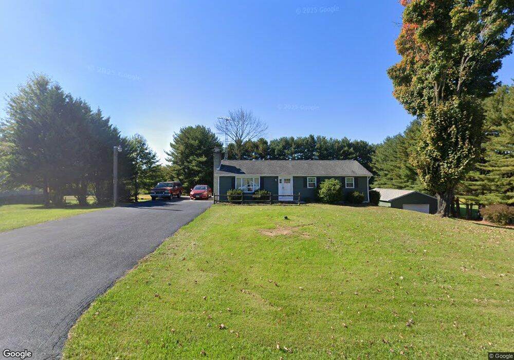
11006 Ashton Rd Clear Spring, MD 21722
Estimated Value: $238,197 - $263,000
Studio
2
Baths
1,104
Sq Ft
$228/Sq Ft
Est. Value
About This Home
This home is located at 11006 Ashton Rd, Clear Spring, MD 21722 and is currently estimated at $251,549, approximately $227 per square foot. 11006 Ashton Rd is a home located in Washington County with nearby schools including Clear Spring Elementary School, Clear Spring Middle School, and Clear Spring High School.
Ownership History
Date
Name
Owned For
Owner Type
Purchase Details
Closed on
Sep 3, 1986
Sold by
Ebersole David W
Bought by
Rowe Gary W and Rowe Linda M
Current Estimated Value
Home Financials for this Owner
Home Financials are based on the most recent Mortgage that was taken out on this home.
Original Mortgage
$35,000
Interest Rate
9.93%
Purchase Details
Closed on
Dec 20, 1984
Sold by
Williams Ivan M
Bought by
Ebersole David W
Home Financials for this Owner
Home Financials are based on the most recent Mortgage that was taken out on this home.
Original Mortgage
$53,500
Interest Rate
13.2%
Create a Home Valuation Report for This Property
The Home Valuation Report is an in-depth analysis detailing your home's value as well as a comparison with similar homes in the area
Purchase History
We collect this data history from publicly available records. To have your information removed, we recommend requesting removal directly through your county’s website.
| Date | Buyer | Sale Price | Title Company |
|---|---|---|---|
| Rowe Gary W | $59,900 | -- | |
| Ebersole David W | $52,000 | -- |
Source: Public Records
Mortgage History
We collect this data history from publicly available records. To have your information removed, we recommend requesting removal directly through your county’s website.
| Date | Status | Borrower | Loan Amount |
|---|---|---|---|
| Closed | Rowe Gary W | $35,000 | |
| Previous Owner | Ebersole David W | $53,500 |
Source: Public Records
Tax History
| Year | Tax Paid | Tax Assessment Tax Assessment Total Assessment is a certain percentage of the fair market value that is determined by local assessors to be the total taxable value of land and additions on the property. | Land | Improvement |
|---|---|---|---|---|
| 2025 | $1,901 | $209,967 | $0 | $0 |
| 2024 | $1,901 | $189,233 | $0 | $0 |
| 2023 | $1,805 | $168,500 | $77,600 | $90,900 |
| 2022 | $1,762 | $164,367 | $0 | $0 |
| 2021 | $1,707 | $160,233 | $0 | $0 |
| 2020 | $1,707 | $156,100 | $77,600 | $78,500 |
| 2019 | $1,715 | $156,100 | $77,600 | $78,500 |
| 2018 | $1,715 | $156,100 | $77,600 | $78,500 |
| 2017 | $1,728 | $157,400 | $0 | $0 |
| 2016 | -- | $156,133 | $0 | $0 |
| 2015 | -- | $154,867 | $0 | $0 |
| 2014 | $1,549 | $153,600 | $0 | $0 |
Source: Public Records
Map
Nearby Homes
- Block 1 Lot 35 Boo Blvd
- Block 1 Lot 27 Boo Blvd
- Block 1 Lot 36 Boo Blvd
- Block 6 Lot 21 Yogi Bear Ln
- Block 1 Lot 42 Boo Blvd
- Block 2 lot 6 Boo Blvd
- Block 6 Lots 15 & 16 Poison Oak
- Block 2 lot 8 Cindy Ave
- Block 5 Lots 2 & 3 Poison Oak Rd
- Block 7 Lot 30 & 31 Campfire Blvd
- Block 7 Lot 21 Campfire Blvd
- Block 8 Lot 16 & 17 Campfire Blvd
- Block 5 lot 7 Poison Oak
- Block 18 Lot 44 Hollow Log
- Block 92 Lot 41 Neverglades Rd
- Block 92 Lot 40 Neverglades Ave
- 25-20 Rocky Rd
- Block 24 Lots 19 & 2 Poison Oak Rd
- Block 25 Lot 8 Poison Oak
- Block 91 Lot 5 Bear Bottom Rd
- 10962 Ashton Rd
- 11010 Ashton Rd
- 11010 Ashton Rd
- 11001 Ashton Rd
- 10958 Ashton Rd
- 10953 Ashton Rd
- 10945 Ashton Rd
- 11005 Ashton Rd
- 10931 Ashton Rd
- 10917 Ashton Rd
- 11044 Ashton Rd
- 10913 Ashton Rd
- 12928 Lucky Bean Ln
- 10612 Dam Number 5 Rd
- 11046 Ashton Rd
- 10623 Dam Number 5 Rd
- 10602 Dam Number 5 Rd
- 10635 Dam Number 5 Rd
- 5 Dam Rd
- 10642 Dam Number 5 Rd Unit AND
Your Personal Tour Guide
Ask me questions while you tour the home.