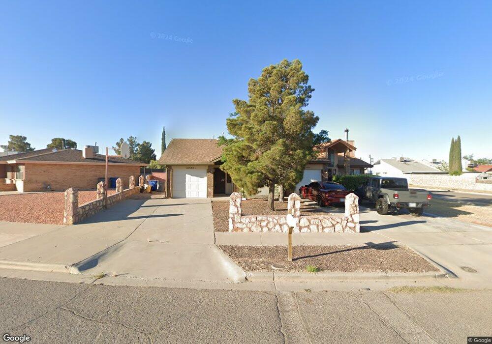
10932 Delafield Dr Unit B El Paso, TX 79936
Pebble Hills NeighborhoodEstimated Value: $138,000 - $182,000
--
Bed
2
Baths
1,212
Sq Ft
$136/Sq Ft
Est. Value
About This Home
This home is located at 10932 Delafield Dr Unit B, El Paso, TX 79936 and is currently estimated at $165,264, approximately $136 per square foot. 10932 Delafield Dr Unit B is a home located in El Paso County with nearby schools including Robbin E L Washington Elementary School, J.M. Hanks Middle School, and J M Hanks High School.
Ownership History
Date
Name
Owned For
Owner Type
Purchase Details
Closed on
Oct 29, 1997
Sold by
Gonzales Oscar and Gonzales Hilda N
Bought by
Blanco Viola
Current Estimated Value
Home Financials for this Owner
Home Financials are based on the most recent Mortgage that was taken out on this home.
Original Mortgage
$53,936
Outstanding Balance
$8,844
Interest Rate
7.27%
Mortgage Type
FHA
Estimated Equity
$156,420
Purchase Details
Closed on
Oct 7, 1994
Sold by
Rojo Jesus A and Rojo Esther
Bought by
Borunda Ronald
Home Financials for this Owner
Home Financials are based on the most recent Mortgage that was taken out on this home.
Original Mortgage
$50,343
Interest Rate
8.5%
Mortgage Type
Seller Take Back
Create a Home Valuation Report for This Property
The Home Valuation Report is an in-depth analysis detailing your home's value as well as a comparison with similar homes in the area
Home Values in the Area
Average Home Value in this Area
Purchase History
| Date | Buyer | Sale Price | Title Company |
|---|---|---|---|
| Blanco Viola | -- | -- | |
| Borunda Ronald | -- | -- |
Source: Public Records
Mortgage History
| Date | Status | Borrower | Loan Amount |
|---|---|---|---|
| Open | Blanco Viola | $53,936 | |
| Previous Owner | Borunda Ronald | $50,343 |
Source: Public Records
Tax History Compared to Growth
Tax History
| Year | Tax Paid | Tax Assessment Tax Assessment Total Assessment is a certain percentage of the fair market value that is determined by local assessors to be the total taxable value of land and additions on the property. | Land | Improvement |
|---|---|---|---|---|
| 2025 | $1,794 | $134,567 | -- | -- |
| 2024 | $1,794 | $122,334 | -- | -- |
| 2023 | $1,748 | $111,213 | $0 | $0 |
| 2022 | $3,140 | $101,103 | $0 | $0 |
| 2021 | $2,988 | $98,030 | $17,813 | $80,217 |
| 2020 | $2,639 | $83,556 | $14,524 | $69,032 |
| 2018 | $2,598 | $83,556 | $14,524 | $69,032 |
| 2017 | $2,445 | $82,202 | $14,524 | $67,678 |
| 2016 | $2,223 | $82,202 | $14,524 | $67,678 |
| 2015 | $1,450 | $66,108 | $14,524 | $51,584 |
| 2014 | $1,450 | $66,108 | $14,524 | $51,584 |
Source: Public Records
Map
Nearby Homes
- 11025 Sunshine Ct
- 11016 Aqua Ct
- 10905 Sagebrush Way Unit A & B
- 10816 Cardigan Dr
- 3453 Guthrie St
- 3428 Itasca St
- 3324 Kilgore Place
- 3319 Menard Ln
- 3369 Freeport Dr
- 3316 Slocum St
- 3332 Mclean St
- 11165 Shiner Ave
- 11189 Childress Ave
- 3229 E Glen Dr
- 3425 Brookrock St
- 3400 Brookrock St
- 3200 Voss Dr
- 3205 Amarillo St
- 10649 Islerock Dr
- 10602 Drillstone Dr
- 10932 Delafield Dr Unit A
- 3516 Blue Grove Ln Unit AB
- 3516 Blue Grove Ln Unit A
- 3516 Blue Grove Ln Unit B
- 10940 Delafield Dr Unit AB
- 10940 Delafield Dr Unit A
- 10940 Delafield Dr Unit B
- 10930 Delafield Dr
- 3512 Blue Grove Ln Unit B
- 3512 Blue Grove Ln Unit A
- 10928 Delafield Dr
- 10933 Highwood Way Unit A
- 10933 Highwood Way Unit B
- 10933 Highwood Way
- 10933 Delafield Dr
- 10950 Delafield Dr Unit B
- 10950 Delafield Dr Unit A
- 10950 Delafield Dr
- 10937 Delafield Dr
- 10924 Delafield Dr Unit 10926