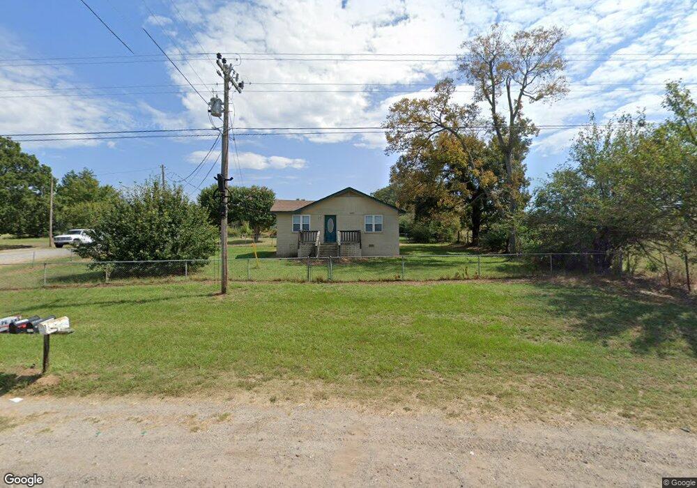
109327 State Highway 64b Muldrow, OK 74948
Estimated Value: $128,000 - $184,000
2
Beds
2
Baths
1,400
Sq Ft
$112/Sq Ft
Est. Value
About This Home
This home is located at 109327 State Highway 64b, Muldrow, OK 74948 and is currently estimated at $157,470, approximately $112 per square foot. 109327 State Highway 64b is a home located in Sequoyah County with nearby schools including Muldrow Elementary School, Muldrow Middle School, and Muldrow High School.
Ownership History
Date
Name
Owned For
Owner Type
Purchase Details
Closed on
May 15, 2015
Sold by
King James A and King Sandra M
Bought by
King Matthew
Current Estimated Value
Home Financials for this Owner
Home Financials are based on the most recent Mortgage that was taken out on this home.
Original Mortgage
$76,836
Outstanding Balance
$59,256
Interest Rate
3.71%
Mortgage Type
New Conventional
Estimated Equity
$98,214
Purchase Details
Closed on
May 23, 2014
Sold by
Federal Home Loan Mtg
Bought by
King James A
Purchase Details
Closed on
Oct 24, 2013
Sold by
Sheriff Sequoyah County
Bought by
Federal Home Loan Mtg
Purchase Details
Closed on
Oct 2, 2007
Sold by
Pollard John and Pollard Tina
Bought by
Rhodes Harbey C and Rhodes Beverly M
Home Financials for this Owner
Home Financials are based on the most recent Mortgage that was taken out on this home.
Original Mortgage
$80,000
Interest Rate
6.55%
Mortgage Type
New Conventional
Create a Home Valuation Report for This Property
The Home Valuation Report is an in-depth analysis detailing your home's value as well as a comparison with similar homes in the area
Home Values in the Area
Average Home Value in this Area
Purchase History
| Date | Buyer | Sale Price | Title Company |
|---|---|---|---|
| King Matthew | $74,000 | None Available | |
| King James A | $30,000 | -- | |
| Federal Home Loan Mtg | -- | -- | |
| Rhodes Harbey C | $80,000 | None Available |
Source: Public Records
Mortgage History
| Date | Status | Borrower | Loan Amount |
|---|---|---|---|
| Open | King Matthew | $76,836 | |
| Previous Owner | Rhodes Harbey C | $80,000 |
Source: Public Records
Tax History Compared to Growth
Tax History
| Year | Tax Paid | Tax Assessment Tax Assessment Total Assessment is a certain percentage of the fair market value that is determined by local assessors to be the total taxable value of land and additions on the property. | Land | Improvement |
|---|---|---|---|---|
| 2024 | $690 | $9,252 | $4,015 | $5,237 |
| 2023 | $657 | $8,811 | $3,990 | $4,821 |
| 2022 | $596 | $8,391 | $3,958 | $4,433 |
| 2021 | $568 | $7,992 | $3,960 | $4,032 |
| 2020 | $568 | $7,992 | $3,960 | $4,032 |
| 2019 | $570 | $8,025 | $3,960 | $4,065 |
| 2018 | $571 | $8,030 | $3,960 | $4,070 |
| 2017 | $573 | $8,069 | $3,960 | $4,109 |
| 2016 | $578 | $8,140 | $3,960 | $4,180 |
| 2015 | $575 | $8,096 | $3,960 | $4,136 |
| 2014 | $578 | $8,135 | $3,960 | $4,175 |
Source: Public Records
Map
Nearby Homes
- Tbd Water Tower Rd
- 203 Pendergrass St
- 109651 S 4720 Rd
- 103 NE 1st St
- 1 Oklahoma 64b
- TBD S 4720 Rd
- 101 NE 2nd St
- 103756 Oklahoma 64b
- 108412 S 4720 Rd
- 304 Oakdale Rd
- 300 S Fargo St
- TBD Hugo St
- 404 W Sequoyah St
- 475745 E 1083 Rd
- 503 S Dogwood St
- 107 7th St
- 505 Juniper Ln
- 701 S Ada St
- 705 Wesley Ln
- 806 S Ada St
- 109305 State Highway 64b
- 109390 State Highway 64b
- 109255 State Highway 64b
- 109412 State Highway 64b
- 472883 E 1094 Rd
- 472812 E 1094 Rd
- 109518 State Highway 64b
- 109115 State Highway 64b
- 109170 State Highway 64b
- 109548 State Highway 64b
- 109558 State Highway 64b
- 473512 E 1097 Rd
- 109628 State Highway 64b
- 109627 State Highway 64b
- 472759 E 1094 Rd
- 473102 E 1090 Rd
- 473134 E 1090 Rd
- 473220 E 1090 Rd
- 473237 E 1097 Rd
- 109691 State Highway 64b