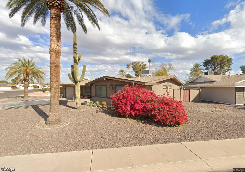
10935 W Deanne Dr Sun City, AZ 85351
Estimated Value: $264,431 - $383,000
--
Bed
2
Baths
1,660
Sq Ft
$202/Sq Ft
Est. Value
About This Home
This home is located at 10935 W Deanne Dr, Sun City, AZ 85351 and is currently estimated at $335,858, approximately $202 per square foot. 10935 W Deanne Dr is a home located in Maricopa County with nearby schools including Desert Mirage Elementary School, Ombudsman - Northwest Charter, and Peoria Accelerated High School.
Ownership History
Date
Name
Owned For
Owner Type
Purchase Details
Closed on
Nov 15, 2007
Sold by
Romeo Linda F and Peterson Linda F
Bought by
Peterson Eric J and Peterson Linda F
Current Estimated Value
Purchase Details
Closed on
Mar 3, 2004
Sold by
Lauterbach Kenneth H and Lauterbach Marilyn J
Bought by
Romeo Linda F
Home Financials for this Owner
Home Financials are based on the most recent Mortgage that was taken out on this home.
Original Mortgage
$128,000
Outstanding Balance
$59,696
Interest Rate
5.64%
Mortgage Type
New Conventional
Estimated Equity
$276,162
Purchase Details
Closed on
Feb 28, 1996
Sold by
Dix Betty J
Bought by
Lauterbach Kenneth H and Lauterbach Marilyn J
Home Financials for this Owner
Home Financials are based on the most recent Mortgage that was taken out on this home.
Original Mortgage
$60,000
Interest Rate
7.34%
Create a Home Valuation Report for This Property
The Home Valuation Report is an in-depth analysis detailing your home's value as well as a comparison with similar homes in the area
Home Values in the Area
Average Home Value in this Area
Purchase History
| Date | Buyer | Sale Price | Title Company |
|---|---|---|---|
| Peterson Eric J | -- | None Available | |
| Romeo Linda F | $160,000 | First American Title Ins Co | |
| Lauterbach Kenneth H | $99,500 | United Title Agency |
Source: Public Records
Mortgage History
| Date | Status | Borrower | Loan Amount |
|---|---|---|---|
| Open | Romeo Linda F | $128,000 | |
| Previous Owner | Lauterbach Kenneth H | $60,000 |
Source: Public Records
Tax History Compared to Growth
Tax History
| Year | Tax Paid | Tax Assessment Tax Assessment Total Assessment is a certain percentage of the fair market value that is determined by local assessors to be the total taxable value of land and additions on the property. | Land | Improvement |
|---|---|---|---|---|
| 2025 | $1,031 | $12,793 | -- | -- |
| 2024 | $926 | $12,184 | -- | -- |
| 2023 | $926 | $22,470 | $4,490 | $17,980 |
| 2022 | $873 | $17,600 | $3,520 | $14,080 |
| 2021 | $901 | $16,410 | $3,280 | $13,130 |
| 2020 | $877 | $14,670 | $2,930 | $11,740 |
| 2019 | $869 | $13,530 | $2,700 | $10,830 |
| 2018 | $834 | $12,160 | $2,430 | $9,730 |
| 2017 | $808 | $10,780 | $2,150 | $8,630 |
| 2016 | $755 | $10,170 | $2,030 | $8,140 |
| 2015 | $719 | $9,210 | $1,840 | $7,370 |
Source: Public Records
Map
Nearby Homes
- 11002 W Deanne Dr
- 10216 N 110th Ave
- 11001 W Peoria Ave Unit 9
- 11132 W Kolina Ln
- 10931 W Peoria Ave Unit 7
- 11024 W Peoria Ave Unit 3
- 10895 W Clair Dr Unit 31
- 10232 N 109th Ave
- 10873 W Clair Dr Unit 26
- 10916 W Peoria Ave
- 10908 W Peoria Ave Unit 3
- 10926 W Abbott Ave
- 11002 W Greer Ave
- 10235 N 108th Dr Unit 45
- 10816 N Madison Dr
- 11513 W Arron Dr
- 11160 W Cinnebar Ave
- 11118 W Missouri Ave
- 10743 W Clair Dr Unit 8
- 11505 W Ohio Ave
- 10929 W Deanne Dr
- 10237 N 110th Ave
- 10925 W Deanne Dr
- 10231 N 110th Ave
- 11001 W Deanne Dr
- 10932 W Deanne Dr
- 10232 N 110th Ave
- 10919 W Deanne Dr
- 10225 N 110th Ave
- 11010 W Deanne Dr
- 11011 W Deanne Dr
- 10411 N 111th Ave
- 10419 N 111th Ave
- 10915 W Deanne Dr
- 11024 W Arron Cir
- 10219 N 110th Ave
- 10220 N 110th Ave
- 10922 W Deanne Dr
- 11030 W Arron Cir
- 10914 W Deanne Dr Unit 6C