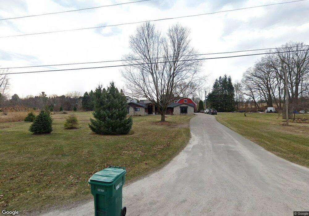
10938 Tuthill Rd South Lyon, MI 48178
Estimated Value: $453,000 - $686,000
3
Beds
3
Baths
3,156
Sq Ft
$175/Sq Ft
Est. Value
About This Home
This home is located at 10938 Tuthill Rd, South Lyon, MI 48178 and is currently estimated at $553,312, approximately $175 per square foot. 10938 Tuthill Rd is a home located in Livingston County with nearby schools including Hawkins Elementary School, Scranton Middle School, and Brighton High School.
Ownership History
Date
Name
Owned For
Owner Type
Purchase Details
Closed on
Aug 20, 2021
Sold by
Chartier Maryellen and Chartier Maryellen Rlt
Bought by
Chartier Marcus Patrick
Current Estimated Value
Purchase Details
Closed on
Feb 17, 2015
Sold by
Chartier Joseph
Bought by
Chartier Maryellen and Maryellen Chartier Revocable Living Tru
Purchase Details
Closed on
Apr 21, 2011
Sold by
Federal Home Loan Mortgage Corporation
Bought by
Chartier Joseph
Purchase Details
Closed on
Jul 22, 2009
Sold by
Dubay Jack A and Dubay Nancy B
Bought by
Federal Home Loan Mortgage Corporation
Create a Home Valuation Report for This Property
The Home Valuation Report is an in-depth analysis detailing your home's value as well as a comparison with similar homes in the area
Home Values in the Area
Average Home Value in this Area
Purchase History
| Date | Buyer | Sale Price | Title Company |
|---|---|---|---|
| Chartier Marcus Patrick | -- | None Available | |
| Chartier Maryellen | -- | -- | |
| Chartier Joseph | $142,000 | -- | |
| Federal Home Loan Mortgage Corporation | $229,490 | -- |
Source: Public Records
Tax History Compared to Growth
Tax History
| Year | Tax Paid | Tax Assessment Tax Assessment Total Assessment is a certain percentage of the fair market value that is determined by local assessors to be the total taxable value of land and additions on the property. | Land | Improvement |
|---|---|---|---|---|
| 2025 | $5,317 | $281,200 | $0 | $0 |
| 2024 | $2,295 | $267,300 | $0 | $0 |
| 2023 | $2,194 | $238,800 | $0 | $0 |
| 2022 | $6,714 | $173,900 | $0 | $0 |
| 2021 | $6,714 | $207,900 | $0 | $0 |
| 2020 | $6,714 | $185,400 | $0 | $0 |
| 2019 | $6,594 | $173,900 | $0 | $0 |
| 2018 | $6,464 | $168,800 | $0 | $0 |
| 2017 | $6,345 | $162,700 | $0 | $0 |
| 2016 | $6,304 | $154,100 | $0 | $0 |
Source: Public Records
Map
Nearby Homes
- 10537 Oak Forest Dr
- 10512 Oak Forest Dr
- 10456 Oak Shore Dr
- 10468 Oak Shore Dr
- 10536 Oak Shore Dr
- 10820 Bouldercrest Dr
- 11433 Marshall Rd
- 10403 Bouldercrest Dr
- 10593 9 Mile Rd
- 11078 Wood Run Cir
- 11108 Wood Run Cir
- 10320 Harpers Ferry Ct
- 11346 E Shore Dr
- 10076 Fairlane Dr
- 10303 9 Mile Rd
- 11390 Ridge Rd
- 10324 Greenwood Rd
- 11755 Shenandoah Dr Unit 159-4
- 11734 Shenandoah Dr Unit 3
- 11160 Chestnut Run Ct
- 10917 Spicer Farms Dr
- 10920 Tuthill Rd
- V/L Tuthill Rd
- 12 Spicer Farms Dr
- LOT 9 Spicer Farms
- 0 LOT 13 Spicer Farms Dr
- 10965 Spicer Farms Dr
- LOT 14 Spicer Farms
- LOT 10 Spicer Farms
- 10878 Tuthill Rd
- 0 Spicer Farms Dr Unit 5312457
- 0 Spicer Farms Dr Unit 5310674
- 0 Spicer Farms Dr Unit 5140251
- 0 Spicer Farms Dr Unit 5132044
- 0 Spicer Farms Dr Unit 5309592
- 10884 Libby Ln
- LOT 1 Libby Ln
- LOT 3 Libby Ln
- 10989 Spicer Farms Dr
- 10866 Tuthill Rd