NOT LISTED FOR SALE

109394 S 4710 Rd Muldrow, OK 74948

Estimated Value: $196,000 - $320,000

10 Acres
$26,809 Price per Acre
435,600 Sq Ft Lot

Last Sold January 11, 2018

Last sale price $30,000 $36 Per Sq Ft

Est. 790% increase in value since last sale

Current estimated payment $1,554/month

6 Days on Market

About This Lot

As of January 2018

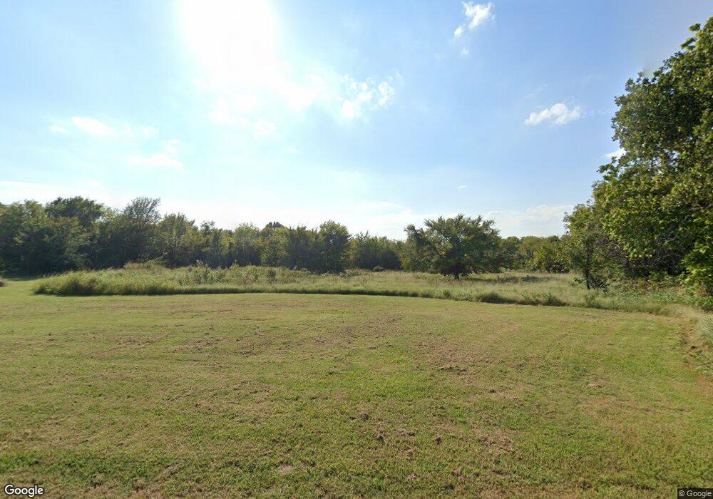
This 10 acre parcel is located just West of Muldrow, Ok. on NORTH Redland Rd. (4710) There is a house on the property that will need to be torn down. The property is fenced on all sides, there is a wet weather pond on the property. If you are looking for 10 acres that has several locations for a future home site be sure to take a look at this property.

Last Agent to Sell the Property

Dennis Huggins

O'Neal Real Estate License #SA00075852 Listed on: 12/05/2017

Co-Listed By

Cindy Huggins

O'Neal Real Estate License #SA00070425

Last Buyer's Agent

Lana Tate

O'Neal Real Estate License #172245

Property Details

Property Type

  • Land

Est. Annual Taxes

  • $1,108

Lot Details

  • 10 Acre Lot
  • Property fronts a county road
  • Rural Setting
  • Partially Wooded Lot

Home Design

  • Mixed Use

Schools

  • Muldrow Elementary And Middle School
  • Muldrow High School

Utilities

  • Well
  • Septic Tank

Additional Features

  • Outside City Limits
  • Mobile Home Allowed

Listing and Financial Details

  • Assessor Parcel Number 0000-15-011-025-0-002-00

Property Details

Property Type

Land

Est. Annual Taxes

$1,108

Lot Details

0

Listing Details

  • Reso Property Sub Type: Mixed Use
  • Prop. Type: Land
  • ResoLotFeatures: Mobile Home Allowed, Outside City Limits, Other, Rural Lot, See Remarks
  • Road Frontage Type: County Road
  • Road Surface Type: Gravel
  • Co List Office Mls Id: F3627
  • Co List Office Phone: 479-739-8087
  • Co List Office Mls Id: F3627
  • ResoSpecialListingConditions: None
  • Subdivision Name: n/a
  • Directions: From the intersection of Hwy 64 and 64B in Muldrow, Ok. go West 2.5 miles to NORTH Redland Rd. (4710 Rd.) At 4710 Rd. go North approx. 3 miles to the property location on the Left (West) side of 4710.
  • Property Sub Type Additional: Mixed Use
  • Special Features: None
  • Property Sub Type: LotsLands

Exterior Features

  • Fencing: Other, See Remarks
  • Acres: 10.0

Utilities

  • Water Source: Well

Condo/Co-op/Association

  • Community Features: Other, See Remarks

Schools

  • Junior High Dist: Muldrow
  • Ninth Grade High School: Muldrow
  • Middle Or Junior School: Muldrow

Lot Info

  • Lot Dimensions: 10 acres
  • Parcel #: 0000-15-011-025-0-002-00

Tax Info

  • Tax Annual Amount: 90.0
  • Tax Block: n/a
  • Tax Lot: n/a

MLS Schools

  • Elementary School: Muldrow

Ownership History

Date Name Owned For Owner Type

Purchase Details

Closed on
Jan 11, 2023
Sold by
Nolan Chad
Bought by
Nolan Chad and Hoover Mysha
Current Estimated Value
$267,020

Purchase Details

Listed on
Dec 5, 2017
Closed on
Jan 11, 2018
Sold by
Luma Lester C
Bought by
Nolan Chad
Seller's Agent
Dennis Huggins
O'Neal Real Estate
Buyer's Agent
Lana Tate
O'Neal Real Estate
List Price
$35,000
Sold Price
$30,000
Premium/Discount to List
-$5,000
-14.29%

Home Financials for this Owner

Home Financials are based on the most recent Mortgage that was taken out on this home.
Avg. Annual Appreciation
33.20%
Original Mortgage
$31,999
Interest Rate
3.9%
Mortgage Type
Commercial

Purchase Details

Closed on
Aug 7, 2002
Sold by
Mcgehee
Bought by
Luma

Purchase Details

Closed on
Feb 21, 2000
Sold by
Mcgehee Flossie
Bought by
Mcgehee Kenneth

Purchase Details

Closed on
Aug 20, 1980
Sold by
Mcgehee Flossie
Bought by
Mcgehee Kenneth and Mcgehee Bonnie
Source: Public Records

Range of Values:

Collateral Analytics

Collateral Analytics Collateral Analytics AVMs (Automated Valuation Model) employ a number of statistical approaches combined with neighborhood-specific comparable selection guarantees the most up-to-date and precise valuations.

Not Available

Collateral Analytics does not have data for the current month. Please view the chart for historical values.

ICE

ICE Mortgage Technology ICE Mortgage Technology’s AVM (Automated Valuation Model) is a state-of-the-art online residential property valuation tool that provides a quick and accurate estimate of the value of almost any home in the U.S.

Not Available

ICE Mortgage Technology does not have data for the current month. Please view the chart for historical values.

First American

First American First American Data & Analytics’ next-generation AVM combines unrivaled data assets with a blended ensemble of valuation models to produce highly accurate, reliable valuations you can trust.

Not Available

First American does not have data for the current month. Please view the chart for historical values.

Quantarium

Quantarium Quantarium’s valuation service, repeatedly proven the industry’s most accurate and comprehensive, is supercharged with a self-learning and auto-tuning AI engine that continually becomes smarter and more accurate as it processes daily inputs from the industry’s leading RE data lake.

Not Available

Quantarium does not have data for the current month. Please view the chart for historical values.

Average Value
Not Available
List Price
Sold Price
Create a Home Valuation Report for This Property
The Home Valuation Report is an in-depth analysis detailing your home's value as well as a comparison with similar homes in the area

Home Values in the Area

Source: Public Records

Average Home Value in this Area


Source: Public Records

Purchase History

Date Buyer Sale Price Title Company
Nolan Chad -- --
Nolan Chad $30,000 None Available
Luma $32,000 --
Mcgehee Kenneth -- --
Source: Public Records

Mortgage History

Date Status Borrower Loan Amount
Previous Owner Nolan Chad $31,999
Source: Public Records

Property History

Date Event Price Change Sq Ft Price
01/11/2018 01/11/18 Sold $30,000 -14.3% $36 / Sq Ft
12/12/2017 12/12/17 Pending -- -- --
12/05/2017 12/05/17 For Sale $35,000 -- $42 / Sq Ft
Source: Western River Valley Board of REALTORS®

Tax History Compared to Growth

Source: Public Records

Tax History

Year Tax Paid Tax Assessment Tax Assessment Total Assessment is a certain percentage of the fair market value that is determined by local assessors to be the total taxable value of land and additions on the property. Land Improvement
2024 $1,108 $16,590 $4,070 $12,520
2023 $1,108 $16,107 $4,044 $12,063
2022 $1,040 $15,638 $4,007 $11,631
2021 $1,008 $15,638 $4,015 $11,623
2020 $976 $14,740 $3,729 $11,011
2019 $946 $14,311 $3,300 $11,011
2018 $99 $1,390 $1,148 $242
2017 $94 $1,323 $1,093 $230
2016 $90 $1,260 $1,041 $219
2015 $85 $1,201 $992 $209
2014 $81 $1,143 $944 $199
Source: Public Records

Agents Affiliated with this Home

  • Section Image
  • Section Image
  • Section Image
See All Agents

Map

Source: Western River Valley Board of REALTORS®

MLS Number: 1014950

APN: 0000-15-011-025-0-002-00