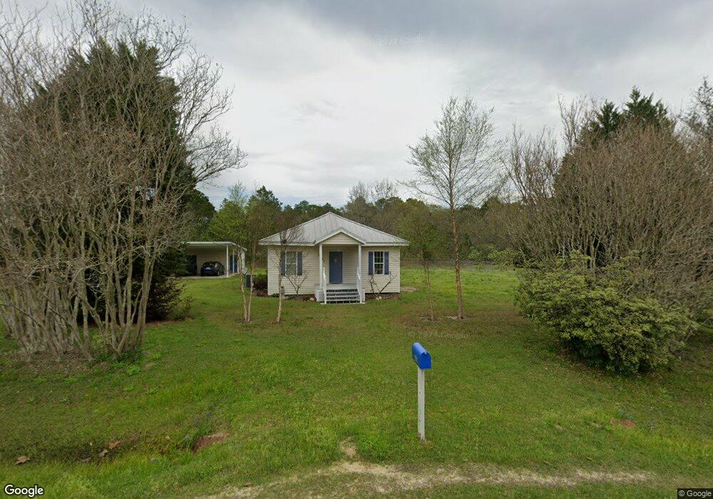
1094 County Highway 181 W Defuniak Springs, FL 32433
Estimated Value: $159,633 - $230,000
2
Beds
1
Bath
1,134
Sq Ft
$172/Sq Ft
Est. Value
About This Home
This home is located at 1094 County Highway 181 W, Defuniak Springs, FL 32433 and is currently estimated at $194,908, approximately $171 per square foot. 1094 County Highway 181 W is a home located in Walton County with nearby schools including Paxton School.
Ownership History
Date
Name
Owned For
Owner Type
Purchase Details
Closed on
Jan 26, 2006
Sold by
Dyess Jonathan E
Bought by
Stutz Gerald A and Stutz Elizabeth A
Current Estimated Value
Home Financials for this Owner
Home Financials are based on the most recent Mortgage that was taken out on this home.
Original Mortgage
$88,000
Outstanding Balance
$49,570
Interest Rate
6.21%
Mortgage Type
Fannie Mae Freddie Mac
Estimated Equity
$145,338
Purchase Details
Closed on
Nov 16, 2005
Sold by
Campbell James L and Campbell Etha
Bought by
Prigden Virginia D and Prigden Kenneth S
Purchase Details
Closed on
Aug 2, 2004
Sold by
Byrd Brooke A and Stewart Brooke A
Bought by
Dyess Jonathan Edward
Home Financials for this Owner
Home Financials are based on the most recent Mortgage that was taken out on this home.
Original Mortgage
$66,500
Interest Rate
5.97%
Mortgage Type
Purchase Money Mortgage
Create a Home Valuation Report for This Property
The Home Valuation Report is an in-depth analysis detailing your home's value as well as a comparison with similar homes in the area
Home Values in the Area
Average Home Value in this Area
Purchase History
| Date | Buyer | Sale Price | Title Company |
|---|---|---|---|
| Stutz Gerald A | $110,000 | Landmark Title & Escrow Inc | |
| Prigden Virginia D | $36,000 | -- | |
| Dyess Jonathan Edward | $62,900 | Landmark Title & Escrow Inc |
Source: Public Records
Mortgage History
| Date | Status | Borrower | Loan Amount |
|---|---|---|---|
| Open | Stutz Gerald A | $88,000 | |
| Previous Owner | Dyess Jonathan Edward | $66,500 | |
| Closed | Dyess Jonathan Edward | $5,000 |
Source: Public Records
Tax History Compared to Growth
Tax History
| Year | Tax Paid | Tax Assessment Tax Assessment Total Assessment is a certain percentage of the fair market value that is determined by local assessors to be the total taxable value of land and additions on the property. | Land | Improvement |
|---|---|---|---|---|
| 2024 | $349 | $67,525 | -- | -- |
| 2023 | $349 | $65,558 | $0 | $0 |
| 2022 | $348 | $63,649 | $0 | $0 |
| 2021 | $355 | $61,795 | $0 | $0 |
| 2020 | $361 | $66,533 | $7,000 | $59,533 |
| 2019 | $353 | $59,572 | $0 | $0 |
| 2018 | $348 | $58,461 | $0 | $0 |
| 2017 | $344 | $57,259 | $0 | $0 |
| 2016 | $338 | $55,513 | $0 | $0 |
| 2015 | $340 | $55,127 | $0 | $0 |
| 2014 | $348 | $55,777 | $0 | $0 |
Source: Public Records
Map
Nearby Homes
- Tract#6201 W County Hwy 181 Unit Nat B-01
- Tract#6201 8 Mile Cemetery Rd Unit 2
- Tract#6201 W Co Hwy 181 Nat B-01
- Tract#6201 Doyle Morgan Rd
- 258 Briar Rd
- 7257 State Highway 153
- 1921 Adams Dr
- Parcel B Adams Dr
- 0 Cuthriell Rd
- 0 Co Rd 10
- 601 Oak Grove Rd
- 0 Gopher Ridge Rd
- xx Wallace Rd
- 261 Wilkerson Rd
- 0 County Highway 0605
- 3223 Alford Rd
- 139 Acres Yorkey Rd
- 239 Aubie Rd
- 11 Sandy Ramp Rd
- 6455 County Highway 0605
- 138 Schofield Rd
- 845 County Highway 181 W
- 41 ACRES Schofield Rd
- 295 Schofield Rd
- 366 Schofield Rd
- 807 County Highway 181 W
- 807 County Highway 181 W
- 59 ACRES Pen Williams Rd
- 00 Schofield Rd
- 20-N Ac Schofield Rd
- 20-S Ac Schofield Rd
- 40 Ac Schofield Rd
- 106 Leddon Rd
- 222 Leddon Rd
- 452 Pen Williams Rd
- 19.8 Acres Hemphill Rd
- TBD Hemphill Rd
- 10 AC W Co Hwy 181
- 216 County Highway 181 W
- 915 Hemphill Rd