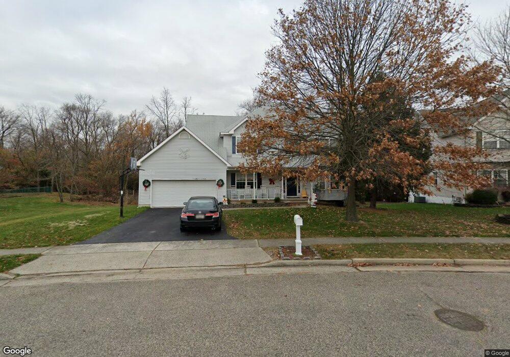
1094 Hawthorne Pkwy Spring Lake, NJ 07762
Estimated Value: $988,000 - $1,414,000
4
Beds
3
Baths
2,684
Sq Ft
$453/Sq Ft
Est. Value
About This Home
This home is located at 1094 Hawthorne Pkwy, Spring Lake, NJ 07762 and is currently estimated at $1,216,163, approximately $453 per square foot. 1094 Hawthorne Pkwy is a home located in Monmouth County with nearby schools including Wall High School and The Brookside School.
Ownership History
Date
Name
Owned For
Owner Type
Purchase Details
Closed on
Sep 24, 1998
Sold by
Kipling Estates Inc
Bought by
Gilbert Peter and Gilbert Kathleen
Current Estimated Value
Home Financials for this Owner
Home Financials are based on the most recent Mortgage that was taken out on this home.
Original Mortgage
$224,400
Outstanding Balance
$47,270
Interest Rate
6.74%
Estimated Equity
$1,168,893
Create a Home Valuation Report for This Property
The Home Valuation Report is an in-depth analysis detailing your home's value as well as a comparison with similar homes in the area
Home Values in the Area
Average Home Value in this Area
Purchase History
| Date | Buyer | Sale Price | Title Company |
|---|---|---|---|
| Gilbert Peter | $260,000 | -- |
Source: Public Records
Mortgage History
| Date | Status | Borrower | Loan Amount |
|---|---|---|---|
| Open | Gilbert Peter | $224,400 |
Source: Public Records
Tax History Compared to Growth
Tax History
| Year | Tax Paid | Tax Assessment Tax Assessment Total Assessment is a certain percentage of the fair market value that is determined by local assessors to be the total taxable value of land and additions on the property. | Land | Improvement |
|---|---|---|---|---|
| 2025 | $11,365 | $530,600 | $142,900 | $387,700 |
| 2024 | $11,084 | $530,600 | $142,900 | $387,700 |
| 2023 | $11,084 | $530,600 | $142,900 | $387,700 |
| 2022 | $10,739 | $530,600 | $142,900 | $387,700 |
| 2021 | $10,739 | $530,600 | $142,900 | $387,700 |
| 2020 | $10,601 | $530,600 | $142,900 | $387,700 |
| 2019 | $10,479 | $530,600 | $142,900 | $387,700 |
| 2018 | $10,363 | $530,600 | $142,900 | $387,700 |
| 2017 | $10,156 | $530,600 | $142,900 | $387,700 |
| 2016 | $9,906 | $530,600 | $142,900 | $387,700 |
| 2015 | $11,613 | $390,100 | $142,700 | $247,400 |
| 2014 | $11,103 | $381,800 | $165,400 | $216,400 |
Source: Public Records
Map
Nearby Homes
- 2419 Kipling Ave
- 1838 Highway 35 Unit 36
- 1820 New Jersey 35 Unit 34
- 1820 New Jersey 35 Unit Home Site 26
- 905 Wall Rd
- 24 Old Mill Ct
- 1211 18th Ave
- 1027 2nd Ave
- 2217 Old Mill Rd
- 1704 Grove St
- 12 Wyckham Rd
- 15 Wyckham Rd
- 19 Willow Ln
- 1331 New Jersey 138
- 1014 Glenn St
- 1012 Glenn St
- 1024 17th Ave
- 1644 Riverview Terrace
- 1630 Oakwood Rd
- 1301 Warren Ave Unit 5
- 1092 Hawthorne Pkwy
- 1096 Hawthorne Pkwy
- 1090 Hawthorne Pkwy
- 1097 Hawthorne Pkwy
- 1093 Hawthorne Pkwy
- 1088 Hawthorne Pkwy
- 1091 Hawthorne Pkwy
- 1098 Hawthorne Pkwy
- 1099 Hawthorne Pkwy
- 2602 Kipling Ave
- 1086 Hawthorne Pkwy
- 1089 Hawthorne Pkwy
- 2502 Kipling Ave
- 1087 Hawthorne Pkwy
- 2604 Kipling Ave
- 1084 Hawthorne Pkwy
- 2500 Kipling Ave
- 1085 Hawthorne Pkwy
- 2490 Kipling Ave
- 2606 Kipling Ave