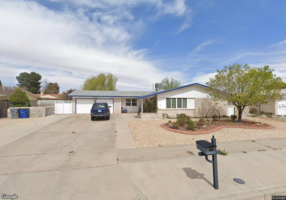
10949 Art Wall Dr El Paso, TX 79936
Glen Cove NeighborhoodEstimated Value: $223,832 - $247,000
3
Beds
2
Baths
1,448
Sq Ft
$162/Sq Ft
Est. Value
About This Home
This home is located at 10949 Art Wall Dr, El Paso, TX 79936 and is currently estimated at $234,208, approximately $161 per square foot. 10949 Art Wall Dr is a home located in El Paso County with nearby schools including Tierra Del Sol Elementary School, J M Hanks High School, and EL PASO LEADERSHIP ACADEMY - MIDDLE EAST.
Ownership History
Date
Name
Owned For
Owner Type
Purchase Details
Closed on
Apr 17, 2012
Sold by
Vazquez Jose A and Vazquez Juanita R
Bought by
Reidland James A
Current Estimated Value
Purchase Details
Closed on
Feb 13, 2006
Sold by
Alvarez Rudy L and Alvarez Rudolfo L
Bought by
Reidland Michael Andrew and Reidland Donna B
Home Financials for this Owner
Home Financials are based on the most recent Mortgage that was taken out on this home.
Original Mortgage
$69,513
Interest Rate
6.15%
Mortgage Type
Fannie Mae Freddie Mac
Purchase Details
Closed on
Oct 18, 1994
Sold by
Elliott Collin F and Elliott Vernell G
Bought by
Alvarez Rudy L and Alvarez Marene M
Home Financials for this Owner
Home Financials are based on the most recent Mortgage that was taken out on this home.
Original Mortgage
$65,050
Interest Rate
8.5%
Create a Home Valuation Report for This Property
The Home Valuation Report is an in-depth analysis detailing your home's value as well as a comparison with similar homes in the area
Home Values in the Area
Average Home Value in this Area
Purchase History
| Date | Buyer | Sale Price | Title Company |
|---|---|---|---|
| Reidland James A | -- | None Available | |
| Reidland Michael Andrew | -- | St | |
| Alvarez Rudy L | -- | -- |
Source: Public Records
Mortgage History
| Date | Status | Borrower | Loan Amount |
|---|---|---|---|
| Previous Owner | Reidland Michael Andrew | $69,513 | |
| Previous Owner | Alvarez Rudy L | $65,050 |
Source: Public Records
Tax History Compared to Growth
Tax History
| Year | Tax Paid | Tax Assessment Tax Assessment Total Assessment is a certain percentage of the fair market value that is determined by local assessors to be the total taxable value of land and additions on the property. | Land | Improvement |
|---|---|---|---|---|
| 2025 | $2,472 | $214,291 | -- | -- |
| 2024 | $2,472 | $194,810 | -- | -- |
| 2023 | $2,370 | $177,100 | $0 | $0 |
| 2022 | $5,000 | $161,000 | $0 | $0 |
| 2021 | $4,758 | $146,364 | $26,691 | $119,673 |
| 2020 | $4,373 | $138,440 | $19,803 | $118,637 |
| 2018 | $4,209 | $135,357 | $19,803 | $115,554 |
| 2017 | $3,881 | $126,956 | $19,803 | $107,153 |
| 2016 | $3,881 | $126,956 | $19,803 | $107,153 |
| 2015 | $3,033 | $126,956 | $19,803 | $107,153 |
| 2014 | $3,033 | $127,227 | $19,803 | $107,424 |
Source: Public Records
Map
Nearby Homes
- 11008 Johnny Miller Dr
- 11013 Bob Stone Dr
- 11012 Bob Stone Dr
- 11016 Bob Stone Dr
- 2009 Bobby Jones Dr Unit B
- 2325 Ken Venturi Ln
- 2308 Tom Watson Ct
- 1901 Bobby Jones Dr
- 2313 Frank Beard Dr
- 10916 Miller Barber Dr
- 1817 Hugh Royer Place
- 2604 Anise Dr
- 1868 Tom Bolt Dr
- 2820 Beachcomber Dr
- 1844 Jack Nicklaus Dr Unit 1846
- 1913 Seagull Dr
- 2348 Sea Side Dr
- 2825 Wong Place Unit A/D
- 2000 Solano Dr
- 11132 Wharf Cove Dr
- 10949 Art Wall Dr Unit B
- 10945 Art Wall Dr
- 10953 Art Wall Dr
- 2364 Anise Dr
- 2360 Anise Dr
- 2368 Anise Dr
- 10941 Art Wall Dr
- 10948 Art Wall Dr
- 2356 Anise Dr
- 2356 Anise Dr
- 10944 Art Wall Dr
- 10952 Art Wall Dr
- 11001 Art Wall Dr
- 10940 Art Wall Dr
- 10937 Art Wall Dr
- 2352 Anise Dr
- 2400 Anise Dr
- 10937 Bob Stone Dr
- 2365 Anise Dr
- 10933 Bob Stone Dr