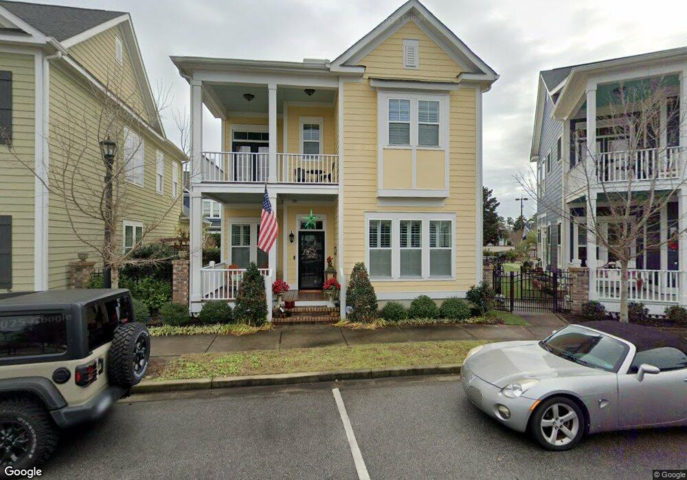
1095 Means Cir Myrtle Beach, SC 29577
Market Commons NeighborhoodEstimated Value: $584,166 - $649,000
3
Beds
3
Baths
2,141
Sq Ft
$290/Sq Ft
Est. Value
About This Home
This home is located at 1095 Means Cir, Myrtle Beach, SC 29577 and is currently estimated at $621,792, approximately $290 per square foot. 1095 Means Cir is a home located in Horry County with nearby schools including Myrtle Beach Child Development Center, Myrtle Beach Primary School, and Myrtle Beach Elementary School.
Ownership History
Date
Name
Owned For
Owner Type
Purchase Details
Closed on
Feb 5, 2016
Sold by
Dockstreet Of Market Common Inc
Bought by
Kobbs Louis W and Kobbs Loreta M
Current Estimated Value
Home Financials for this Owner
Home Financials are based on the most recent Mortgage that was taken out on this home.
Original Mortgage
$321,158
Outstanding Balance
$256,187
Interest Rate
3.97%
Mortgage Type
VA
Estimated Equity
$365,605
Purchase Details
Closed on
Nov 2, 2015
Sold by
Dockstreet Of Market Common Inc
Bought by
Karnes Colt and Karnes Jacqueline B
Create a Home Valuation Report for This Property
The Home Valuation Report is an in-depth analysis detailing your home's value as well as a comparison with similar homes in the area
Home Values in the Area
Average Home Value in this Area
Purchase History
| Date | Buyer | Sale Price | Title Company |
|---|---|---|---|
| Kobbs Louis W | $342,539 | -- | |
| Karnes Colt | $346,642 | -- |
Source: Public Records
Mortgage History
| Date | Status | Borrower | Loan Amount |
|---|---|---|---|
| Open | Kobbs Louis W | $321,158 | |
| Closed | Kobbs Louis W | $321,158 |
Source: Public Records
Tax History Compared to Growth
Tax History
| Year | Tax Paid | Tax Assessment Tax Assessment Total Assessment is a certain percentage of the fair market value that is determined by local assessors to be the total taxable value of land and additions on the property. | Land | Improvement |
|---|---|---|---|---|
| 2024 | $1,471 | $22,951 | $5,015 | $17,936 |
| 2023 | $1,471 | $14,340 | $3,820 | $10,520 |
| 2021 | $1,321 | $14,340 | $3,820 | $10,520 |
| 2020 | $1,141 | $14,340 | $3,820 | $10,520 |
| 2019 | $1,098 | $14,340 | $3,820 | $10,520 |
| 2018 | $873 | $13,107 | $2,983 | $10,124 |
Source: Public Records
Map
Nearby Homes
- 1411 Peterson St
- 763 Moen Place Unit 763-B
- 780 Gabreski Ln Unit A-2
- 830 Howard Ave Unit D
- 847 Iris St Unit A
- 855 Hall Ln Unit D
- 750 Howard Ave Unit E
- 2794 Howard Ave Unit A
- 852 Iris St Unit D
- 2798 Howard Ave Unit B
- 3526 Evergreen Way Unit 3526
- 3530 Evergreen Way
- 2790 Cook Cir Unit B
- 2790 Cook Cir Unit D
- 976 Farrow Pkwy Unit B
- 976 Farrow Pkwy Unit A
- 3452 Baldwin Ln
- 3448 Baldwin Ln
- 2800 Cook Cir Unit C
- 2800 Cook Cir Unit B
- 1095 Means Cir Unit Lot 41 - R13 - The S
- 1091 Means Cir Unit Sweet grass West
- 1091 Means Cir
- 1099 Means Cir
- 1099 Means Cir Unit Lot 40 - R13 - The Y
- 1081 Means Cir
- 1081 Means Cir Unit Lot 44 R13 Lakevie
- 1320 Peterson St
- 1348 Peterson St Unit Lancaster
- 1073 Means Cir
- 1073 Means Cir Unit Lot 45 - R13 - Grand
- 1105 Means Cir
- 1105 Means Cir Unit Lot 39 - R13 - The W
- 1065 Means Cir
- 1065 Means Cir Unit Lot 46 Glenbrook
- 1330 Peterson St Unit 34 Berkley
- 1051 Means Cir Unit Lakeview R13:47
- 1051 Means Cir
- 1045 Means Cir Unit Lot 48 - R13 - The W
- 1111 Means Cir