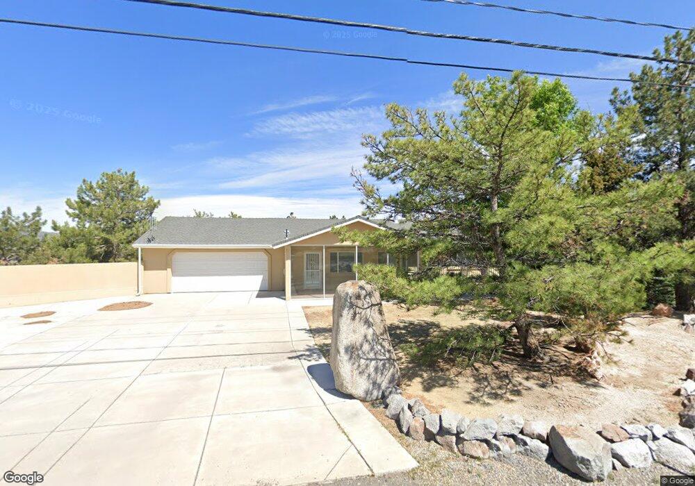
10950 Red Rock Rd Reno, NV 89508
Stead NeighborhoodEstimated Value: $608,000 - $722,000
4
Beds
3
Baths
3,408
Sq Ft
$195/Sq Ft
Est. Value
About This Home
This home is located at 10950 Red Rock Rd, Reno, NV 89508 and is currently estimated at $663,021, approximately $194 per square foot. 10950 Red Rock Rd is a home located in Washoe County with nearby schools including Desert Heights Elementary School, Cold Springs Middle Schools, and North Valleys High School.
Ownership History
Date
Name
Owned For
Owner Type
Purchase Details
Closed on
Apr 11, 2023
Sold by
Kluznik Donald
Bought by
Don Kluznik 2023 Revocable Living Trust
Current Estimated Value
Purchase Details
Closed on
Nov 6, 2015
Sold by
Kluznik Donald and Daugherty Colleen
Bought by
Kluznik Donald
Purchase Details
Closed on
Jan 30, 2015
Sold by
Daugherty Colleen and Kluznik Donald
Bought by
Kluznik Don and 2010 Daugherty 2010
Purchase Details
Closed on
Jan 14, 2010
Sold by
Kluznik Donald and Kluznik Colleen M
Bought by
Kluznik Donald and Daugherty Colleen Cecille
Purchase Details
Closed on
Dec 14, 2004
Sold by
Gray Debbie Dianne
Bought by
Gray Davis John and Gray Debbie Dianne
Home Financials for this Owner
Home Financials are based on the most recent Mortgage that was taken out on this home.
Original Mortgage
$150,000
Interest Rate
4.27%
Mortgage Type
Negative Amortization
Purchase Details
Closed on
Oct 25, 2004
Sold by
Mann Eben D
Bought by
Kluznik Donald and Kluznik Colleen M
Home Financials for this Owner
Home Financials are based on the most recent Mortgage that was taken out on this home.
Original Mortgage
$150,000
Interest Rate
4.27%
Mortgage Type
Negative Amortization
Purchase Details
Closed on
Oct 18, 2004
Sold by
Mann Rheamay
Bought by
Mann Eben D
Home Financials for this Owner
Home Financials are based on the most recent Mortgage that was taken out on this home.
Original Mortgage
$150,000
Interest Rate
4.27%
Mortgage Type
Negative Amortization
Purchase Details
Closed on
Dec 9, 1998
Sold by
Mann Eben D
Bought by
Mann Debbie D
Purchase Details
Closed on
Mar 4, 1998
Sold by
Kerr Thomas A and Kerr Joann C
Bought by
Mann Eben D and Mann Debbie D
Home Financials for this Owner
Home Financials are based on the most recent Mortgage that was taken out on this home.
Original Mortgage
$190,620
Interest Rate
7.02%
Create a Home Valuation Report for This Property
The Home Valuation Report is an in-depth analysis detailing your home's value as well as a comparison with similar homes in the area
Home Values in the Area
Average Home Value in this Area
Purchase History
| Date | Buyer | Sale Price | Title Company |
|---|---|---|---|
| Don Kluznik 2023 Revocable Living Trust | -- | None Listed On Document | |
| Kluznik Donald | -- | First Centennial Title Co | |
| Kluznik Don | -- | First Centennial Title Co | |
| Kluznik Donald | -- | First Centennial Title Co | |
| Kluznik Donald | -- | First Centennial Title Co | |
| Kluznik Donald | -- | None Available | |
| Gray Davis John | -- | -- | |
| Kluznik Donald | $365,000 | First Centennial Title Co | |
| Mann Eben D | -- | First Centennial Title Co | |
| Mann Debbie D | -- | -- | |
| Mann Eben D | $212,000 | Stewart Title |
Source: Public Records
Mortgage History
| Date | Status | Borrower | Loan Amount |
|---|---|---|---|
| Previous Owner | Kluznik Donald | $150,000 | |
| Previous Owner | Mann Eben D | $190,620 |
Source: Public Records
Tax History Compared to Growth
Tax History
| Year | Tax Paid | Tax Assessment Tax Assessment Total Assessment is a certain percentage of the fair market value that is determined by local assessors to be the total taxable value of land and additions on the property. | Land | Improvement |
|---|---|---|---|---|
| 2025 | $3,510 | $126,062 | $35,700 | $90,362 |
| 2024 | $3,408 | $131,656 | $35,700 | $95,956 |
| 2023 | $3,408 | $122,204 | $35,700 | $86,504 |
| 2022 | $2,148 | $68,275 | $28,263 | $40,013 |
| 2021 | $1,989 | $61,325 | $21,280 | $40,045 |
| 2020 | $1,986 | $61,435 | $21,280 | $40,155 |
| 2019 | $1,891 | $61,436 | $21,679 | $39,757 |
| 2018 | $1,804 | $55,684 | $15,827 | $39,857 |
| 2017 | $1,795 | $55,755 | $14,963 | $40,792 |
| 2016 | $1,749 | $55,452 | $13,599 | $41,853 |
| 2015 | $436 | $54,367 | $11,737 | $42,630 |
| 2014 | $1,692 | $52,770 | $10,407 | $42,363 |
| 2013 | -- | $50,683 | $8,047 | $42,636 |
Source: Public Records
Map
Nearby Homes
- 10300 Sutters Mill Ln
- 10725 Santa fe Rd
- 10705 Silver Spur Dr
- 00 Plata Mesa Dr
- 11150 Carlsbad Rd
- 10035 Osage Rd
- 8350 Osage Rd
- 10605 Osage Rd
- 10150 Coyote Run Ct
- 0 N Red Rock Rd Unit 250000494
- 9500 N Red Rock Rd
- 3830 Petrel Ct
- 7663 Crystal Shores Dr
- 8275 Shifting Sands Dr Unit 21
- 13790 Mount Babcock St
- 8720 Malibu Dr
- 5005 Azurite Dr
- 13440 Fort Sage Ct
- 17105 Garnet Dr
- 7956 White Falls Dr
- 10920 Red Rock Rd
- 10980 Red Rock Rd
- 10205 Aldebaran Dr
- 10200 Aldebaran Dr
- 10900 Red Rock Rd
- 10200 Sutters Mill Ln
- 10255 Aldebaran Dr
- 10250 Aldebaran Dr
- 10250 Sutters Mill Ln
- 10300 Aldebaran Dr
- 10305 Aldebaran Dr
- 10880 Red Rock Rd
- 10350 Aldebaran Dr
- 10205 Sutters Mill Ln
- 10355 Aldebaran Dr
- 10830 Red Rock Rd
- 10255 Sutters Mill Ln
- 10350 Sutters Mill Ln
- 10400 Aldebaran Dr
- 10405 Aldebaran Dr