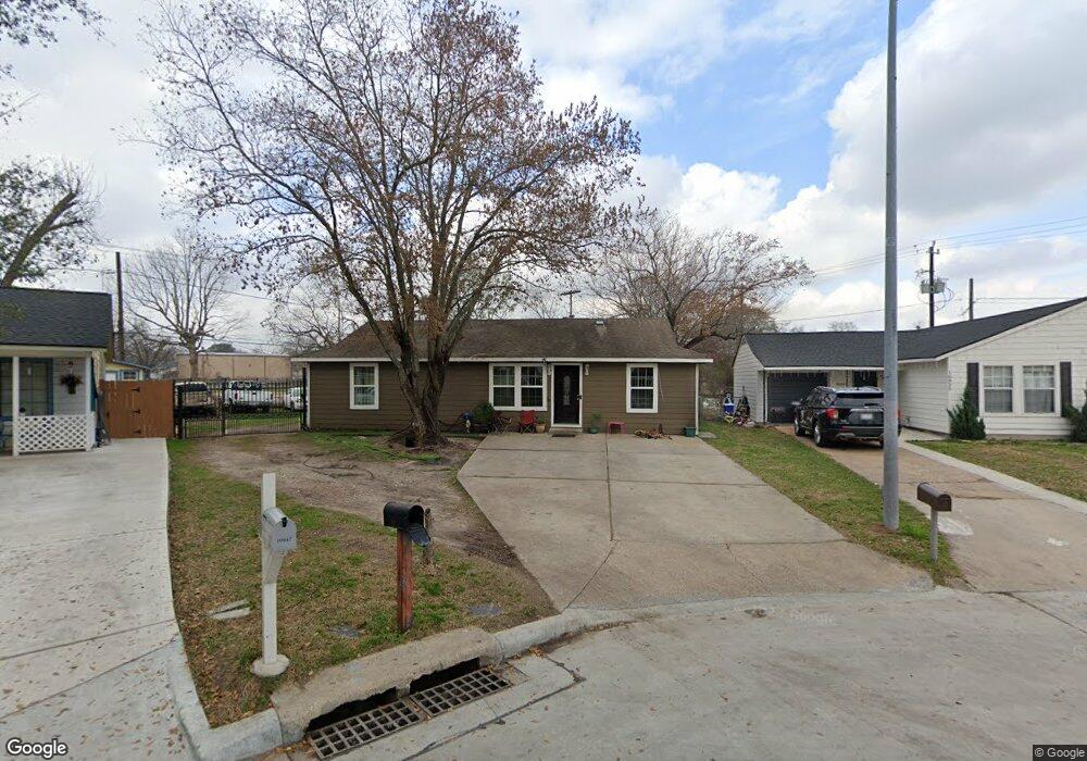
10951 Royal Pine Dr Houston, TX 77093
Eastex-Jensen NeighborhoodEstimated Value: $166,000 - $216,000
3
Beds
2
Baths
1,518
Sq Ft
$129/Sq Ft
Est. Value
About This Home
This home is located at 10951 Royal Pine Dr, Houston, TX 77093 and is currently estimated at $195,866, approximately $129 per square foot. 10951 Royal Pine Dr is a home located in Harris County with nearby schools including Scarborough Elementary School, Patrick Henry Middle School, and Sam Houston Math, Science & Technology Center.
Ownership History
Date
Name
Owned For
Owner Type
Purchase Details
Closed on
Nov 13, 2006
Sold by
Campbell Willie R and Campbell Patricia A
Bought by
Banda Rolando
Current Estimated Value
Home Financials for this Owner
Home Financials are based on the most recent Mortgage that was taken out on this home.
Original Mortgage
$87,400
Outstanding Balance
$52,162
Interest Rate
6.37%
Mortgage Type
Purchase Money Mortgage
Estimated Equity
$143,705
Create a Home Valuation Report for This Property
The Home Valuation Report is an in-depth analysis detailing your home's value as well as a comparison with similar homes in the area
Home Values in the Area
Average Home Value in this Area
Purchase History
| Date | Buyer | Sale Price | Title Company |
|---|---|---|---|
| Banda Rolando | -- | First American Title |
Source: Public Records
Mortgage History
| Date | Status | Borrower | Loan Amount |
|---|---|---|---|
| Open | Banda Rolando | $87,400 |
Source: Public Records
Tax History Compared to Growth
Tax History
| Year | Tax Paid | Tax Assessment Tax Assessment Total Assessment is a certain percentage of the fair market value that is determined by local assessors to be the total taxable value of land and additions on the property. | Land | Improvement |
|---|---|---|---|---|
| 2025 | $3,532 | $180,685 | $67,568 | $113,117 |
| 2024 | $3,532 | $168,805 | $55,688 | $113,117 |
| 2023 | $3,532 | $170,555 | $55,688 | $114,867 |
| 2022 | $3,215 | $146,005 | $37,125 | $108,880 |
| 2021 | $2,764 | $118,584 | $24,131 | $94,453 |
| 2020 | $2,733 | $112,879 | $24,131 | $88,748 |
| 2019 | $2,645 | $104,514 | $20,419 | $84,095 |
| 2018 | $1,502 | $59,358 | $20,419 | $38,939 |
| 2017 | $1,670 | $66,051 | $20,419 | $45,632 |
| 2016 | $1,547 | $61,181 | $20,419 | $40,762 |
| 2015 | $1,798 | $61,181 | $20,419 | $40,762 |
| 2014 | $1,798 | $69,928 | $20,419 | $49,509 |
Source: Public Records
Map
Nearby Homes
- 2636 Lone Oak Rd
- 1728 Little York Rd
- 2629 Kowis St
- 1904 Little York Rd
- 2817 Cromwell St
- 3418 Hopper Rd
- 3214 Brea Crest St
- 2915 Brea Crest St
- 2311 Warwick Rd
- 2237 Cromwell St
- 3804 Cedar Hill Ln
- 2152 William Tell St
- 2315 Langley Rd
- 4918 Langley Rd
- 2122 Kowis St
- 11716 Innsbury Dr
- 2326 Sunny Dr
- 2306 Wardmont St
- 3111 Hartwick Rd
- 2332 Margaret St
- 10955 Royal Pine Dr
- 10947 Royal Pine Dr
- 10959 Royal Pine Dr
- 10943 Royal Pine Dr
- 10963 Royal Pine Dr
- 10939 Royal Pine Dr
- 2911 Sagebrush Dr
- 10940 Royal Pine Dr
- 10935 Royal Pine Dr
- 2908 Sagebrush Dr
- 10926 Shady Ln
- 10936 Royal Pine Dr
- 2915 Sagebrush Dr
- 3001 Kowis St
- 2925 Kowis St
- 3005 Kowis St
- 2921 Kowis St
- 2912 Sagebrush Dr
- 3009 Kowis St
- 10931 Royal Pine Dr