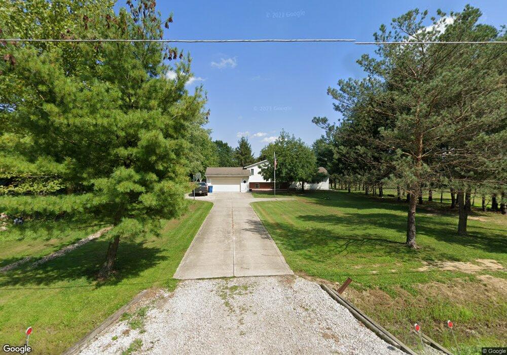
10955 Mitchell Rd Columbia Station, OH 44028
Estimated Value: $301,116 - $438,000
3
Beds
2
Baths
1,840
Sq Ft
$200/Sq Ft
Est. Value
About This Home
This home is located at 10955 Mitchell Rd, Columbia Station, OH 44028 and is currently estimated at $368,279, approximately $200 per square foot. 10955 Mitchell Rd is a home located in Lorain County with nearby schools including Copopa Elementary School, Columbia Middle School, and Columbia High School.
Ownership History
Date
Name
Owned For
Owner Type
Purchase Details
Closed on
Jul 23, 2018
Sold by
Kvetensky Norman D and Kvetensky Caroline A
Bought by
Smith Matthew A and Smith Jennifer R
Current Estimated Value
Home Financials for this Owner
Home Financials are based on the most recent Mortgage that was taken out on this home.
Original Mortgage
$228,000
Outstanding Balance
$196,766
Interest Rate
4.5%
Mortgage Type
New Conventional
Estimated Equity
$171,513
Create a Home Valuation Report for This Property
The Home Valuation Report is an in-depth analysis detailing your home's value as well as a comparison with similar homes in the area
Home Values in the Area
Average Home Value in this Area
Purchase History
| Date | Buyer | Sale Price | Title Company |
|---|---|---|---|
| Smith Matthew A | $240,000 | None Available |
Source: Public Records
Mortgage History
| Date | Status | Borrower | Loan Amount |
|---|---|---|---|
| Open | Smith Matthew A | $228,000 |
Source: Public Records
Tax History Compared to Growth
Tax History
| Year | Tax Paid | Tax Assessment Tax Assessment Total Assessment is a certain percentage of the fair market value that is determined by local assessors to be the total taxable value of land and additions on the property. | Land | Improvement |
|---|---|---|---|---|
| 2024 | $3,160 | $72,300 | $19,656 | $52,644 |
| 2023 | $3,673 | $73,584 | $24,360 | $49,224 |
| 2022 | $3,583 | $73,584 | $24,360 | $49,224 |
| 2021 | $3,618 | $73,584 | $24,360 | $49,224 |
| 2020 | $3,497 | $63,820 | $21,130 | $42,690 |
| 2019 | $3,476 | $63,820 | $21,130 | $42,690 |
| 2018 | $3,409 | $63,820 | $21,130 | $42,690 |
| 2017 | $3,314 | $55,960 | $15,950 | $40,010 |
| 2016 | $3,337 | $55,960 | $15,950 | $40,010 |
| 2015 | $3,338 | $55,960 | $15,950 | $40,010 |
| 2014 | $2,889 | $55,960 | $15,950 | $40,010 |
| 2013 | $2,889 | $55,960 | $15,950 | $40,010 |
Source: Public Records
Map
Nearby Homes
- 33621 Henwell Rd
- 33700 Henwell Rd
- 26571 Sprague Rd
- 33743 Henwell Rd
- 9628 Kingston Trail
- 9954 Ethan Dr
- 27167 Watkin Rd
- 23663 Victory Ln
- 8860 Sharp Rd
- 27056 Sprague Rd
- 33932 Abercorn Place
- 33964 Abercorn Place
- 0 V L Schady Rd Unit 5163658
- 8706 Stearns Rd
- 9129 Riverwood Dr
- 9113 Riverwood Dr
- 9032 Riverwood Dr
- 9130 Devonshire Dr
- 33110 Wren Haven Cir
- 0 Sprague Rd
- 10893 Mitchell Rd
- 10853 Mitchell Rd
- 10969 Mitchell Rd
- 10823 Mitchell Rd
- 10890 Mitchell Rd
- 10844 Mitchell Rd
- 10795 Mitchell Rd
- 10934 Mitchell Rd
- 11030 Mitchell Rd
- 10761 Mitchell Rd
- 10978 Mitchell Rd
- 11088 Mitchell Rd
- 10818 Mitchell Rd
- 10760 Mitchell Rd
- 10713 Mitchell Rd
- 11142 Mitchell Rd
- 10692 Mitchell Rd
- 10685 Mitchell Rd
- 10720 Mitchell Rd
- 0 Mitchell Rd