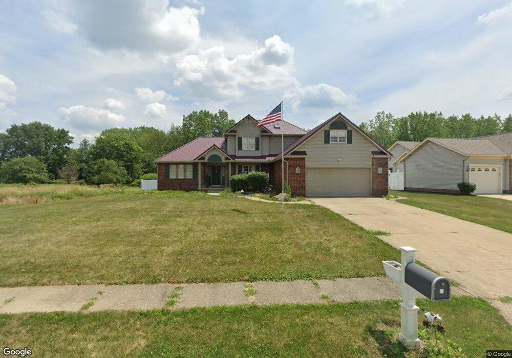
1096 Danielle Ave Louisville, OH 44641
Estimated Value: $317,767 - $362,000
3
Beds
3
Baths
2,430
Sq Ft
$142/Sq Ft
Est. Value
About This Home
This home is located at 1096 Danielle Ave, Louisville, OH 44641 and is currently estimated at $343,942, approximately $141 per square foot. 1096 Danielle Ave is a home located in Stark County with nearby schools including Louisville High School and St. Thomas Aquinas High School & Middle School.
Ownership History
Date
Name
Owned For
Owner Type
Purchase Details
Closed on
Jan 5, 2018
Sold by
Miller Dennis M and Miller Dawn L
Bought by
Norris Tabetha and Miller Irrevocable Heritage Trust
Current Estimated Value
Purchase Details
Closed on
Aug 5, 2005
Sold by
Williams John C and Williams Diane M
Bought by
Miller Dennis M and Miller Dawn L
Home Financials for this Owner
Home Financials are based on the most recent Mortgage that was taken out on this home.
Original Mortgage
$145,250
Outstanding Balance
$76,547
Interest Rate
5.71%
Mortgage Type
Fannie Mae Freddie Mac
Estimated Equity
$267,395
Purchase Details
Closed on
Jun 23, 1997
Sold by
Constitution Dev
Bought by
Williams John C and Williams Diane
Home Financials for this Owner
Home Financials are based on the most recent Mortgage that was taken out on this home.
Original Mortgage
$131,900
Interest Rate
8.25%
Mortgage Type
New Conventional
Create a Home Valuation Report for This Property
The Home Valuation Report is an in-depth analysis detailing your home's value as well as a comparison with similar homes in the area
Home Values in the Area
Average Home Value in this Area
Purchase History
| Date | Buyer | Sale Price | Title Company |
|---|---|---|---|
| Norris Tabetha | -- | None Available | |
| Miller Dennis M | $207,500 | -- | |
| Williams John C | $26,000 | -- |
Source: Public Records
Mortgage History
| Date | Status | Borrower | Loan Amount |
|---|---|---|---|
| Open | Miller Dennis M | $145,250 | |
| Closed | Williams John C | $131,900 |
Source: Public Records
Tax History Compared to Growth
Tax History
| Year | Tax Paid | Tax Assessment Tax Assessment Total Assessment is a certain percentage of the fair market value that is determined by local assessors to be the total taxable value of land and additions on the property. | Land | Improvement |
|---|---|---|---|---|
| 2025 | -- | $101,230 | $15,860 | $85,370 |
| 2024 | -- | $101,230 | $15,860 | $85,370 |
| 2023 | $3,252 | $75,680 | $13,130 | $62,550 |
| 2022 | $1,629 | $75,680 | $13,130 | $62,550 |
| 2021 | $3,267 | $75,680 | $13,130 | $62,550 |
| 2020 | $2,687 | $67,590 | $11,830 | $55,760 |
| 2019 | $2,698 | $66,400 | $14,770 | $51,630 |
| 2018 | $2,640 | $66,400 | $14,770 | $51,630 |
| 2017 | $2,511 | $60,940 | $12,360 | $48,580 |
| 2016 | $2,563 | $60,940 | $12,360 | $48,580 |
| 2015 | $2,570 | $60,940 | $12,360 | $48,580 |
| 2014 | $452 | $54,050 | $10,960 | $43,090 |
| 2013 | $1,230 | $54,050 | $10,960 | $43,090 |
Source: Public Records
Map
Nearby Homes
- 300 Kennedy St
- 614 Reno Dr
- 428 Honeycrisp Dr NE
- 3047 Mcintosh Dr NE
- 432 Honeycrisp Dr NE
- 2962 Mcintosh Dr NE
- 2963 Mcintosh Dr NE
- 430 Honeycrisp Dr NE
- 2957 Mcintosh Dr NE
- 524 Glenbar St
- 1149 Sturbridge Dr
- 1175 Sturbridge Dr
- 0 Glenbar St
- 0 Brookridge Ave
- 316 E Reno Dr
- 5474 Ravenna Ave
- 3580 Brookridge Ave Lot 15
- 325 Lincoln Ave
- 910 Crosswyck Cir
- 1170 Winding Ridge Ave
- 1086 Danielle Ave
- 1078 Danielle Ave
- 703 Joel Cir
- 1070 Danielle Ave
- 713 Joel Cir
- 702 Joel Cir
- 712 Joel Cir
- 1064 Danielle Ave
- 723 Joel Cir
- 280 Devinney Ave
- 1223 Faircliff St
- 722 Joel Cir
- 711 Glencarlyn Ave
- 733 Joel Cir
- 303 Kennedy St
- 704 Reno Dr
- 277 Devinney Ave
- 721 Glencarlyn Ave
- 270 Devinney Ave
- 1239 Faircliff St