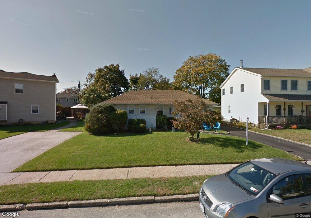
1096 Johnston Ave Wantagh, NY 11793
Estimated Value: $679,598 - $684,000
--
Bed
2
Baths
1,443
Sq Ft
$472/Sq Ft
Est. Value
About This Home
This home is located at 1096 Johnston Ave, Wantagh, NY 11793 and is currently estimated at $681,799, approximately $472 per square foot. 1096 Johnston Ave is a home located in Nassau County with nearby schools including Lee Road Elementary School, Jonas E. Salk Middle School, and Gen. Douglas MacArthur Senior High School.
Ownership History
Date
Name
Owned For
Owner Type
Purchase Details
Closed on
Oct 8, 1998
Sold by
Srifert Steven and Srifert Caryn
Bought by
Bornico Roanld and Bornico Laura
Current Estimated Value
Purchase Details
Closed on
May 13, 1998
Sold by
Seifert Steven
Bought by
Seifert Steven and Seifert Caryn
Purchase Details
Closed on
Aug 29, 1997
Sold by
Nyip
Bought by
Seifert Steven
Purchase Details
Closed on
May 27, 1996
Sold by
Development One Corp
Bought by
Nyip Ii Llc
Purchase Details
Closed on
Mar 18, 1996
Sold by
Lavalee Keith Ref
Bought by
Development One Corp
Create a Home Valuation Report for This Property
The Home Valuation Report is an in-depth analysis detailing your home's value as well as a comparison with similar homes in the area
Home Values in the Area
Average Home Value in this Area
Purchase History
| Date | Buyer | Sale Price | Title Company |
|---|---|---|---|
| Bornico Roanld | $210,000 | -- | |
| Bornico Roanld | $210,000 | -- | |
| Seifert Steven | -- | -- | |
| Seifert Steven | -- | -- | |
| Seifert Steven | $175,000 | -- | |
| Seifert Steven | $175,000 | -- | |
| Nyip Ii Llc | $141,000 | -- | |
| Nyip Ii Llc | $141,000 | -- | |
| Development One Corp | $130,000 | -- | |
| Development One Corp | $130,000 | -- |
Source: Public Records
Tax History Compared to Growth
Tax History
| Year | Tax Paid | Tax Assessment Tax Assessment Total Assessment is a certain percentage of the fair market value that is determined by local assessors to be the total taxable value of land and additions on the property. | Land | Improvement |
|---|---|---|---|---|
| 2025 | $13,341 | $459 | $217 | $242 |
| 2024 | $3,658 | $510 | $241 | $269 |
| 2023 | $13,989 | $527 | $250 | $277 |
| 2022 | $13,989 | $547 | $259 | $288 |
| 2021 | $20,037 | $521 | $247 | $274 |
| 2020 | $14,269 | $750 | $457 | $293 |
| 2019 | $13,682 | $750 | $457 | $293 |
| 2018 | $12,872 | $750 | $0 | $0 |
| 2017 | $8,253 | $750 | $457 | $293 |
| 2016 | $11,528 | $750 | $457 | $293 |
| 2015 | $3,056 | $750 | $457 | $293 |
| 2014 | $3,056 | $750 | $457 | $293 |
| 2013 | $2,866 | $750 | $457 | $293 |
Source: Public Records
Map
Nearby Homes
- 2794 Janet Ave
- 985 Douglas Ave
- 2960 Morgan Dr
- 1200 Roger Rd
- 1243 Peapond Rd
- 930 W Shelley Rd
- 2874 Michael Rd
- 899 Brent Dr
- 1253 Raymond Rd
- 236 Duckpond Dr S
- 859 Brent Dr
- 84 Stanford Ct
- 2846 Walter Rd
- 886 Bellmore Ave
- 2889 Anderson St
- 86 Weaving Ln
- 2720 Elm Dr
- 231 Willowood Dr
- 875 Woodside Dr
- 27 Wildflower Ln
- 1090 Johnston Ave
- 1110 Johnston Ave
- 1099 Douglas Ave
- 1093 Douglas Ave
- 1084 Johnston Ave
- 1107 Douglas Ave
- 1091 Johnston Ave
- 1097 Johnston Ave
- 1087 Douglas Ave
- 1085 Johnston Ave
- 1103 Johnston Ave
- 1078 Johnston Ave
- 1081 Douglas Ave
- 1109 Johnston Ave
- 1079 Johnston Ave
- 1115 Johnston Ave
- 1096 Mclean Ave
- 1072 Johnston Ave
- 1102 Mclean Ave
- 1075 Douglas Ave