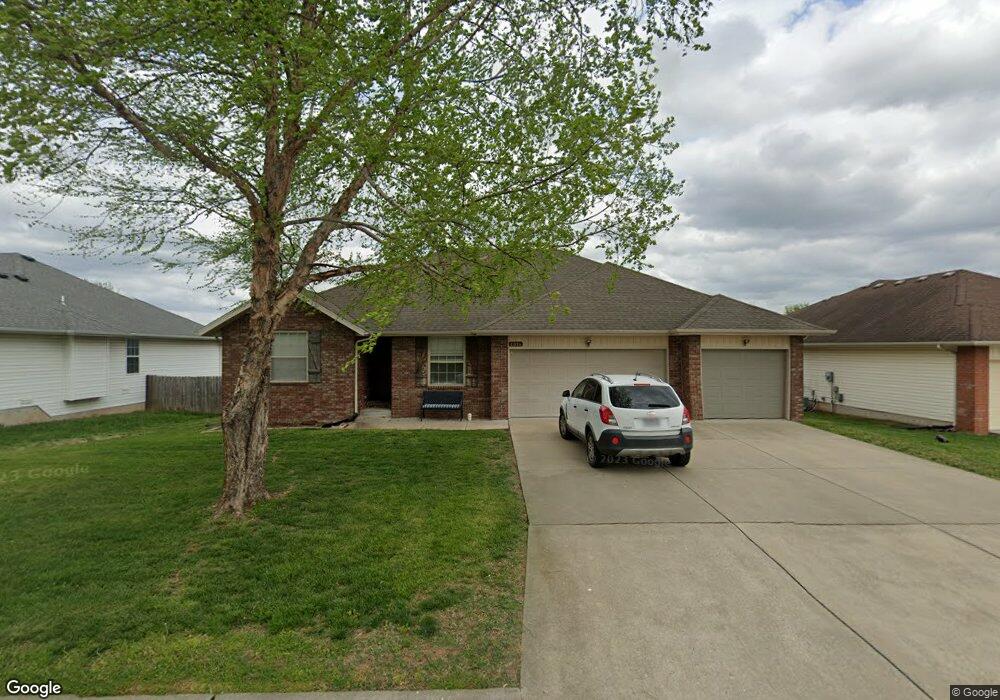
1096 S Red Cedar Ave Springfield, MO 65802
Estimated Value: $277,000 - $294,000
5
Beds
2
Baths
1,843
Sq Ft
$155/Sq Ft
Est. Value
About This Home
This home is located at 1096 S Red Cedar Ave, Springfield, MO 65802 and is currently estimated at $285,257, approximately $154 per square foot. 1096 S Red Cedar Ave is a home located in Greene County with nearby schools including Price Elementary School, Republic Middle School, and Republic High School.
Ownership History
Date
Name
Owned For
Owner Type
Purchase Details
Closed on
Jun 22, 2009
Sold by
Deutsche Bank National Trust Co
Bought by
Sherman Jeff and Sherman Katia
Current Estimated Value
Home Financials for this Owner
Home Financials are based on the most recent Mortgage that was taken out on this home.
Original Mortgage
$115,862
Outstanding Balance
$73,479
Interest Rate
4.84%
Mortgage Type
FHA
Estimated Equity
$211,778
Purchase Details
Closed on
Mar 17, 2009
Sold by
Oates Julie and Oates Steve
Bought by
Deutsche Bank National Trust Co
Purchase Details
Closed on
May 7, 2007
Sold by
Legacy Home Builders Llc
Bought by
Oats Julie and Oats Stece
Home Financials for this Owner
Home Financials are based on the most recent Mortgage that was taken out on this home.
Original Mortgage
$176,850
Interest Rate
9.85%
Mortgage Type
Adjustable Rate Mortgage/ARM
Create a Home Valuation Report for This Property
The Home Valuation Report is an in-depth analysis detailing your home's value as well as a comparison with similar homes in the area
Home Values in the Area
Average Home Value in this Area
Purchase History
| Date | Buyer | Sale Price | Title Company |
|---|---|---|---|
| Sherman Jeff | -- | None Available | |
| Deutsche Bank National Trust Co | $121,600 | None Available | |
| Oats Julie | -- | None Available |
Source: Public Records
Mortgage History
| Date | Status | Borrower | Loan Amount |
|---|---|---|---|
| Open | Sherman Jeff | $115,862 | |
| Previous Owner | Oats Julie | $176,850 |
Source: Public Records
Tax History
| Year | Tax Paid | Tax Assessment Tax Assessment Total Assessment is a certain percentage of the fair market value that is determined by local assessors to be the total taxable value of land and additions on the property. | Land | Improvement |
|---|---|---|---|---|
| 2025 | $2,383 | $42,180 | $8,550 | $33,630 |
| 2024 | $2,097 | $37,390 | $4,750 | $32,640 |
| 2023 | $2,087 | $37,390 | $4,750 | $32,640 |
| 2022 | $1,752 | $31,100 | $4,750 | $26,350 |
| 2021 | $1,753 | $31,100 | $4,750 | $26,350 |
| 2020 | $1,346 | $25,950 | $4,750 | $21,200 |
| 2019 | $1,341 | $25,950 | $4,750 | $21,200 |
| 2018 | $1,220 | $23,480 | $4,750 | $18,730 |
| 2017 | $1,210 | $22,760 | $4,750 | $18,010 |
| 2016 | $1,167 | $22,760 | $4,750 | $18,010 |
| 2015 | $1,158 | $22,760 | $4,750 | $18,010 |
| 2014 | $1,141 | $22,250 | $4,750 | $17,500 |
Source: Public Records
Map
Nearby Homes
- 5348 Basswood Ct W
- 5355 Basswood Ct W
- 5601 W Pecan St
- 5565 W Pine St
- 5669 W Sunflower Dr
- 987 S Natalie Ave
- 5635 W Mangrove St
- 1343 S Mulberry Ave
- 820 S Quade Rd
- 795 S Natalie Ave
- 5163 W Sunstruck St
- 5131 W Sunstruck St
- 5175 W Sunstruck St
- 768 S Long Dr
- 5817 W Alexa Ln
- 4853 Silo Hills Dr
- 1261 S Erika Ave
- 000 W Farm Road 148
- 000 W Independence Dr
- 431 S Bernier Ave
- 1104 S Red Cedar Ave
- 1088 S Red Cedar Ave
- 1093 S Red Cedar Ave
- 1085 S Red Cedar Ave
- 5477 Basswood Ct W
- 1101 S Red Cedar Ave
- 5477 Basswood Ct
- 5465 Basswood Ct
- 5465 Basswood Ct W
- 1072 S Red Cedar Ave
- 1077 S Red Cedar Ave
- 5504 W Bayberry Dr
- 5512 W Bayberry Dr
- 5492 W Bayberry Dr
- 5457 Basswood Ct
- 5520 W Bayberry Dr
- 5457 Basswood Ct W
- 5460 Butternut Dr
- 5484 W Bayberry Dr
- 1102 S Tanner Dr
Your Personal Tour Guide
Ask me questions while you tour the home.