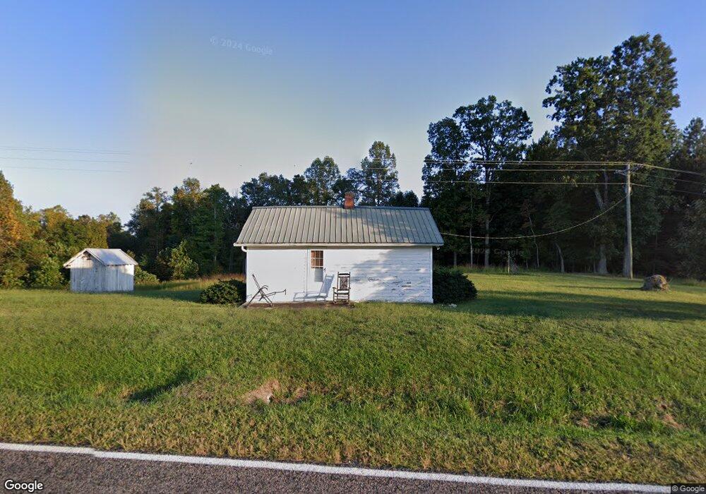
1096 Woodville Rd Mount Airy, NC 27030
Estimated Value: $80,191 - $127,000
2
Beds
1
Bath
676
Sq Ft
$158/Sq Ft
Est. Value
About This Home
This home is located at 1096 Woodville Rd, Mount Airy, NC 27030 and is currently estimated at $107,048, approximately $158 per square foot. 1096 Woodville Rd is a home with nearby schools including Westfield Elementary School, Pilot Mountain Middle School, and East Surry High School.
Ownership History
Date
Name
Owned For
Owner Type
Purchase Details
Closed on
Jul 27, 2016
Sold by
Inman Richard Lane and Inman Debbie G
Bought by
Mccraw Phillip R and Mccraw Andrea Gaye
Current Estimated Value
Purchase Details
Closed on
Jul 18, 2011
Sold by
Inman Sandra Lee
Bought by
Inman Richard Lane
Home Financials for this Owner
Home Financials are based on the most recent Mortgage that was taken out on this home.
Original Mortgage
$108,000
Interest Rate
3.75%
Mortgage Type
Assumption
Purchase Details
Closed on
Jul 1, 1991
Purchase Details
Closed on
Dec 1, 1961
Create a Home Valuation Report for This Property
The Home Valuation Report is an in-depth analysis detailing your home's value as well as a comparison with similar homes in the area
Home Values in the Area
Average Home Value in this Area
Purchase History
| Date | Buyer | Sale Price | Title Company |
|---|---|---|---|
| Mccraw Phillip R | $36,000 | Attorney | |
| Inman Richard Lane | $20,000 | None Available | |
| -- | -- | -- | |
| -- | -- | -- |
Source: Public Records
Mortgage History
| Date | Status | Borrower | Loan Amount |
|---|---|---|---|
| Previous Owner | Inman Richard Lane | $108,000 |
Source: Public Records
Tax History Compared to Growth
Tax History
| Year | Tax Paid | Tax Assessment Tax Assessment Total Assessment is a certain percentage of the fair market value that is determined by local assessors to be the total taxable value of land and additions on the property. | Land | Improvement |
|---|---|---|---|---|
| 2025 | $209 | $25,990 | $21,150 | $4,840 |
| 2024 | $326 | $42,500 | $21,150 | $21,350 |
| 2023 | $322 | $42,500 | $21,150 | $21,350 |
| 2022 | $322 | $42,500 | $21,150 | $21,350 |
| 2021 | $326 | $42,500 | $21,150 | $21,350 |
| 2020 | $165 | $24,430 | $19,340 | $5,090 |
| 2019 | $165 | $24,430 | $19,340 | $5,090 |
| 2018 | $304 | $40,430 | $0 | $0 |
| 2017 | $292 | $40,430 | $0 | $0 |
| 2016 | $292 | $39,660 | $0 | $0 |
| 2013 | -- | $39,660 | $0 | $0 |
Source: Public Records
Map
Nearby Homes
- 00 Albion Church Rd
- 7.8ac Norman Rd
- 1507 Rogers Rd
- 1305 Brim Rd
- TBD Rogers Rd Unit TBD Rogers Road
- 140 Daniels Dell Ln
- 0 Sunset Ridge Rd
- 0 Norman Rd
- 733 Slate Mountain Rd
- Lot 4,5,6 Sideview Ln
- 1311 Flippin Rd
- 203 Brannock Ln
- 0 Joyce Acres Rd
- 107 Cory Trail
- 1135 Daisy Creek Farm Rd
- 00 Blue Hollow Rd Unit 5
- 23 Mills School Rd
- 583 Snody Rd
- 105 Big Dan Lake Dr
- 00 Mills Rd
- 148 Ryan Rd
- 1159 Woodville Rd
- 1033 Woodville Rd
- 1000 Woodville Rd
- 17AC Woodville Rd Unit 17Ac
- 119 Provision Trail
- 244 Ryan Rd
- 931 Albion Church Rd
- 988 Albion Church Rd
- 923 Albion Church Rd
- 960 Woodville Rd
- 1061 Albion Church Rd
- 950 Albion Church Rd
- 934 Albion Church Rd
- 887 Woodville Rd
- 132 Buchanan Ln
- 691 Epperson Church Rd
- 882 Woodville Rd
- 115 Buchanan Ln
- 1118 Albion Church Rd