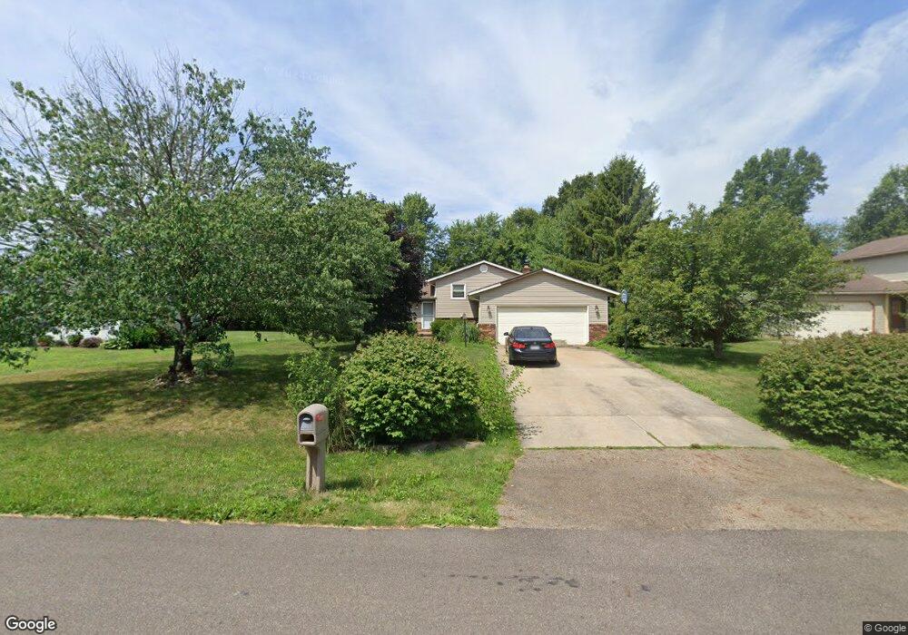
10961 Jan Cir NW Uniontown, OH 44685
Estimated Value: $258,000 - $281,269
3
Beds
2
Baths
1,188
Sq Ft
$227/Sq Ft
Est. Value
About This Home
This home is located at 10961 Jan Cir NW, Uniontown, OH 44685 and is currently estimated at $269,567, approximately $226 per square foot. 10961 Jan Cir NW is a home located in Stark County with nearby schools including Lake Middle/High School and Lake Center Christian School.
Ownership History
Date
Name
Owned For
Owner Type
Purchase Details
Closed on
Sep 18, 2007
Sold by
Douglas Craig Steven and Marosell-Douglas Lori A
Bought by
Marosell Douglas Lori A
Current Estimated Value
Home Financials for this Owner
Home Financials are based on the most recent Mortgage that was taken out on this home.
Original Mortgage
$100,000
Outstanding Balance
$63,605
Interest Rate
6.66%
Mortgage Type
Stand Alone Refi Refinance Of Original Loan
Estimated Equity
$205,962
Purchase Details
Closed on
May 6, 1991
Create a Home Valuation Report for This Property
The Home Valuation Report is an in-depth analysis detailing your home's value as well as a comparison with similar homes in the area
Home Values in the Area
Average Home Value in this Area
Purchase History
| Date | Buyer | Sale Price | Title Company |
|---|---|---|---|
| Marosell Douglas Lori A | -- | Attorney | |
| -- | $85,000 | -- |
Source: Public Records
Mortgage History
| Date | Status | Borrower | Loan Amount |
|---|---|---|---|
| Open | Marosell Douglas Lori A | $100,000 |
Source: Public Records
Tax History Compared to Growth
Tax History
| Year | Tax Paid | Tax Assessment Tax Assessment Total Assessment is a certain percentage of the fair market value that is determined by local assessors to be the total taxable value of land and additions on the property. | Land | Improvement |
|---|---|---|---|---|
| 2025 | -- | $86,770 | $21,210 | $65,560 |
| 2024 | -- | $86,770 | $21,210 | $65,560 |
| 2023 | $3,256 | $69,760 | $13,230 | $56,530 |
| 2022 | $3,267 | $69,760 | $13,230 | $56,530 |
| 2021 | $3,304 | $69,760 | $13,230 | $56,530 |
| 2020 | $3,197 | $60,520 | $11,410 | $49,110 |
| 2019 | $3,167 | $60,520 | $11,410 | $49,110 |
| 2018 | $3,169 | $60,520 | $11,410 | $49,110 |
| 2017 | $2,928 | $51,940 | $11,410 | $40,530 |
| 2016 | $2,933 | $51,940 | $11,410 | $40,530 |
| 2015 | $2,931 | $51,940 | $11,410 | $40,530 |
| 2014 | $526 | $46,590 | $10,220 | $36,370 |
| 2013 | $1,263 | $46,590 | $10,220 | $36,370 |
Source: Public Records
Map
Nearby Homes
- 1037 Canyon St NE
- 10277 Market Ave N
- 1771 Midway St NW
- 12055 King Church Ave NW
- 11121 Geib Ave NE
- 747 Grandview Cir
- 786 Fair Vista Cir SW
- 778 Fair Vista Cir SW
- 531 Gentlebrook Blvd SW
- 12201 King Church Ave NW
- 525 Gentlebrook Blvd SW
- 9790 Smithdale Ave NE
- 550 Woodlands Glen Ave
- 9766 Smithdale Ave NE
- 2084 Hazel St NE
- 510 Meadow Cir SW Unit 11
- 425 Tonawanda Trail SW
- 11900 Geib Ave NE
- 1975 Eloise Cir NE
- Unit 9 Meadow Trail SW Unit 9
- 10981 Jan Cir NW
- 10941 Jan Cir NW
- 10997 Jan Cir NW
- 1189 Royce St NW
- 1188 Canyon St NW
- 0 Jan Cir NW Unit 4444532
- 1220 Royce St NW
- 1238 Royce St NW
- 1169 Royce St NW
- 1178 Canyon St NW
- 1200 Royce St NW
- 1255 Royce St NW
- 1180 Royce St NW
- 11043 Jan Cir NW
- 1147 Royce St NW
- 1148 Canyon St NW
- 1179 Canyon St NW
- 1267 Royce St NW
- 1162 Royce St NW
- 1127 Royce St NW