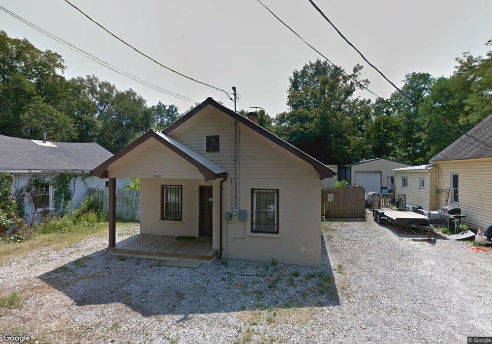
10967 Lincoln Ave North Bend, OH 45052
Estimated Value: $58,140 - $289,000
2
Beds
--
Bath
728
Sq Ft
$195/Sq Ft
Est. Value
About This Home
This home is located at 10967 Lincoln Ave, North Bend, OH 45052 and is currently estimated at $142,035, approximately $195 per square foot. 10967 Lincoln Ave is a home located in Hamilton County with nearby schools including William Henry Harrison High School.
Ownership History
Date
Name
Owned For
Owner Type
Purchase Details
Closed on
Jun 24, 2014
Sold by
Cook Brenda S and Cook Charles
Bought by
Thompson Erik
Current Estimated Value
Purchase Details
Closed on
Jun 24, 2003
Sold by
Centex Home Equity Corp
Bought by
Cook Brenda S
Purchase Details
Closed on
Aug 2, 2002
Sold by
Scott Battig and Scott Pamela
Bought by
Centex Home Equity Corp
Purchase Details
Closed on
Jun 30, 1998
Sold by
Undercoffer Rhein Jeanne G Tr & Kathryn G
Bought by
Battig Scott and Battig Pamela
Home Financials for this Owner
Home Financials are based on the most recent Mortgage that was taken out on this home.
Original Mortgage
$25,900
Interest Rate
10.95%
Create a Home Valuation Report for This Property
The Home Valuation Report is an in-depth analysis detailing your home's value as well as a comparison with similar homes in the area
Purchase History
| Date | Buyer | Sale Price | Title Company |
|---|---|---|---|
| Thompson Erik | $19,000 | Prodigy Title Agency | |
| Cook Brenda S | $8,000 | -- | |
| Centex Home Equity Corp | $20,000 | -- | |
| Battig Scott | $8,500 | -- |
Source: Public Records
Mortgage History
| Date | Status | Borrower | Loan Amount |
|---|---|---|---|
| Previous Owner | Battig Scott | $25,900 |
Source: Public Records
Tax History
| Year | Tax Paid | Tax Assessment Tax Assessment Total Assessment is a certain percentage of the fair market value that is determined by local assessors to be the total taxable value of land and additions on the property. | Land | Improvement |
|---|---|---|---|---|
| 2025 | $487 | $9,947 | $4,606 | $5,341 |
| 2023 | $472 | $9,947 | $4,606 | $5,341 |
| 2022 | $389 | $6,990 | $3,829 | $3,161 |
| 2021 | $385 | $6,990 | $3,829 | $3,161 |
| 2020 | $389 | $6,990 | $3,829 | $3,161 |
| 2019 | $365 | $6,185 | $3,388 | $2,797 |
| 2018 | $368 | $6,185 | $3,388 | $2,797 |
| 2017 | $348 | $6,185 | $3,388 | $2,797 |
| 2016 | $344 | $6,651 | $4,064 | $2,587 |
| 2015 | $312 | $6,651 | $4,064 | $2,587 |
| 2014 | $328 | $6,651 | $4,064 | $2,587 |
| 2013 | $443 | $8,957 | $4,064 | $4,893 |
Source: Public Records
Map
Nearby Homes
- 11225 U S 50
- 20082 Augusta Dr
- 0 Hidden Valley Dr
- 0 Cresthaven Dr Unit 204573
- 0 Augusta Dr Unit 193297
- 1293 Cresthaven Dr
- 478 Eagleview Dr
- 627 Hickory Rd
- 19949 Overlook Cir
- 0 Hickory Rd Unit 1867131
- 0 Hickory Rd Unit 206753
- Lot 1525 Lakeview Dr
- 957 Greentree Rd
- 0 Hartford Cir
- 3216 Hanover Dr
- 3217 Hanover Dr
- 10883 Sand Run Rd
- 19271 Hampton Dr
- 1525 Lakeview Dr
- 20338 Cedarview Ct
- 10961 Lincoln Ave
- 10971 Lincoln Ave
- 10957 Lincoln Ave
- 7 Lincoln Ave
- 10949 Lincoln Ave
- 10981 Lincoln Ave
- 10962 Lincoln Ave
- 10977 Lincoln Ave
- 10954 Lincoln Ave
- 10987 Lincoln Ave
- 10952 Lincoln Ave
- 10991 Lincoln Ave
- 10995 Lincoln Ave
- 10997 Lincoln Ave
- 3399 Lawrenceburg
- 3339 Lawrenceburg Rd
- 3317 Lawrenceburg Rd
- 3447 Main St
- 3351 Lawrenceburg Rd
- 3481 Lawrenceburg
Your Personal Tour Guide
Ask me questions while you tour the home.