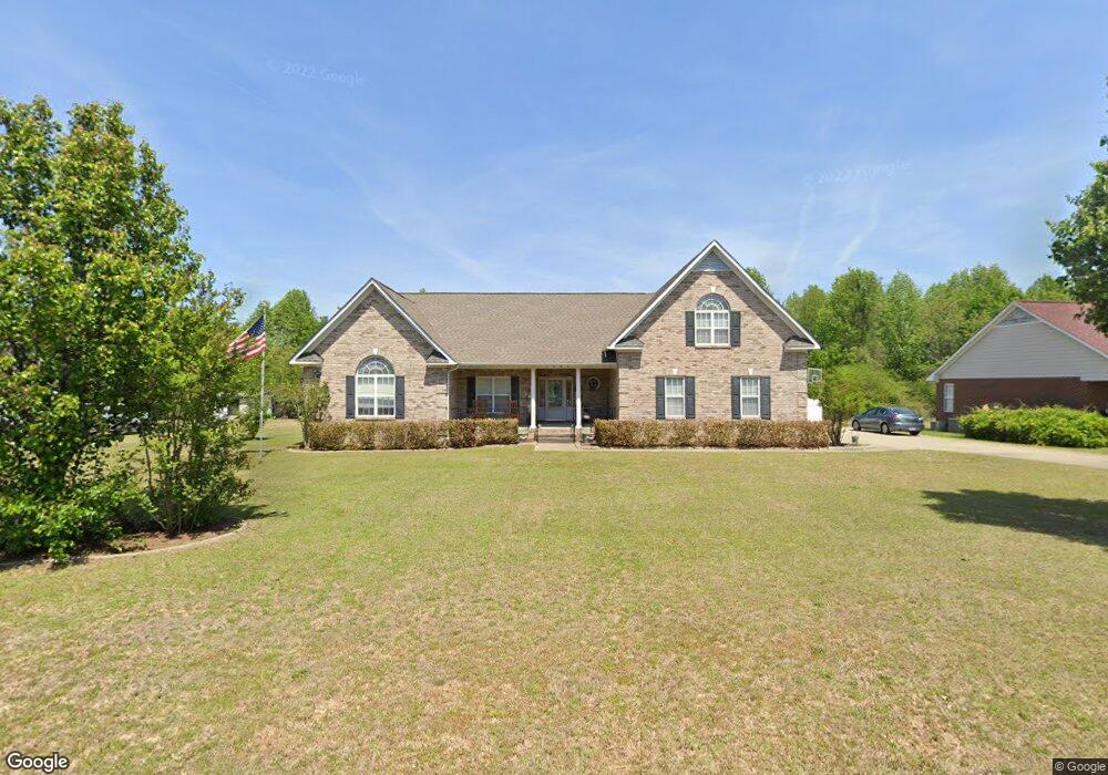
1097 Adcox Rd Raeford, NC 28376
Estimated Value: $344,000 - $410,748
3
Beds
3
Baths
2,596
Sq Ft
$148/Sq Ft
Est. Value
About This Home
This home is located at 1097 Adcox Rd, Raeford, NC 28376 and is currently estimated at $383,437, approximately $147 per square foot. 1097 Adcox Rd is a home located in Hoke County with nearby schools including Rockfish Hoke Elementary School, East Hoke Middle, and Hoke County High.
Ownership History
Date
Name
Owned For
Owner Type
Purchase Details
Closed on
Aug 28, 2017
Sold by
Evans Michael and Evans Crystal
Bought by
Ebbert Arthur E and Ebbert Melanie W
Current Estimated Value
Home Financials for this Owner
Home Financials are based on the most recent Mortgage that was taken out on this home.
Original Mortgage
$291,000
Outstanding Balance
$242,817
Interest Rate
3.96%
Estimated Equity
$140,620
Create a Home Valuation Report for This Property
The Home Valuation Report is an in-depth analysis detailing your home's value as well as a comparison with similar homes in the area
Home Values in the Area
Average Home Value in this Area
Purchase History
| Date | Buyer | Sale Price | Title Company |
|---|---|---|---|
| Ebbert Arthur E | $291,000 | None Available |
Source: Public Records
Mortgage History
| Date | Status | Borrower | Loan Amount |
|---|---|---|---|
| Open | Ebbert Arthur E | $291,000 |
Source: Public Records
Tax History Compared to Growth
Tax History
| Year | Tax Paid | Tax Assessment Tax Assessment Total Assessment is a certain percentage of the fair market value that is determined by local assessors to be the total taxable value of land and additions on the property. | Land | Improvement |
|---|---|---|---|---|
| 2025 | $2,814 | $331,400 | $27,000 | $304,400 |
| 2024 | $2,814 | $331,400 | $27,000 | $304,400 |
| 2023 | $2,814 | $331,400 | $27,000 | $304,400 |
| 2022 | $2,761 | $331,400 | $27,000 | $304,400 |
| 2021 | $2,527 | $294,680 | $27,000 | $267,680 |
| 2020 | $2,574 | $294,680 | $27,000 | $267,680 |
| 2019 | $2,574 | $294,680 | $27,000 | $267,680 |
| 2018 | $2,574 | $294,680 | $27,000 | $267,680 |
| 2017 | $2,574 | $294,680 | $27,000 | $267,680 |
| 2016 | $2,525 | $294,680 | $27,000 | $267,680 |
| 2015 | $2,525 | $294,680 | $27,000 | $267,680 |
| 2014 | $2,497 | $294,680 | $27,000 | $267,680 |
| 2013 | -- | $263,750 | $27,000 | $236,750 |
Source: Public Records
Map
Nearby Homes
- 168 Bennington Dr
- 273 Saint George Dr
- 626 Fairfield Cir
- 180 Barkley Ct
- 865 Fairfield Cir
- 386 Forrest Woods Dr
- 161 Bayleaf Dr
- 131 Emerywood Ct
- 202 Crestwood Ln
- 202 Ivy Stone Dr
- 258 Lennox Loop
- 260 Stockbridge Dr
- 573 Thorncliff Dr
- 220 Ladden Ln
- 1093 Saint Johns Loop
- 667 Saint Johns Loop
- 207 Boswell St
- 225 Hogart St
- 0 Fayettevill Raod and Paraclete Dr
- 8318 Umstead Dr
- 1121 Adcox Rd
- 1061 Adcox Rd
- 1153 Adcox Rd
- 313 Fairfield Cir
- 301 Fairfield Cir
- 285 Fairfield Cir
- 327 Fairfield Cir
- 345 Fairfield (L31) Cir
- 271 Fairfield Cir
- 345 Fairfield Cir
- 369 Fairfield Cir
- 357 Fairfield Cir
- 259 Fairfield Cir
- 1023 Adcox Rd
- 379 Fairfield (L34) Cir
- 1191 Adcox Rd
- 107 Huntington Dr
- 243 Fairfield Cir
- 227 Fairfield Cir
- 358 Fairfield Cir