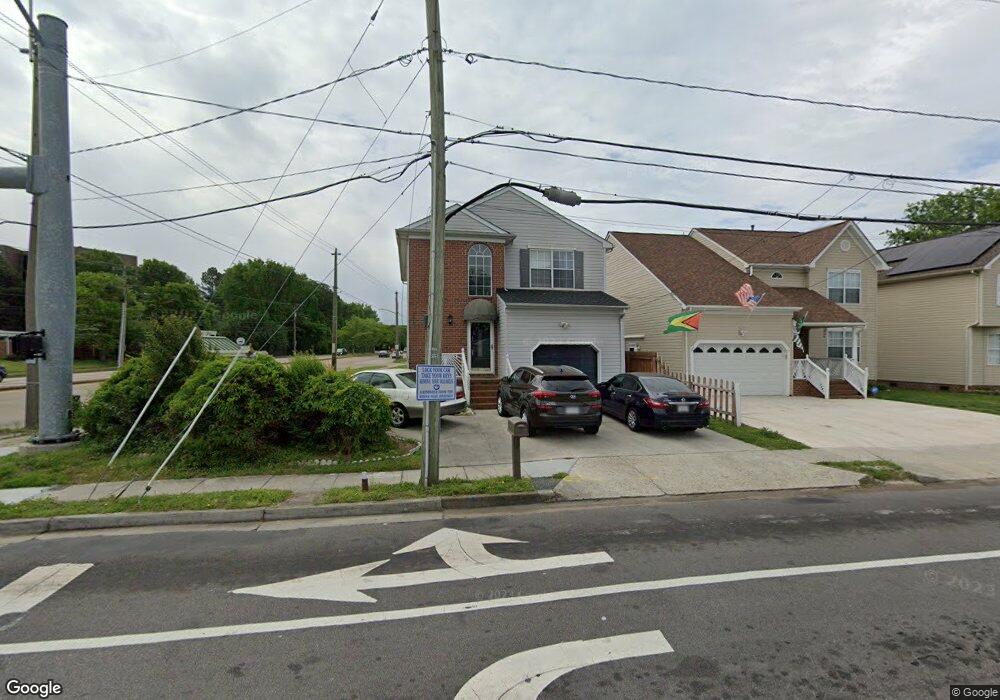
1097 Johnstons Rd Norfolk, VA 23513
Colonial Heights NeighborhoodEstimated Value: $319,000 - $396,000
3
Beds
3
Baths
1,838
Sq Ft
$192/Sq Ft
Est. Value
About This Home
This home is located at 1097 Johnstons Rd, Norfolk, VA 23513 and is currently estimated at $352,791, approximately $191 per square foot. 1097 Johnstons Rd is a home located in Norfolk City with nearby schools including Crossroads School, Norview Middle School, and Norview High School.
Ownership History
Date
Name
Owned For
Owner Type
Purchase Details
Closed on
May 25, 2022
Sold by
King Douglas C
Bought by
King Douglas and King Bertha Denise
Current Estimated Value
Home Financials for this Owner
Home Financials are based on the most recent Mortgage that was taken out on this home.
Original Mortgage
$261,500
Outstanding Balance
$246,669
Interest Rate
4.5%
Mortgage Type
VA
Estimated Equity
$106,122
Create a Home Valuation Report for This Property
The Home Valuation Report is an in-depth analysis detailing your home's value as well as a comparison with similar homes in the area
Home Values in the Area
Average Home Value in this Area
Purchase History
| Date | Buyer | Sale Price | Title Company |
|---|---|---|---|
| King Douglas | -- | Servicelink |
Source: Public Records
Mortgage History
| Date | Status | Borrower | Loan Amount |
|---|---|---|---|
| Open | King Douglas | $261,500 |
Source: Public Records
Tax History
| Year | Tax Paid | Tax Assessment Tax Assessment Total Assessment is a certain percentage of the fair market value that is determined by local assessors to be the total taxable value of land and additions on the property. | Land | Improvement |
|---|---|---|---|---|
| 2025 | $3,833 | $306,600 | $47,500 | $259,100 |
| 2024 | $3,555 | $284,400 | $47,500 | $236,900 |
| 2023 | $3,470 | $277,600 | $43,000 | $234,600 |
| 2022 | $3,389 | $271,100 | $36,500 | $234,600 |
| 2021 | $2,995 | $239,600 | $27,000 | $212,600 |
| 2020 | $2,843 | $227,400 | $20,500 | $206,900 |
| 2019 | $2,818 | $225,400 | $18,500 | $206,900 |
| 2018 | $2,654 | $212,300 | $17,000 | $195,300 |
| 2017 | $2,400 | $208,700 | $17,000 | $191,700 |
| 2016 | $2,360 | $202,000 | $17,000 | $185,000 |
| 2015 | $2,297 | $202,000 | $17,000 | $185,000 |
| 2014 | $2,297 | $202,000 | $17,000 | $185,000 |
Source: Public Records
Map
Nearby Homes
- 1090 Johnstons Rd
- 1033 Avenue E
- 1072 Joyner St
- 1055 Kittrell St
- 7012 Gregory Dr
- 7417 Evelyn T Butts Ave
- 1008 Wolcott Ave
- 909 Workwood Rd
- 6618 Palem Rd
- 6804 Thaxton St
- 977 Wolcott Ave
- 6612 Pilot Ave
- 936 Widgeon Rd
- 7434 Spartan Ave
- 920 Widgeon Rd
- 6456 Palem Rd
- 974 Philpotts Rd
- 837 Tifton St
- 6459 Clare Rd
- 6447 Wellington St
- 1093 Johnstons Rd
- 1089 Johnstons Rd
- 1094 Kane St
- 1092 Kane St
- 1083 Johnstons Rd
- 1086 Johnstons Rd
- 1088 Kane St
- 1084 Johnstons Rd
- 1081 Johnstons Rd
- 1079 Johnstons Rd
- 1082 Johnstons Rd
- 1093 Kane St
- 1084 Kane St
- 1095 Kane St
- 1087 Kane St
- 7036 Chesapeake Blvd
- 1078 Johnstons Rd
- 1075 Johnstons Rd
- 1080 Kane St
- 1045 Avenue E
Your Personal Tour Guide
Ask me questions while you tour the home.