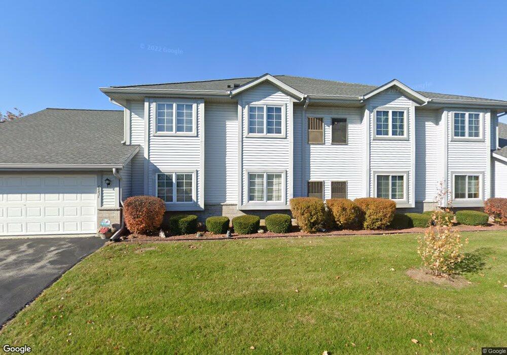
1097 Quinlan Dr Unit E Pewaukee, WI 53072
Estimated Value: $275,498 - $285,000
Studio
--
Bath
--
Sq Ft
36
Acres
About This Home
This home is located at 1097 Quinlan Dr Unit E, Pewaukee, WI 53072 and is currently estimated at $280,625. 1097 Quinlan Dr Unit E is a home located in Waukesha County with nearby schools including Pewaukee Lake Elementary School, Asa Clark Middle School, and Pewaukee High School.
Ownership History
Date
Name
Owned For
Owner Type
Purchase Details
Closed on
Jul 16, 2018
Sold by
Laven Gail A and Deakin Gail A
Bought by
Nettesheim Kimberly A
Current Estimated Value
Home Financials for this Owner
Home Financials are based on the most recent Mortgage that was taken out on this home.
Original Mortgage
$110,000
Outstanding Balance
$95,542
Interest Rate
4.6%
Mortgage Type
New Conventional
Estimated Equity
$185,083
Purchase Details
Closed on
Aug 19, 1997
Sold by
Shorebrook Inc
Bought by
Laven Gail A
Home Financials for this Owner
Home Financials are based on the most recent Mortgage that was taken out on this home.
Original Mortgage
$16,000
Interest Rate
7.44%
Create a Home Valuation Report for This Property
The Home Valuation Report is an in-depth analysis detailing your home's value as well as a comparison with similar homes in the area
Home Values in the Area
Average Home Value in this Area
Purchase History
| Date | Buyer | Sale Price | Title Company |
|---|---|---|---|
| Nettesheim Kimberly A | $147,000 | None Available | |
| Laven Gail A | $118,000 | -- |
Source: Public Records
Mortgage History
| Date | Status | Borrower | Loan Amount |
|---|---|---|---|
| Open | Nettesheim Kimberly A | $110,000 | |
| Previous Owner | Laven Gail A | $16,000 |
Source: Public Records
Tax History
| Year | Tax Paid | Tax Assessment Tax Assessment Total Assessment is a certain percentage of the fair market value that is determined by local assessors to be the total taxable value of land and additions on the property. | Land | Improvement |
|---|---|---|---|---|
| 2024 | $2,815 | $229,200 | $25,000 | $204,200 |
| 2023 | $2,716 | $201,700 | $25,000 | $176,700 |
| 2022 | $2,354 | $172,200 | $10,000 | $162,200 |
| 2021 | $2,506 | $172,200 | $10,000 | $162,200 |
| 2020 | $2,407 | $154,800 | $10,000 | $144,800 |
| 2019 | $2,326 | $154,800 | $10,000 | $144,800 |
| 2018 | $2,059 | $138,600 | $10,000 | $128,600 |
| 2017 | $2,429 | $138,600 | $10,000 | $128,600 |
| 2016 | $1,960 | $116,600 | $10,000 | $106,600 |
| 2015 | $1,958 | $116,600 | $10,000 | $106,600 |
| 2014 | $2,270 | $116,600 | $10,000 | $106,600 |
| 2013 | $2,270 | $117,200 | $10,000 | $107,200 |
Source: Public Records
Map
Nearby Homes
- 827 Quinlan Dr Unit H
- N39W27485 Hillside Grove Rd
- 327 Sandy Cir
- 450 Sandy Cir
- 394 Sandy Cir
- 411 Sandy Cir
- 293 Meadowside Ct
- N48W26400 Bayberry Ct
- N44W25902 Lindsay Rd
- 321 Park Hill Dr Unit A
- 360 Park Hill Dr Unit G
- 360 Park Hill Dr Unit C
- N44W28076 Capitol Dr
- N59W25898 Amberwood Ct
- 285 Cardinal Ridge Dr Unit 285
- W226N1933 Cedar Court Ct Unit 202
- W226N2020 Cedar Lane Ln Unit 1002
- 1114 Oxbow Ct
- W226N2020 Cedar Lane Ln Unit 1004
- W226N2020 Cedar Lane Ln Unit 1001
- 1097 Quinlan Dr Unit B
- 1097 Quinlan Dr Unit H
- 1097 Quinlan Dr Unit F
- 1097 Quinlan Dr Unit G
- 1043 Quinlan Dr Unit H
- 1043 Quinlan Dr Unit E
- 1097 Quinlan Dr Unit A
- 1043 Quinlan Dr Unit B
- 1097 Quinlan Dr Unit C
- 1043 Quinlan Dr Unit D
- 1043 Quinlan Dr Unit C
- 1043 Quinlan Dr Unit G
- 1043 Quinlan Dr Unit F
- 1043 Quinlan Dr Unit A
- 1043 Quinlan Dr Unit 1043
- 1097 Quinlan Dr Unit 1097
- 1097 Quinlan Dr
- 1081 Quinlan Dr Unit B
- 1081 Quinlan Dr Unit C
- 1081 Quinlan Dr Unit F