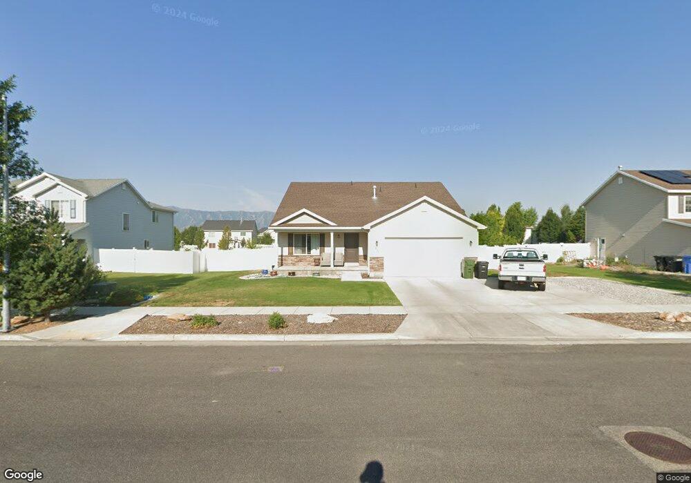
1097 S 830 W Logan, UT 84321
Woodruff NeighborhoodEstimated Value: $478,000 - $501,000
5
Beds
3
Baths
2,590
Sq Ft
$189/Sq Ft
Est. Value
About This Home
This home is located at 1097 S 830 W, Logan, UT 84321 and is currently estimated at $488,779, approximately $188 per square foot. 1097 S 830 W is a home located in Cache County with nearby schools including Woodruff School, Mount Logan Middle School, and Logan High School.
Ownership History
Date
Name
Owned For
Owner Type
Purchase Details
Closed on
May 20, 2011
Sold by
Muir Albert T and Muir Cynthia Ann
Bought by
Muir Albert T and Muir Cynthia Ann
Current Estimated Value
Home Financials for this Owner
Home Financials are based on the most recent Mortgage that was taken out on this home.
Original Mortgage
$40,500
Outstanding Balance
$2,183
Interest Rate
4.84%
Mortgage Type
New Conventional
Estimated Equity
$486,596
Purchase Details
Closed on
Feb 17, 2011
Sold by
Continental Development Inc
Bought by
Muir Albert T and Muir Cynthia Ann
Home Financials for this Owner
Home Financials are based on the most recent Mortgage that was taken out on this home.
Original Mortgage
$168,800
Outstanding Balance
$114,476
Interest Rate
4.67%
Mortgage Type
Construction
Estimated Equity
$374,303
Purchase Details
Closed on
Dec 28, 2007
Sold by
Countryside Village Llc
Bought by
Continental Development Inc
Home Financials for this Owner
Home Financials are based on the most recent Mortgage that was taken out on this home.
Original Mortgage
$299,616
Interest Rate
10%
Mortgage Type
Seller Take Back
Create a Home Valuation Report for This Property
The Home Valuation Report is an in-depth analysis detailing your home's value as well as a comparison with similar homes in the area
Home Values in the Area
Average Home Value in this Area
Purchase History
| Date | Buyer | Sale Price | Title Company |
|---|---|---|---|
| Muir Albert T | -- | Cache Title Company | |
| Muir Albert T | -- | Cache Title Company | |
| Continental Development Inc | -- | Cache Title Company |
Source: Public Records
Mortgage History
| Date | Status | Borrower | Loan Amount |
|---|---|---|---|
| Open | Muir Albert T | $40,500 | |
| Open | Muir Albert T | $168,800 | |
| Previous Owner | Continental Development Inc | $299,616 |
Source: Public Records
Tax History Compared to Growth
Tax History
| Year | Tax Paid | Tax Assessment Tax Assessment Total Assessment is a certain percentage of the fair market value that is determined by local assessors to be the total taxable value of land and additions on the property. | Land | Improvement |
|---|---|---|---|---|
| 2025 | $2,163 | $279,705 | $0 | $0 |
| 2024 | $2,236 | $280,065 | $0 | $0 |
| 2023 | $2,328 | $277,915 | $0 | $0 |
| 2022 | $2,140 | $238,590 | $0 | $0 |
| 2021 | $1,775 | $305,751 | $51,500 | $254,251 |
| 2020 | $1,758 | $272,588 | $51,500 | $221,088 |
| 2019 | $1,838 | $272,588 | $51,500 | $221,088 |
| 2018 | $1,838 | $248,900 | $51,500 | $197,400 |
| 2017 | $1,763 | $126,225 | $0 | $0 |
| 2016 | $1,828 | $125,015 | $0 | $0 |
| 2015 | $1,443 | $99,530 | $0 | $0 |
| 2014 | $1,304 | $99,530 | $0 | $0 |
| 2013 | -- | $99,530 | $0 | $0 |
Source: Public Records
Map
Nearby Homes
- 1206 S 900 W
- 736 Majestic Dr
- 985 W 720 S
- 553 Center Ave
- 420 S 1400 W
- 866 Riverwood Dr
- 740 S 350 W
- 501 Southwest St
- 1220 W 575 S
- 658 W 500 S
- 548 S 1225 W Unit 115
- 542 S 1225 W Unit 116
- 1645 S 1380 W
- 1239 W 575 S Unit 152
- 1239 W 575 S
- 268 W 1030 S
- 273 W 1010 S
- 1183 W 1820 S
- 2399 W 430 S Unit 33
- 518 S 1225 W